
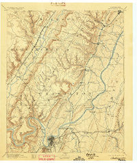
~ Chattanooga TN topo map, 1:125000 scale, 30 X 30 Minute, Historical, 1893, updated 1898
Chattanooga, Tennessee, USGS topographic map dated 1893.
Includes geographic coordinates (latitude and longitude). This topographic map is suitable for hiking, camping, and exploring, or framing it as a wall map.
Printed on-demand using high resolution imagery, on heavy weight and acid free paper, or alternatively on a variety of synthetic materials.
Topos available on paper, Waterproof, Poly, or Tyvek. Usually shipping rolled, unless combined with other folded maps in one order.
- Product Number: USGS-5338934
- Free digital map download (high-resolution, GeoPDF): Chattanooga, Tennessee (file size: 7 MB)
- Map Size: please refer to the dimensions of the GeoPDF map above
- Weight (paper map): ca. 55 grams
- Map Type: POD USGS Topographic Map
- Map Series: HTMC
- Map Verison: Historical
- Cell ID: 65175
- Scan ID: 153497
- Imprint Year: 1898
- Survey Year: 1886
- Datum: Unstated
- Map Projection: Unstated
- Map published by United States Geological Survey
- Map Language: English
- Scanner Resolution: 600 dpi
- Map Cell Name: Chattnooga
- Grid size: 30 X 30 Minute
- Date on map: 1893
- Map Scale: 1:125000
- Geographical region: Tennessee, United States
Neighboring Maps:
All neighboring USGS topo maps are available for sale online at a variety of scales.
Spatial coverage:
Topo map Chattanooga, Tennessee, covers the geographical area associated the following places:
- Holiday Hills - Camp Jordan - Sequoyah Hills - Forestdale - Colonial Village - Lower Mill - Dallas Crest - Murray Hills - Stanley - Oakhurst - Acres of Shade Mobile Home Park - East Lake - Elm Hill - Indian Hills - Green Acres - Applewood - Prairie Creek - North Soddy - Olde Mill - Valdeau - Shady Rest - Liberty - Falling Water - Mount Airy - Highland Park - Hickory Valley - Birnam Wood - Collegedale - Five Points - Blaney Forest - Manchester Park - Hickory Hills - Springvale - Coulterville - Foxwood Estates - Parkshore Estates - Laurel Brook - Webb Trailer Court - North Chattanooga - Briarfield - Hodgetown - Hickory Woods - Harrison Bluff - Forestwood - Sale Creek - Glenmar Hills - Glenwood - Dayton - Talley Place - Lakeshore Estates - Lake Crest - Cross Creek - Shake Rag - Jeffery Acres - Marimont - Shelton Estates - Lakeshor Manor - Metro Park - Echo Glen - Harrison - Fair Meadows Mobile Home Park - Deerwood Forest - Powells Crossroads - Fairmount - Tall Oaks Mobile Home Park - Fairfax Heights - Huntingdon Forest - Walden - Ryall Springs - Hidden Hills Estates - Dallas Gardens - Stoneridge - Forest Hills - Soddy - Shepherd - Brainerd - Harbor Heights - Blue Ridge View - Dunlap - Farrington Forest - Hampton Heights - Carriage Hill - Montague - Rock Ledge Estates - Suck Creek - Lake Dweller - Silverdale - Green Gables Mobile Home Park - Chattanooga - Maplewood Heights - Northwoods - Boyce - Washington Place - Summit - Mineral Park - Claremont - Green Hills - Clearwater Acres - Shannon Hills - Signal Hills
- Map Area ID: AREA35.535-85.5-85
- Northwest corner Lat/Long code: USGSNW35.5-85.5
- Northeast corner Lat/Long code: USGSNE35.5-85
- Southwest corner Lat/Long code: USGSSW35-85.5
- Southeast corner Lat/Long code: USGSSE35-85
- Northern map edge Latitude: 35.5
- Southern map edge Latitude: 35
- Western map edge Longitude: -85.5
- Eastern map edge Longitude: -85


