
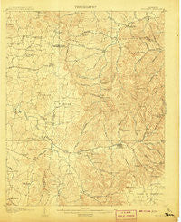
~ Woodbury TN topo map, 1:62500 scale, 15 X 15 Minute, Historical, 1908
Woodbury, Tennessee, USGS topographic map dated 1908.
Includes geographic coordinates (latitude and longitude). This topographic map is suitable for hiking, camping, and exploring, or framing it as a wall map.
Printed on-demand using high resolution imagery, on heavy weight and acid free paper, or alternatively on a variety of synthetic materials.
Topos available on paper, Waterproof, Poly, or Tyvek. Usually shipping rolled, unless combined with other folded maps in one order.
- Product Number: USGS-5338830
- Free digital map download (high-resolution, GeoPDF): Woodbury, Tennessee (file size: 8 MB)
- Map Size: please refer to the dimensions of the GeoPDF map above
- Weight (paper map): ca. 55 grams
- Map Type: POD USGS Topographic Map
- Map Series: HTMC
- Map Verison: Historical
- Cell ID: 64699
- Scan ID: 153424
- Survey Year: 1906
- Datum: Unstated
- Map Projection: Unstated
- Map published by United States Geological Survey
- Map Language: English
- Scanner Resolution: 600 dpi
- Map Cell Name: Woodbury
- Grid size: 15 X 15 Minute
- Date on map: 1908
- Map Scale: 1:62500
- Geographical region: Tennessee, United States
Neighboring Maps:
All neighboring USGS topo maps are available for sale online at a variety of scales.
Spatial coverage:
Topo map Woodbury, Tennessee, covers the geographical area associated the following places:
- Gloriana (historical) - Prospect Hill (historical) - Culpepper - Ewingsville (historical) - New Hope - Auburntown - Manus Town (historical) - Prosperity - Curlee - Pleasant Ridge - Brysonville - Milton - Berea (historical) - Greenvale - Sheybogan - Halls Hill - Jimtown (historical) - Elkins (historical) - Cottage Home - Porterfield - Sunny Slope - Iconium - Cateston - Oregon (historical) - Burt - Readyville - Talome (historical) - Kittrell - Stringtown - Cainsville - Hardscrabble - Woodbury - Jones Chapel (historical) - Bethlehem (historical)
- Map Area ID: AREA3635.75-86.25-86
- Northwest corner Lat/Long code: USGSNW36-86.25
- Northeast corner Lat/Long code: USGSNE36-86
- Southwest corner Lat/Long code: USGSSW35.75-86.25
- Southeast corner Lat/Long code: USGSSE35.75-86
- Northern map edge Latitude: 36
- Southern map edge Latitude: 35.75
- Western map edge Longitude: -86.25
- Eastern map edge Longitude: -86


