
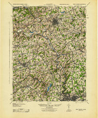
~ West Chester PA topo map, 1:62500 scale, 15 X 15 Minute, Historical, 1943
West Chester, Pennsylvania, USGS topographic map dated 1943.
Includes geographic coordinates (latitude and longitude). This topographic map is suitable for hiking, camping, and exploring, or framing it as a wall map.
Printed on-demand using high resolution imagery, on heavy weight and acid free paper, or alternatively on a variety of synthetic materials.
Topos available on paper, Waterproof, Poly, or Tyvek. Usually shipping rolled, unless combined with other folded maps in one order.
- Product Number: USGS-5331832
- Free digital map download (high-resolution, GeoPDF): West Chester, Pennsylvania (file size: 10 MB)
- Map Size: please refer to the dimensions of the GeoPDF map above
- Weight (paper map): ca. 55 grams
- Map Type: POD USGS Topographic Map
- Map Series: HTMC
- Map Verison: Historical
- Cell ID: 64403
- Scan ID: 222474
- Woodland Tint: Yes
- Aerial Photo Year: 1937
- Survey Year: 1901
- Datum: NAD27
- Map Projection: Polyconic
- Map published by United States Army Corps of Engineers
- Map published by United States Army
- Map published by United States Department of War
- Map Language: English
- Scanner Resolution: 600 dpi
- Map Cell Name: West Chester
- Grid size: 15 X 15 Minute
- Date on map: 1943
- Map Scale: 1:62500
- Geographical region: Pennsylvania, United States
Neighboring Maps:
All neighboring USGS topo maps are available for sale online at a variety of scales.
Spatial coverage:
Topo map West Chester, Pennsylvania, covers the geographical area associated the following places:
- Cornish Hills - Country Gates - Concordville - Concord Crossing - Shipley Woods - Fairfax - Holly Knoll - Sugartown - Chapelcrest - Brandywine Commons - Pennington Farm - Hampton - Windmere Place - Boulder Brook - Kentmere - Madelyn Gardens - Painters Crossing - Meriweather Farms - Centerville - Brookmeade - Dartmouth Woods II - Naamans Gardens - Cameron Hills - Sconnelltown - Penns Grant - Winterset Farms - Tavistock - Hillcrest - Winterthur - Rockwood Hills - Granogue - Allegiance - Lynnfield - Ward - Embreeville - Canterbury Hills - Goshen Commons - Worington Commons - Chatwood - Longwood - Brandywine Forge - Chadds Ford Knoll - West Farm - Woodbine - Hockessin Hunt - Mitchell Estates - Chadds Ford - Clermont - Penny Acres - The Ridings of Chadds Ford - Goshenville - Marrow Tract - Suburban Village - Wawaset - Park Woods - Cherrington - Williamsburg Court - Calais Woods - Carrcroft Crest - Northshire - Oakwood Hills - Willowdale - Norway - Hilloch Manor - Brandywine Summit - Rockland Village I and II - North Chase - Pennyhill Terrace - Forwood - Bellewood - Auburn Hills - Plumly Acres - Shellburne - Phillips Heights - Perth - Ways Corner - Williamhurst - Painters Crossroads - Chalfonte - Pierson Farms - Chatham - Highland Meadows - Stoneridge - Dutts Mill - Fair Acres Farm - Jarrell Farms - Talleys Corner - Altor - Skyline Orchard - Brackenville Woods - Windon - Cossart - Westmont - Yorklyn Ridge - Silverbrook - Loveville - Manley - Concord Hunt - Kimberly Chase - Dilworthtown
- Map Area ID: AREA4039.75-75.75-75.5
- Northwest corner Lat/Long code: USGSNW40-75.75
- Northeast corner Lat/Long code: USGSNE40-75.5
- Southwest corner Lat/Long code: USGSSW39.75-75.75
- Southeast corner Lat/Long code: USGSSE39.75-75.5
- Northern map edge Latitude: 40
- Southern map edge Latitude: 39.75
- Western map edge Longitude: -75.75
- Eastern map edge Longitude: -75.5


