
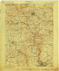
~ West Chester PA topo map, 1:62500 scale, 15 X 15 Minute, Historical, 1904, updated 1915
West Chester, Pennsylvania, USGS topographic map dated 1904.
Includes geographic coordinates (latitude and longitude). This topographic map is suitable for hiking, camping, and exploring, or framing it as a wall map.
Printed on-demand using high resolution imagery, on heavy weight and acid free paper, or alternatively on a variety of synthetic materials.
Topos available on paper, Waterproof, Poly, or Tyvek. Usually shipping rolled, unless combined with other folded maps in one order.
- Product Number: USGS-5331824
- Free digital map download (high-resolution, GeoPDF): West Chester, Pennsylvania (file size: 8 MB)
- Map Size: please refer to the dimensions of the GeoPDF map above
- Weight (paper map): ca. 55 grams
- Map Type: POD USGS Topographic Map
- Map Series: HTMC
- Map Verison: Historical
- Cell ID: 64403
- Scan ID: 170094
- Imprint Year: 1915
- Survey Year: 1901
- Datum: Unstated
- Map Projection: Unstated
- Map published by United States Geological Survey
- Map Language: English
- Scanner Resolution: 600 dpi
- Map Cell Name: West Chester
- Grid size: 15 X 15 Minute
- Date on map: 1904
- Map Scale: 1:62500
- Geographical region: Pennsylvania, United States
Neighboring Maps:
All neighboring USGS topo maps are available for sale online at a variety of scales.
Spatial coverage:
Topo map West Chester, Pennsylvania, covers the geographical area associated the following places:
- Greenville Manor - Hummingbird Farm - Wickwood - Westmont - Concord Manor - Ways Corner - Cheyney - Mockingbird Hills - Hampton - Talleys Corner - Mount Cuba - Boulder Brook - Hockessin Park - Heatherton - Tiberton - Ringfield - Westtown Hillside - Cherrington - Bridlewood Farm - Montchanin - Delwoods - Wynnewood - Hamilton Place - Northshire - Mockingbird Hill - North Minister - Coffee Run - Walnut Ridge - Monroe Park - Liftwood - Calais Woods - Bellewood - Thornbury - Oakwood Hills - Beau Tree - Forwood - Hickory Ridge - Penns Grant - Lamatan I - Southwood - Elam - Woodcock Farm - Hilloch Manor - Augustine Hills - Sconnelltown - Runnymeade - Quaker Hill - Highland West - Gallagherville - Longwood - Webster Farm - Twin Creeks at Mendenhall - North Hills - Carriages at Cobblestones - Edenridge - Granogue - Twin Turns Farm - Sedgley Farms - Galewood - Shipley Heights - Brookfield - Parkersville - Rockland Woods - Bow Tree - Wilmont - Weber Tract - Kirby Woods - Ridgewood - Greenville - Markham - Rock Manor - Marshallton - Revolutionary Farm - Madelyn Gardens - Tanguy - Foulk Woods - Suburban Village - Wynleigh - Brandywine Perry Park - Smithfield Estates - Fair Meadow - Beacon Hill - Concordville - Brandywood - Williamhurst - Bella Vista - Bon Ayre - Plumly Acres - Cossart - Kimberly Chase - Westbrite - Wood Ridge - Deerbrook I - Westtown Country Estates - Brandywine - Talleyville - Brookmeade - Fair Acres Farm - Oak Lane Manor - Village of Rocky Run
- Map Area ID: AREA4039.75-75.75-75.5
- Northwest corner Lat/Long code: USGSNW40-75.75
- Northeast corner Lat/Long code: USGSNE40-75.5
- Southwest corner Lat/Long code: USGSSW39.75-75.75
- Southeast corner Lat/Long code: USGSSE39.75-75.5
- Northern map edge Latitude: 40
- Southern map edge Latitude: 39.75
- Western map edge Longitude: -75.75
- Eastern map edge Longitude: -75.5


