
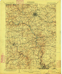
~ West Chester PA topo map, 1:62500 scale, 15 X 15 Minute, Historical, 1904, updated 1908
West Chester, Pennsylvania, USGS topographic map dated 1904.
Includes geographic coordinates (latitude and longitude). This topographic map is suitable for hiking, camping, and exploring, or framing it as a wall map.
Printed on-demand using high resolution imagery, on heavy weight and acid free paper, or alternatively on a variety of synthetic materials.
Topos available on paper, Waterproof, Poly, or Tyvek. Usually shipping rolled, unless combined with other folded maps in one order.
- Product Number: USGS-5331820
- Free digital map download (high-resolution, GeoPDF): West Chester, Pennsylvania (file size: 9 MB)
- Map Size: please refer to the dimensions of the GeoPDF map above
- Weight (paper map): ca. 55 grams
- Map Type: POD USGS Topographic Map
- Map Series: HTMC
- Map Verison: Historical
- Cell ID: 64403
- Scan ID: 170092
- Imprint Year: 1908
- Survey Year: 1901
- Datum: Unstated
- Map Projection: Unstated
- Map published by United States Geological Survey
- Map Language: English
- Scanner Resolution: 600 dpi
- Map Cell Name: West Chester
- Grid size: 15 X 15 Minute
- Date on map: 1904
- Map Scale: 1:62500
- Geographical region: Pennsylvania, United States
Neighboring Maps:
All neighboring USGS topo maps are available for sale online at a variety of scales.
Spatial coverage:
Topo map West Chester, Pennsylvania, covers the geographical area associated the following places:
- Goshenville - Ashland - West Goshen - Brandywine - Chapelcrest - Fairfax Farms - Hollingsworth Development - Spring Valley - Cornish Hills - Heather Valley - Penarth - Hamorton - Welshire - Unionville - Yorklyn - Berkeley Ridge - Darlington Corners - West Riding - Longwood - Alapocas - White Briar - Westtown Park - Mockingbird Hills - Talleyville - Stirrup Farms - Auburn Hills - Wylie Farms - Kennett Square - Cobblestones at Thornbury - Stoneridge - Brandywine Commons - Beaver Valley - Plumly Farms - Westgate Farms - Queonemysing (historical) - Hyllwynd - Birdwood Hill - Hampton - Dilworthtown Woods - Beacon Hill - Talcose - Sharpless Farms - Oakwood Hills - Park Woods - Windsor Hills - Locksley - Ways Corner - Brackenville Woods - Charter Oaks - Bella Vista - Fairville - Johnsons Corner - Dutton Mill - Wawaset - Winterbury - Cossart - Marlboro - Rollinwood - Burnt Mills - Silver Springs - Pennwood South - Woodcock Farm - Dartmouth Woods II - West Goshen Hills - Bow Tree - West Chester - North Chase - Sugartown - Rockland Woods - Southwood - Goshen West - Guyencourt - Marrow Tract - Land Grant Farms - Mayfield - Corinne - Tavistock - Brandywine Perry Park - Concord Hills - Pembrey - Wyllpen Farms - Memel Farms - Westwood Manor - Brandon - Runnymeade - McDaniel Heights - Parkersville - Bellewood - Ebright - Penny Acres - Haverford - Green Lane Village - Oak Lane Manor - Twin Creeks at Mendenhall - Quaker Hill - Deerhurst - Larchmont - Galewood - Gumwood - Woodbine
- Map Area ID: AREA4039.75-75.75-75.5
- Northwest corner Lat/Long code: USGSNW40-75.75
- Northeast corner Lat/Long code: USGSNE40-75.5
- Southwest corner Lat/Long code: USGSSW39.75-75.75
- Southeast corner Lat/Long code: USGSSE39.75-75.5
- Northern map edge Latitude: 40
- Southern map edge Latitude: 39.75
- Western map edge Longitude: -75.75
- Eastern map edge Longitude: -75.5


