
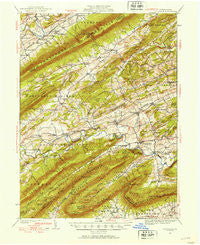
~ Loysville PA topo map, 1:62500 scale, 15 X 15 Minute, Historical, 1930, updated 1953
Loysville, Pennsylvania, USGS topographic map dated 1930.
Includes geographic coordinates (latitude and longitude). This topographic map is suitable for hiking, camping, and exploring, or framing it as a wall map.
Printed on-demand using high resolution imagery, on heavy weight and acid free paper, or alternatively on a variety of synthetic materials.
Topos available on paper, Waterproof, Poly, or Tyvek. Usually shipping rolled, unless combined with other folded maps in one order.
- Product Number: USGS-5330656
- Free digital map download (high-resolution, GeoPDF): Loysville, Pennsylvania (file size: 10 MB)
- Map Size: please refer to the dimensions of the GeoPDF map above
- Weight (paper map): ca. 55 grams
- Map Type: POD USGS Topographic Map
- Map Series: HTMC
- Map Verison: Historical
- Cell ID: 56955
- Scan ID: 172245
- Imprint Year: 1953
- Woodland Tint: Yes
- Survey Year: 1930
- Datum: Unstated
- Map Projection: Polyconic
- Map published by United States Geological Survey
- Map Language: English
- Scanner Resolution: 600 dpi
- Map Cell Name: Loysville
- Grid size: 15 X 15 Minute
- Date on map: 1930
- Map Scale: 1:62500
- Geographical region: Pennsylvania, United States
Neighboring Maps:
All neighboring USGS topo maps are available for sale online at a variety of scales.
Spatial coverage:
Topo map Loysville, Pennsylvania, covers the geographical area associated the following places:
- Pleasant View - Bridgeport - Milltown - Roseburg - Pine Grove - Spruce Hill - Andersonburg - Landisburg - Oakgrove - Little Germany - Saville - Mannsville - Ickesburg - Roseburg - Elliottsburg - Walnut Grove - Stony Point - Erly - Entlerville - Alinda - Loysville - Bixler - Green Park - Centre - Sundy Place - Cisna Run - Academia - Kistler - Fort Robertson - Doubling Gap - Seven Pines - Couchtown - Eshcol
- Map Area ID: AREA40.540.25-77.5-77.25
- Northwest corner Lat/Long code: USGSNW40.5-77.5
- Northeast corner Lat/Long code: USGSNE40.5-77.25
- Southwest corner Lat/Long code: USGSSW40.25-77.5
- Southeast corner Lat/Long code: USGSSE40.25-77.25
- Northern map edge Latitude: 40.5
- Southern map edge Latitude: 40.25
- Western map edge Longitude: -77.5
- Eastern map edge Longitude: -77.25


