
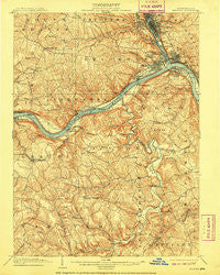
~ Beaver PA topo map, 1:62500 scale, 15 X 15 Minute, Historical, 1904, updated 1909
Beaver, Pennsylvania, USGS topographic map dated 1904.
Includes geographic coordinates (latitude and longitude). This topographic map is suitable for hiking, camping, and exploring, or framing it as a wall map.
Printed on-demand using high resolution imagery, on heavy weight and acid free paper, or alternatively on a variety of synthetic materials.
Topos available on paper, Waterproof, Poly, or Tyvek. Usually shipping rolled, unless combined with other folded maps in one order.
- Product Number: USGS-5329366
- Free digital map download (high-resolution, GeoPDF): Beaver, Pennsylvania (file size: 10 MB)
- Map Size: please refer to the dimensions of the GeoPDF map above
- Weight (paper map): ca. 55 grams
- Map Type: POD USGS Topographic Map
- Map Series: HTMC
- Map Verison: Historical
- Cell ID: 51051
- Scan ID: 169790
- Imprint Year: 1909
- Survey Year: 1901
- Datum: Unstated
- Map Projection: Unstated
- Map published by United States Geological Survey
- Map Language: English
- Scanner Resolution: 600 dpi
- Map Cell Name: Beaver
- Grid size: 15 X 15 Minute
- Date on map: 1904
- Map Scale: 1:62500
- Geographical region: Pennsylvania, United States
Neighboring Maps:
All neighboring USGS topo maps are available for sale online at a variety of scales.
Spatial coverage:
Topo map Beaver, Pennsylvania, covers the geographical area associated the following places:
- New Brighton - Shippingport - Davidson Heights - Industry - Hookstown - Blackhawk - Gringo - Marion Hill - Holt - McAlisters Crossroads - East Rochester - Dawson - Kenwood - Merrill - Georgetown - Patterson Heights - McDonaldtown - Midland - Rochester - Monaca - Ohioview - Crestmont Village - Saint Clair - New Sheffield - Five Points - Stobo - Esther (historical) - Mechanicsburg - Bridgewater - Bellowsville - Doctor Heights - Kendall - Bocktown - McCleary - Fairview - Beaver - Scottsville - Freedom - Independence - North Rochester - Josephtown - Five Points - Pulaski - Harshaville - Ohioville - Vanport - Phillipsburg - Fallston
- Map Area ID: AREA40.7540.5-80.5-80.25
- Northwest corner Lat/Long code: USGSNW40.75-80.5
- Northeast corner Lat/Long code: USGSNE40.75-80.25
- Southwest corner Lat/Long code: USGSSW40.5-80.5
- Southeast corner Lat/Long code: USGSSE40.5-80.25
- Northern map edge Latitude: 40.75
- Southern map edge Latitude: 40.5
- Western map edge Longitude: -80.5
- Eastern map edge Longitude: -80.25


