
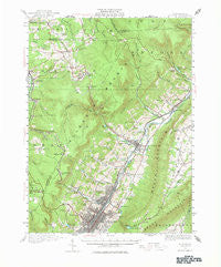
~ Altoona PA topo map, 1:62500 scale, 15 X 15 Minute, Historical, 1920, updated 1976
Altoona, Pennsylvania, USGS topographic map dated 1920.
Includes geographic coordinates (latitude and longitude). This topographic map is suitable for hiking, camping, and exploring, or framing it as a wall map.
Printed on-demand using high resolution imagery, on heavy weight and acid free paper, or alternatively on a variety of synthetic materials.
Topos available on paper, Waterproof, Poly, or Tyvek. Usually shipping rolled, unless combined with other folded maps in one order.
- Product Number: USGS-5329316
- Free digital map download (high-resolution, GeoPDF): Altoona, Pennsylvania (file size: 9 MB)
- Map Size: please refer to the dimensions of the GeoPDF map above
- Weight (paper map): ca. 55 grams
- Map Type: POD USGS Topographic Map
- Map Series: HTMC
- Map Verison: Historical
- Cell ID: 50479
- Scan ID: 167970
- Imprint Year: 1976
- Woodland Tint: Yes
- Survey Year: 1920
- Datum: NAD27
- Map Projection: Polyconic
- Map published by United States Geological Survey
- Map Language: English
- Scanner Resolution: 600 dpi
- Map Cell Name: Altoona
- Grid size: 15 X 15 Minute
- Date on map: 1920
- Map Scale: 1:62500
- Geographical region: Pennsylvania, United States
Neighboring Maps:
All neighboring USGS topo maps are available for sale online at a variety of scales.
Spatial coverage:
Topo map Altoona, Pennsylvania, covers the geographical area associated the following places:
- Van Ormer - Newburg - Juniata - Bellwood - Roots - Juniata Gap - East Altoona - Charlottsville - Skelp - Buckhorn - Elberta - Fairview - Frugality - Mountaindale - Utahville - Beverly Hills - Wehnwood - Dougherty - Pleasant Valley - Orners Corner - Hollentown - Richland - Highland Fling - Sickles Corner - Pinecroft - Mill Run - Lloydville - Fostoria - Tipton - Reightown - Greenwood - Fallentimber - Alta Manor - Allemans - Culp - Altoona - East End - Riggles Gap - Westmont - Calvert Hills - Wopsononock - Homer Gap - Blandburg - Grazierville - Gray - Glasgow - Bear Loop
- Map Area ID: AREA40.7540.5-78.5-78.25
- Northwest corner Lat/Long code: USGSNW40.75-78.5
- Northeast corner Lat/Long code: USGSNE40.75-78.25
- Southwest corner Lat/Long code: USGSSW40.5-78.5
- Southeast corner Lat/Long code: USGSSE40.5-78.25
- Northern map edge Latitude: 40.75
- Southern map edge Latitude: 40.5
- Western map edge Longitude: -78.5
- Eastern map edge Longitude: -78.25


