
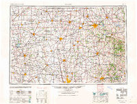
~ Marion OH topo map, 1:250000 scale, 1 X 2 Degree, Historical, 1962, updated 1962
Marion, Ohio, USGS topographic map dated 1962.
Includes geographic coordinates (latitude and longitude). This topographic map is suitable for hiking, camping, and exploring, or framing it as a wall map.
Printed on-demand using high resolution imagery, on heavy weight and acid free paper, or alternatively on a variety of synthetic materials.
Topos available on paper, Waterproof, Poly, or Tyvek. Usually shipping rolled, unless combined with other folded maps in one order.
- Product Number: USGS-5321592
- Free digital map download (high-resolution, GeoPDF): Marion, Ohio (file size: 15 MB)
- Map Size: please refer to the dimensions of the GeoPDF map above
- Weight (paper map): ca. 55 grams
- Map Type: POD USGS Topographic Map
- Map Series: HTMC
- Map Verison: Historical
- Cell ID: 75002
- Scan ID: 225743
- Imprint Year: 1962
- Woodland Tint: Yes
- Aerial Photo Year: 1944
- Datum: NAD27
- Map Projection: Transverse Mercator
- Map published by United States Geological Survey
- Map published by United States Army Corps of Engineers
- Map published by United States Army
- Map Language: English
- Scanner Resolution: 600 dpi
- Map Cell Name: Marion
- Grid size: 1 X 2 Degree
- Date on map: 1962
- Map Scale: 1:250000
- Geographical region: Ohio, United States
Neighboring Maps:
All neighboring USGS topo maps are available for sale online at a variety of scales.
Spatial coverage:
Topo map Marion, Ohio, covers the geographical area associated the following places:
- Westerville Estates - North Robinson - Shawnee Hills - Paint Valley - Sandy Hill - Planters Grove - Moreland Corners - Hyatts - Lincoln Heights - Windsor - Essex - Grant - Huntersville - Heath - Rich Hill - Saint Johns (historical) - Green Valley - Hopes Mobile Home Park - Congress - Heritage Creek - Highway (historical) - Resaca - Jackson - Hayesville - Lakewood - Batemantown - Fleetwood Park - Bowsherville (historical) - Leesville - Africa - Mount Blanchard - Meadows of North Lewisburg - Richland Cottage Area - Lakeland Beach - Pagetown - Glenville (historical) - Melco - Martinstown (historical) - Norton - Nettleton (historical) - Lewis Center - Lloyd Corners - Braumiller Woods - Climax - Bangs - Crystal Lakes - Big Prairie - Sunbury - Nevada - Hyde Park - Ealy Crossing - Lucerne - Rush Mobile Home Park - Lake View - Craigton - Greyland Estates - Tunnel Hill - Shawtown - Marne - Bucyrus - Central City (historical) - Royal Elm - Abbey Chase - Welsh Hills - Harbor Pointe - Concord - New Winchester - Ashleigh Village - Fieldstone - Woodland - Middleburg - The Woods At Dornoch Estates - Estates At Braumiller - Carson Farms - Westerville - Mononcue - Amoy - Bellaire Gardens - Deunquat - Highwater - Big Springs - Nankin - Shire Cove - Pleasant Acres Mobile Home Park - Coulter - Eris - McGuffey - Carpenters Mobile Home Park - Mount Air - Westview Mobile Home Park - Walnut Grove Estates - Sparta - Nashville - Richlanne Acres - Hidden Creek - Bethlehem - Marengo - Waverly Place - Brindle Corner - Silver Springs
- Map Area ID: AREA4140-84-82
- Northwest corner Lat/Long code: USGSNW41-84
- Northeast corner Lat/Long code: USGSNE41-82
- Southwest corner Lat/Long code: USGSSW40-84
- Southeast corner Lat/Long code: USGSSE40-82
- Northern map edge Latitude: 41
- Southern map edge Latitude: 40
- Western map edge Longitude: -84
- Eastern map edge Longitude: -82


