
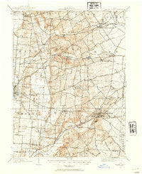
~ Mechanicsburg OH topo map, 1:62500 scale, 15 X 15 Minute, Historical, 1914, updated 1954
Mechanicsburg, Ohio, USGS topographic map dated 1914.
Includes geographic coordinates (latitude and longitude). This topographic map is suitable for hiking, camping, and exploring, or framing it as a wall map.
Printed on-demand using high resolution imagery, on heavy weight and acid free paper, or alternatively on a variety of synthetic materials.
Topos available on paper, Waterproof, Poly, or Tyvek. Usually shipping rolled, unless combined with other folded maps in one order.
- Product Number: USGS-5321094
- Free digital map download (high-resolution, GeoPDF): Mechanicsburg, Ohio (file size: 8 MB)
- Map Size: please refer to the dimensions of the GeoPDF map above
- Weight (paper map): ca. 55 grams
- Map Type: POD USGS Topographic Map
- Map Series: HTMC
- Map Verison: Historical
- Cell ID: 57442
- Scan ID: 227826
- Imprint Year: 1954
- Survey Year: 1914
- Datum: NAD27
- Map Projection: Polyconic
- Map published by United States Geological Survey
- Map Language: English
- Scanner Resolution: 600 dpi
- Map Cell Name: Mechanicsburg
- Grid size: 15 X 15 Minute
- Date on map: 1914
- Map Scale: 1:62500
- Geographical region: Ohio, United States
Neighboring Maps:
All neighboring USGS topo maps are available for sale online at a variety of scales.
Spatial coverage:
Topo map Mechanicsburg, Ohio, covers the geographical area associated the following places:
- McKeever Mobile Home Park - Powhattan - Meadows of North Lewisburg - Five Points - Mutual - Mar-nel Mobile Home Park - Mumper Estates - Woodstock - North Lewisburg - Kingscreek - Fountain Park - Mackachack (historical) - Crimville (historical) - Brush Lake (historical) - Plateau Acres - Hagenbaugh (historical) - Frost Mobile Home Park - Middletown - Mingo - Catawba Station - Mechanicsburg - Kennard - The Knolls - Cable
- Map Area ID: AREA40.2540-83.75-83.5
- Northwest corner Lat/Long code: USGSNW40.25-83.75
- Northeast corner Lat/Long code: USGSNE40.25-83.5
- Southwest corner Lat/Long code: USGSSW40-83.75
- Southeast corner Lat/Long code: USGSSE40-83.5
- Northern map edge Latitude: 40.25
- Southern map edge Latitude: 40
- Western map edge Longitude: -83.75
- Eastern map edge Longitude: -83.5


