
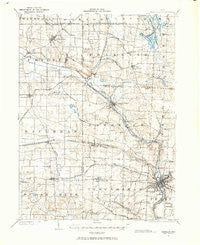
~ Massillon OH topo map, 1:62500 scale, 15 X 15 Minute, Historical, 1901, updated 1963
Massillon, Ohio, USGS topographic map dated 1901.
Includes geographic coordinates (latitude and longitude). This topographic map is suitable for hiking, camping, and exploring, or framing it as a wall map.
Printed on-demand using high resolution imagery, on heavy weight and acid free paper, or alternatively on a variety of synthetic materials.
Topos available on paper, Waterproof, Poly, or Tyvek. Usually shipping rolled, unless combined with other folded maps in one order.
- Product Number: USGS-5321074
- Free digital map download (high-resolution, GeoPDF): Massillon, Ohio (file size: 8 MB)
- Map Size: please refer to the dimensions of the GeoPDF map above
- Weight (paper map): ca. 55 grams
- Map Type: POD USGS Topographic Map
- Map Series: HTMC
- Map Verison: Historical
- Cell ID: 57262
- Scan ID: 227753
- Imprint Year: 1963
- Datum: NAD27
- Map Projection: Polyconic
- Map published by United States Geological Survey
- Map Language: English
- Scanner Resolution: 600 dpi
- Map Cell Name: Massillon
- Grid size: 15 X 15 Minute
- Date on map: 1901
- Map Scale: 1:62500
- Geographical region: Ohio, United States
Neighboring Maps:
All neighboring USGS topo maps are available for sale online at a variety of scales.
Spatial coverage:
Topo map Massillon, Ohio, covers the geographical area associated the following places:
- West Park - Pauls (historical) - Audubon Ridge - East Brookfield - Solar Estates - New Franklin - Kendall Heights - Columbia - Doylestown - Pine Knoll Estates - Serenity Shores - Manchester - Summit (historical) - Clinton - Warwick - Tamarack Lake Estates - Burton City - Sippo Heights - Merestead Farms - Rhodes (historical) - McQuaid (historical) - Aldawood Hills - Gloucester Village - Country Place Estates - L And S Trailer Park - Crystal Lake Park - Snively - North Lawrence - Autumn Ridge Estates - Smithville Trailer Park - Infant of Prague Villa - Scenic Ridge - Canal Fulton - Carrington - Oak Ridge - Mayflower Village - M And C Mobile Village - Sundial Mobile Home Park - Deer Valley Estates - Sherwood (historical) - Ellis Estates - Coventry Hills - Camelot Hills - Rex Hill Mobile Home Park - Westview Mobile Home Park - Sippo - Marshallville - Elms Acres - Spring Valley Estates - Comet Trailer Park - Pleasant Hills Estates - West Fulton - Stanwood - New England - Top of the Hill Mobile Home Park - Withering Heights - Robins Trace - Walnut Hills - Marshall Estates - Forestwood - Brimestone Corners (historical) - Hearthstone Estates - Cottage Grove - Tamarack Highlands - Oak Park Mobile Home Park - Pinn (historical) - Hillcrest Highlands - Nimisila Mobile Home Park - Amherst Heights - Clearview - Westarado - West Brookfield - Forty Corners Village - Waterside - West Massillon - Charity Rotch - Easton - Lawndale - Massillon - Nimisila Sunset Heights - Lockwood Corners - Lakeview - Moffitt Heights - Urban Hill - Newman - Weavers (historical) - Kings Ridge - Turkeyfoot Heights - Sandy Beach Trailer Park - Greenwood Acres - Hemlock Green Estates - Dalton - Crystal Springs - Sherylton Hills - Hametown - Comet - Rolling Hills Village - East Greenville
- Map Area ID: AREA4140.75-81.75-81.5
- Northwest corner Lat/Long code: USGSNW41-81.75
- Northeast corner Lat/Long code: USGSNE41-81.5
- Southwest corner Lat/Long code: USGSSW40.75-81.75
- Southeast corner Lat/Long code: USGSSE40.75-81.5
- Northern map edge Latitude: 41
- Southern map edge Latitude: 40.75
- Western map edge Longitude: -81.75
- Eastern map edge Longitude: -81.5


