
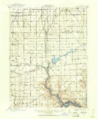
~ Loramie OH topo map, 1:62500 scale, 15 X 15 Minute, Historical, 1909, updated 1961
Loramie, Ohio, USGS topographic map dated 1909.
Includes geographic coordinates (latitude and longitude). This topographic map is suitable for hiking, camping, and exploring, or framing it as a wall map.
Printed on-demand using high resolution imagery, on heavy weight and acid free paper, or alternatively on a variety of synthetic materials.
Topos available on paper, Waterproof, Poly, or Tyvek. Usually shipping rolled, unless combined with other folded maps in one order.
- Product Number: USGS-5321036
- Free digital map download (high-resolution, GeoPDF): Loramie, Ohio (file size: 6 MB)
- Map Size: please refer to the dimensions of the GeoPDF map above
- Weight (paper map): ca. 55 grams
- Map Type: POD USGS Topographic Map
- Map Series: HTMC
- Map Verison: Historical
- Cell ID: 56911
- Scan ID: 225643
- Imprint Year: 1961
- Survey Year: 1909
- Datum: NAD27
- Map Projection: Polyconic
- Map published by United States Geological Survey
- Map Language: English
- Scanner Resolution: 600 dpi
- Map Cell Name: Loramie
- Grid size: 15 X 15 Minute
- Date on map: 1909
- Map Scale: 1:62500
- Geographical region: Ohio, United States
Neighboring Maps:
All neighboring USGS topo maps are available for sale online at a variety of scales.
Spatial coverage:
Topo map Loramie, Ohio, covers the geographical area associated the following places:
- Strakers (historical) - Houston - Filburns Island - Earls Island - West Lake Village - Chickasaw - Oran - Spirk Mobile Home Park - Lehmkuhl Landing - Hegemanns Landing - Minster - Maria Stein - Yorkshire - New Bremen - Saint Johns - New Knoxville - Willowdell - Newport - Egypt - Osgood - Saint Patrick - Steinman (historical) - Kettlersville - McCartyville - Uno - Dawson - Fort Loramie - Lock Two
- Map Area ID: AREA40.540.25-84.5-84.25
- Northwest corner Lat/Long code: USGSNW40.5-84.5
- Northeast corner Lat/Long code: USGSNE40.5-84.25
- Southwest corner Lat/Long code: USGSSW40.25-84.5
- Southeast corner Lat/Long code: USGSSE40.25-84.25
- Northern map edge Latitude: 40.5
- Southern map edge Latitude: 40.25
- Western map edge Longitude: -84.5
- Eastern map edge Longitude: -84.25


