
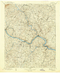
~ Palmyra VA topo map, 1:125000 scale, 30 X 30 Minute, Historical, 1897, updated 1938
Palmyra, Virginia, USGS topographic map dated 1897.
Includes geographic coordinates (latitude and longitude). This topographic map is suitable for hiking, camping, and exploring, or framing it as a wall map.
Printed on-demand using high resolution imagery, on heavy weight and acid free paper, or alternatively on a variety of synthetic materials.
Topos available on paper, Waterproof, Poly, or Tyvek. Usually shipping rolled, unless combined with other folded maps in one order.
- Product Number: USGS-5304058
- Free digital map download (high-resolution, GeoPDF): Palmyra, Virginia (file size: 8 MB)
- Map Size: please refer to the dimensions of the GeoPDF map above
- Weight (paper map): ca. 55 grams
- Map Type: POD USGS Topographic Map
- Map Series: HTMC
- Map Verison: Historical
- Cell ID: 66276
- Scan ID: 189131
- Imprint Year: 1938
- Survey Year: 1889
- Datum: Unstated
- Map Projection: Polyconic
- Map published by United States Geological Survey
- Map Language: English
- Scanner Resolution: 600 dpi
- Map Cell Name: Palmyra
- Grid size: 30 X 30 Minute
- Date on map: 1897
- Map Scale: 1:125000
- Geographical region: Virginia, United States
Neighboring Maps:
All neighboring USGS topo maps are available for sale online at a variety of scales.
Spatial coverage:
Topo map Palmyra, Virginia, covers the geographical area associated the following places:
- Pemberton - Shannon Hills - Sprouses Corner - Rose Hill - Royal Oaks Estates - Antioch - Ashby - Crafton - Tabscott - Weber City - Dunreath (historical) - Shannon Hills Estates - Hardware - Georges Tavern - Zion - Blenheim - Arvonia - Strathouse - Tabscott East - Enon - Cunningham - Scottsville - Stokes (historical) - Dixie - Chimney Springs - Wilmington - Paynes Mill - Tamworth - Kents Store - Alpha - Kidds Store - Whiteville - Running Deer - Milton Hills - Payne - Ferncliff - Hamilton - Shannon Hills Farms - Stony Point - Union Hill - Boswell (historical) - Trenholm - Bridgeport - Penlan - Bush Park (historical) - Paynes Mill - Elk Hill - Hideaway Lake - Nicholas - Quail - Trents Mill - Stage Junction - Rockaway - Hatcher - Hidden Acres - Palmyra - Bula - Dillwyn - Byrd Mill - Fife - Lakeside Village - Holmhead - Gold Hill - Smiths Crossroads - Sunny Side - Clinton - Trice (historical) - Ashmere - Tally (historical) - Cartersville - Union Mills - Nahor - Nuckols - Wildwood - Cohasset - Columbia - Belona - Eldridge Mill - Woodridge - Bells Crossroads - Cloverdale - Campbell Corner - Oak Forest - Caledonia - Shannon Hill - Lake Monticello - Zion Crossroads - LeSueur - Stearnes - James River Landing - Hatchers - Taggart - Simeon - West View - Mechunk Acres - Allenslevel - Rosney - Hunters Trail - Georges Landing - Cranks (historical)
- Map Area ID: AREA3837.5-78.5-78
- Northwest corner Lat/Long code: USGSNW38-78.5
- Northeast corner Lat/Long code: USGSNE38-78
- Southwest corner Lat/Long code: USGSSW37.5-78.5
- Southeast corner Lat/Long code: USGSSE37.5-78
- Northern map edge Latitude: 38
- Southern map edge Latitude: 37.5
- Western map edge Longitude: -78.5
- Eastern map edge Longitude: -78


