
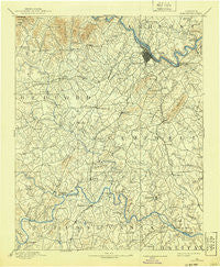
~ Lynchburg VA topo map, 1:125000 scale, 30 X 30 Minute, Historical, 1892, updated 1940
Lynchburg, Virginia, USGS topographic map dated 1892.
Includes geographic coordinates (latitude and longitude). This topographic map is suitable for hiking, camping, and exploring, or framing it as a wall map.
Printed on-demand using high resolution imagery, on heavy weight and acid free paper, or alternatively on a variety of synthetic materials.
Topos available on paper, Waterproof, Poly, or Tyvek. Usually shipping rolled, unless combined with other folded maps in one order.
- Product Number: USGS-5303996
- Free digital map download (high-resolution, GeoPDF): Lynchburg, Virginia (file size: 7 MB)
- Map Size: please refer to the dimensions of the GeoPDF map above
- Weight (paper map): ca. 55 grams
- Map Type: POD USGS Topographic Map
- Map Series: HTMC
- Map Verison: Historical
- Cell ID: 65956
- Scan ID: 189062
- Imprint Year: 1940
- Survey Year: 1890
- Datum: Unstated
- Map Projection: Polyconic
- Map published by United States Geological Survey
- Map Language: English
- Scanner Resolution: 600 dpi
- Map Cell Name: Lynchburg
- Grid size: 30 X 30 Minute
- Date on map: 1892
- Map Scale: 1:125000
- Geographical region: Virginia, United States
Neighboring Maps:
All neighboring USGS topo maps are available for sale online at a variety of scales.
Spatial coverage:
Topo map Lynchburg, Virginia, covers the geographical area associated the following places:
- Forest Park - Altavista - Oak Grove - Holiday Acres - Long Mountain Estates - Norwood - Mount Airy - Westward Park - Galts Mill - Brutus - Seneca - New London - Kelly - Mount Zion - Charlemont - Bluemont Estates - Prices Store - Diamond Hill - Joshua Falls - Hillsman Corner - Clay - Mitchell Mill - Edgewood - Bocock - Garland Hill - Ruritan - Blue Ridge Farms - Penn Forest - Woodlawn - Bedford Springs - Marysville - Long Island - Tanglewood - Brush Tavern - Merry Moor - Perkins Park - Woodford Corner - Melwood Manor - Forest Hill - Sunny Banks - Panorama Hills - College Park - Great Oaks - Tulip Tree Acres - Lanes Well Fork - Jackson Heights - Cedar Forest - Forest Dale - Viking Fiord - Meadowview Hills - Sandy Bottom - Montrose Heights - Oxford Furnace - Timberlake - Glenwood - Thomas Terrace - Vista Acres - Curtis - Sandusky Park - Westbrook - Beechwood Hills - Holly Hills South - Brights - Lamont Acres - Woodbine Village - Sedalia - Brookville - Lowry - Moseley Heights - Woodlands - Keystone Forest - Forest - Winesap - Reusens - Brightwell Mill - Federal Hill - Otter Hill - Federal Hill Estates - Abert - Meadow Wood - Sheffield - West Lynchburg - Black Rock Farm - Deer Creek - Eagles Eyrie - Maple Hill - Naruna - Rainbow Forest - Forest Brook Hills - Sherwood Forest - West Bethel - Yellow Branch - Taber - Woodbine Acres - Heritage Hills - Court House Hill - Sandy Acres - Lo Roy Acres - Lawyers - Fort Hill
- Map Area ID: AREA37.537-79.5-79
- Northwest corner Lat/Long code: USGSNW37.5-79.5
- Northeast corner Lat/Long code: USGSNE37.5-79
- Southwest corner Lat/Long code: USGSSW37-79.5
- Southeast corner Lat/Long code: USGSSE37-79
- Northern map edge Latitude: 37.5
- Southern map edge Latitude: 37
- Western map edge Longitude: -79.5
- Eastern map edge Longitude: -79


