
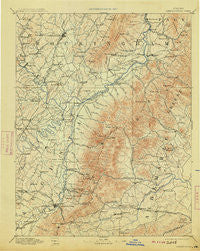
~ Harrisonburg VA topo map, 1:125000 scale, 30 X 30 Minute, Historical, 1892, updated 1913
Harrisonburg, Virginia, USGS topographic map dated 1892.
Includes geographic coordinates (latitude and longitude). This topographic map is suitable for hiking, camping, and exploring, or framing it as a wall map.
Printed on-demand using high resolution imagery, on heavy weight and acid free paper, or alternatively on a variety of synthetic materials.
Topos available on paper, Waterproof, Poly, or Tyvek. Usually shipping rolled, unless combined with other folded maps in one order.
- Product Number: USGS-5303922
- Free digital map download (high-resolution, GeoPDF): Harrisonburg, Virginia (file size: 8 MB)
- Map Size: please refer to the dimensions of the GeoPDF map above
- Weight (paper map): ca. 55 grams
- Map Type: POD USGS Topographic Map
- Map Series: HTMC
- Map Verison: Historical
- Cell ID: 65649
- Scan ID: 189002
- Imprint Year: 1913
- Survey Year: 1887
- Datum: Unstated
- Map Projection: Unstated
- Map published by United States Geological Survey
- Map Language: English
- Scanner Resolution: 600 dpi
- Map Cell Name: Harrisonburg
- Grid size: 30 X 30 Minute
- Date on map: 1892
- Map Scale: 1:125000
- Geographical region: Virginia, United States
Neighboring Maps:
All neighboring USGS topo maps are available for sale online at a variety of scales.
Spatial coverage:
Topo map Harrisonburg, Virginia, covers the geographical area associated the following places:
- Oak Hill - University Heights - Wilhait - Bridgewater - Barren Ridge - Williams Fork - Stillfield - Preston Heights - Kidville - Weyers Cave - Simmons Gap - Knightly - Montezuma - Mill Ridge - Inglewood - Huntington Village - Mallard Lake - East Point - Whispering Pines - Peacock Hill - Whipporwill Hollow - Windrift - Peach Grove (historical) - Sampson - Beaver Hill Mobile Home Park - Wayland Park - Millington - Thurston - White Hall - Wyngate - Friedens - Annex - Dayton - Loch Leigh - Ivy - McCormick Road Houses - Ashby Heights - Hermitage - Crozet - Foothill Village - Stonewall - Brookwood - Island Ford - Ladd - Hickory Ridge - Country View - Fleeburg - Lyndhurst - Waynesboro - Glenaire - Nortonsville - Oak Hill Mobile Home Park - Lewis Hill East - Broad Axe (historical) - Verbena - Berrytown - Boonesville - Nob Hill - Pineville - Rocky Bar - Queen Charlotte - Grottoes - Candlewyck - Colthurst - New Erection - Reynard Woods - Mount Sidney - Blue Ridge View - Peales Crossroads - Fairgrove - Brownsville - Harriston - Emerald Hills - Jollett - Pirkey - Canterbury Hills - Georgetown Green - Beldor - Afton - Beazley (historical) - Elkton - Yancey Mills - Crimora - Keezletown - Sneads Mobile Home Park - Sullivan (historical) - Logan Village - Lewis Hill West - Decca (historical) - Westover Hills - Red Mills - Orchard Acres - Brinnington - Pleasant Valley - Teaverton - McGaheysville - Liberty Hill - Midway - Montevideo - Alderman Road Houses
- Map Area ID: AREA38.538-79-78.5
- Northwest corner Lat/Long code: USGSNW38.5-79
- Northeast corner Lat/Long code: USGSNE38.5-78.5
- Southwest corner Lat/Long code: USGSSW38-79
- Southeast corner Lat/Long code: USGSSE38-78.5
- Northern map edge Latitude: 38.5
- Southern map edge Latitude: 38
- Western map edge Longitude: -79
- Eastern map edge Longitude: -78.5


