
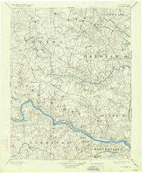
~ Goochland VA topo map, 1:125000 scale, 30 X 30 Minute, Historical, 1892, updated 1934
Goochland, Virginia, USGS topographic map dated 1892.
Includes geographic coordinates (latitude and longitude). This topographic map is suitable for hiking, camping, and exploring, or framing it as a wall map.
Printed on-demand using high resolution imagery, on heavy weight and acid free paper, or alternatively on a variety of synthetic materials.
Topos available on paper, Waterproof, Poly, or Tyvek. Usually shipping rolled, unless combined with other folded maps in one order.
- Product Number: USGS-5303884
- Free digital map download (high-resolution, GeoPDF): Goochland, Virginia (file size: 7 MB)
- Map Size: please refer to the dimensions of the GeoPDF map above
- Weight (paper map): ca. 55 grams
- Map Type: POD USGS Topographic Map
- Map Series: HTMC
- Map Verison: Historical
- Cell ID: 65577
- Scan ID: 188966
- Imprint Year: 1934
- Survey Year: 1888
- Datum: Unstated
- Map Projection: Polyconic
- Map published by United States Geological Survey
- Map Language: English
- Scanner Resolution: 600 dpi
- Map Cell Name: Goochland
- Grid size: 30 X 30 Minute
- Date on map: 1892
- Map Scale: 1:125000
- Geographical region: Virginia, United States
Neighboring Maps:
All neighboring USGS topo maps are available for sale online at a variety of scales.
Spatial coverage:
Topo map Goochland, Virginia, covers the geographical area associated the following places:
- Jefferson - Holly Grove - The Forest - Amber Lake - Oliver - Red Lane - Worshams - Glenbrook Hills - Cedar Hills - Beaufont Hills - Crozier - Westham - Whitehall Acres - Old Oaks - Southhampton Hills - Huguenot - Pembroke - Samary Forest - Bon Air - Gayton - Dorset Woods - Old Bandana - Chesterfield Village - Buckingham - English Hills - Green Bay - Glen Echo Place - Irwin - Midlothian - Maidens Forest - Johnsons Springs - Grand Summit - Bumpass - Auburn Chase - Vigor - Holiday Hills - Mooreland - Crestview - Buckner - Tylers - Tally Ho Estates - Powhatan - Smokey Hollow - Horsepen Hills - Wheatlands - Ramsgate - Coffey Corner - Maidens - Forest Hill Farms - Tuckahoe - Laurel Village - Sabot - Brookwood Estates - Goochland - Chelsea - Hadensville - Coatesville - Covington - Vontay - Threemile Corner - Manakin Farms - Sheffield Court - Willow Oaks - Deerfield - Ashwoods - Sweet Briar Park - East Courthouse Estates - Jackson - Beaverdam - Wyndham - Gilman - Apple Grove - Broad Meadows - Macon - Huguenot Farms - Laurel - Thorncliff - Village Acres - Vinita - Canterbury - Dover Run - Cedar Fork - Cherokee Hills - Highland Hills - Nelwood Estates - Manakin - Gayton (historical) - Hewlett - Sandy Hook - Lanes Corner - Buford Estates - Edgehill - Teman - Gravel Hill - Lorraine - Woodmont - Scotchtown - Duggins Store - Terrell Store - Cedar Point
- Map Area ID: AREA3837.5-78-77.5
- Northwest corner Lat/Long code: USGSNW38-78
- Northeast corner Lat/Long code: USGSNE38-77.5
- Southwest corner Lat/Long code: USGSSW37.5-78
- Southeast corner Lat/Long code: USGSSE37.5-77.5
- Northern map edge Latitude: 38
- Southern map edge Latitude: 37.5
- Western map edge Longitude: -78
- Eastern map edge Longitude: -77.5


