
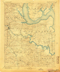
~ Fredericksburg VA topo map, 1:125000 scale, 30 X 30 Minute, Historical, 1894, updated 1905
Fredericksburg, Virginia, USGS topographic map dated 1894.
Includes geographic coordinates (latitude and longitude). This topographic map is suitable for hiking, camping, and exploring, or framing it as a wall map.
Printed on-demand using high resolution imagery, on heavy weight and acid free paper, or alternatively on a variety of synthetic materials.
Topos available on paper, Waterproof, Poly, or Tyvek. Usually shipping rolled, unless combined with other folded maps in one order.
- Product Number: USGS-5303854
- Free digital map download (high-resolution, GeoPDF): Fredericksburg, Virginia (file size: 7 MB)
- Map Size: please refer to the dimensions of the GeoPDF map above
- Weight (paper map): ca. 55 grams
- Map Type: POD USGS Topographic Map
- Map Series: HTMC
- Map Verison: Historical
- Cell ID: 65520
- Scan ID: 188945
- Imprint Year: 1905
- Survey Year: 1888
- Datum: Unstated
- Map Projection: Unstated
- Map published by United States Geological Survey
- Map Language: English
- Scanner Resolution: 600 dpi
- Map Cell Name: Fredericksburg
- Grid size: 30 X 30 Minute
- Date on map: 1894
- Map Scale: 1:125000
- Geographical region: Virginia, United States
Neighboring Maps:
All neighboring USGS topo maps are available for sale online at a variety of scales.
Spatial coverage:
Topo map Fredericksburg, Virginia, covers the geographical area associated the following places:
- Fairview and Oakland - Maryes Heights - Young Corner - Artillery Ridge - The Falls - Rivendell - Dogue - Daniel Corner - Towns of East Chatham Heights - Flippos Corner - Skywoods - Boscobel Woods - Stafford Heights - Alden - Gulvey - Wildcat Corner - Argyle Terrace - Iraville - Ferry Farm - Moores Corner - Smith Lake Landing - Lee's Hill Mobile Home Park - Port Royal Cross Roads - White Oak Hills - Wrightsville - Beau Ridge - Crows Nest Harbor - Rixey - Butterfield - Falmouth - Argyle Heights - Lyons Den - Hickory Ridge - Brentland - Freedom Estates - Stafford - Walnut Hill - J A Macgregor Estate - Misty Forest - Belvedere Beach - The Oaks Mobile Home Park - Dahlgren Junction (historical) - Sky Terrace - Cabin Creekwood - Eastern View - Widewater - North Ferry Farms - Debruyn - Hampstead - Huntington Hills - Walter Roberson Estate - Cox Corner - Ramoth Church Estates - Courts at Stafford - Park Ridge - Hillcrest Terrace - Cranes Corner - Loretto - Little Falls - Concord Heights - Youngstead - Broaddus - Whitson Run - River Bend - Shiloh - Shenandoah - Olney Corner - Hickory Fork - Allnut - Woodford - Carruthers Corner - Bells Run - The Columns - Monroe Corner - Stuart Corner - Harris - Shadow Woods - Featherstone Fork - Brandywine - Martins Corner - Potomac Creek Estates - Magnolia Woods - Cottage Green - Sunnyside Division - Garrisonville Estates - Grafton Village - Whites Corner - Clarion Woods - Biscoe - Locks Corner - Potomac - Brookstone - High School Heights - Hop Yard Landing - Coal Landing - Whitaker - Canterbury Village - Gera - Saratoga - Collins Crossing
- Map Area ID: AREA38.538-77.5-77
- Northwest corner Lat/Long code: USGSNW38.5-77.5
- Northeast corner Lat/Long code: USGSNE38.5-77
- Southwest corner Lat/Long code: USGSSW38-77.5
- Southeast corner Lat/Long code: USGSSE38-77
- Northern map edge Latitude: 38.5
- Southern map edge Latitude: 38
- Western map edge Longitude: -77.5
- Eastern map edge Longitude: -77


