
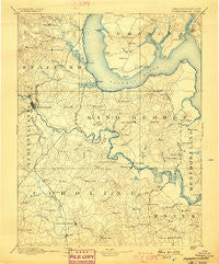
~ Fredericksburg VA topo map, 1:125000 scale, 30 X 30 Minute, Historical, 1894, updated 1898
Fredericksburg, Virginia, USGS topographic map dated 1894.
Includes geographic coordinates (latitude and longitude). This topographic map is suitable for hiking, camping, and exploring, or framing it as a wall map.
Printed on-demand using high resolution imagery, on heavy weight and acid free paper, or alternatively on a variety of synthetic materials.
Topos available on paper, Waterproof, Poly, or Tyvek. Usually shipping rolled, unless combined with other folded maps in one order.
- Product Number: USGS-5303852
- Free digital map download (high-resolution, GeoPDF): Fredericksburg, Virginia (file size: 6 MB)
- Map Size: please refer to the dimensions of the GeoPDF map above
- Weight (paper map): ca. 55 grams
- Map Type: POD USGS Topographic Map
- Map Series: HTMC
- Map Verison: Historical
- Cell ID: 65520
- Scan ID: 188944
- Imprint Year: 1898
- Survey Year: 1888
- Datum: Unstated
- Map Projection: Unstated
- Map published by United States Geological Survey
- Map Language: English
- Scanner Resolution: 600 dpi
- Map Cell Name: Fredericksburg
- Grid size: 30 X 30 Minute
- Date on map: 1894
- Map Scale: 1:125000
- Geographical region: Virginia, United States
Neighboring Maps:
All neighboring USGS topo maps are available for sale online at a variety of scales.
Spatial coverage:
Topo map Fredericksburg, Virginia, covers the geographical area associated the following places:
- Barrett Heights - Johnsons Corner - Hickory Ridge - Northridge - Purkins Corner - Rolling Meadows - Whitaker - Potomac Hills - Freedom Estates - Iraville - Olney Corner - Heritage Commons - Whites Corner - Phillips - Chestnut Hill - Somerset Beach - Welcome Acres - Butterfield - White Oak - King James Village - Brafferton - Gayles - Graves Corner - Hampstead - Chapel Heights - Jessica Estates - Rappahannock Academy - Docstone Commons - The Oaks at Ferry Farm - Grayton - Graninger Mobile Home Park - Boscobel Woods - Spring Valley - Presidential Lakes - Harris - Christopher Fork - Sunshine View - Port Conway - Sweetbriar Woods - Bel Plains Estates - Stafford Greens - Woods of Able Lake - Goby - Cottage Green - Cobblestone - Clarion Woods - Upper Zion - Cresent Pointe - Hickory Fork - Will Morgan Farm - Meadowbrook Estates - Fairview and Oakland - Summerwind - Owens - Northern View Estates - Range Corner - Rappahannock Corner - Kings Crest - Chatham Heights - Aquia Harbour - Saratoga - Poorhouse Corner - Brookfield - Dartmoor - Villboro - Aquia Creek - England Run North - Walnut Hill - Ridge Pointe - Hooes - Little Falls - Office Hall - Sycamore Ridge - Welchs - Alden - Mica - Brooke Ridge - Carruthers Corner - Naulakla - Part Little Falls - River Heights - Windermere - Raymonds Fork - Waverly - Potomac Shores - Rollins Fork - Widewater Village at Stafford - J A Macgregor Estate - Concord Heights - Shea Estates - White Oak Hills - Cabin Creekwood - Serena Forest - Canterbury Estates - Hunter Trail at Stafford - Fitzhugh - Belmont - Rivendell - Saint Georges Estates - Briarwood Estates
- Map Area ID: AREA38.538-77.5-77
- Northwest corner Lat/Long code: USGSNW38.5-77.5
- Northeast corner Lat/Long code: USGSNE38.5-77
- Southwest corner Lat/Long code: USGSSW38-77.5
- Southeast corner Lat/Long code: USGSSE38-77
- Northern map edge Latitude: 38.5
- Southern map edge Latitude: 38
- Western map edge Longitude: -77.5
- Eastern map edge Longitude: -77


