
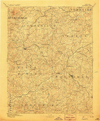
~ Farmville VA topo map, 1:125000 scale, 30 X 30 Minute, Historical, 1893, updated 1906
Farmville, Virginia, USGS topographic map dated 1893.
Includes geographic coordinates (latitude and longitude). This topographic map is suitable for hiking, camping, and exploring, or framing it as a wall map.
Printed on-demand using high resolution imagery, on heavy weight and acid free paper, or alternatively on a variety of synthetic materials.
Topos available on paper, Waterproof, Poly, or Tyvek. Usually shipping rolled, unless combined with other folded maps in one order.
- Product Number: USGS-5303838
- Free digital map download (high-resolution, GeoPDF): Farmville, Virginia (file size: 9 MB)
- Map Size: please refer to the dimensions of the GeoPDF map above
- Weight (paper map): ca. 55 grams
- Map Type: POD USGS Topographic Map
- Map Series: HTMC
- Map Verison: Historical
- Cell ID: 65467
- Scan ID: 188932
- Imprint Year: 1906
- Survey Year: 1889
- Datum: Unstated
- Map Projection: Unstated
- Map published by United States Geological Survey
- Map Language: English
- Scanner Resolution: 600 dpi
- Map Cell Name: Farmville
- Grid size: 30 X 30 Minute
- Date on map: 1893
- Map Scale: 1:125000
- Geographical region: Virginia, United States
Neighboring Maps:
All neighboring USGS topo maps are available for sale online at a variety of scales.
Spatial coverage:
Topo map Farmville, Virginia, covers the geographical area associated the following places:
- Oliveville - Briery - Nottoway Court House - Burkeville - Amelia Springs (historical) - Curdsville - Sheppards - Jamestown (historical) - Jetersville - Moryen - Plymouth - Felixville (historical) - Moran - Worsham - Hillcrest - Bruceville - Farmville - Kingsville - Hawk - Laurel Hill (historical) - Martins Corner - Hampden Sydney - Cotton Town - Sneads Spring - Rubermont - Paineville - Nutbush - Deatonville - Moores Corner - Rice - Murdocks - Blake Village - Winnie - Reeds - Jennings Ordinary - Pleasant Grove - Virso - Meherrin - Simplicity - Raines Tavern - Green Bay - Sunny Side - Hendersonville (historical) - Haw Branch - Scholfield - Irby - McRae - Tobaccoville - Burkes Tavern - Arvins Store - Truxillo - Cumberland - Mutt - Rodophil - Kimberly Hills - Ballsville - Angola - Gills - Stoddert - Guinea Mills - Fergusonville - Crewe - Lodore - Tuggle - Keysville - Clementown Mills - Pleasant Valley - Maplewood
- Map Area ID: AREA37.537-78.5-78
- Northwest corner Lat/Long code: USGSNW37.5-78.5
- Northeast corner Lat/Long code: USGSNE37.5-78
- Southwest corner Lat/Long code: USGSSW37-78.5
- Southeast corner Lat/Long code: USGSSE37-78
- Northern map edge Latitude: 37.5
- Southern map edge Latitude: 37
- Western map edge Longitude: -78.5
- Eastern map edge Longitude: -78


