
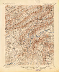
~ Christiansburg VA topo map, 1:125000 scale, 30 X 30 Minute, Historical, 1890, updated 1945
Christiansburg, Virginia, USGS topographic map dated 1890.
Includes geographic coordinates (latitude and longitude). This topographic map is suitable for hiking, camping, and exploring, or framing it as a wall map.
Printed on-demand using high resolution imagery, on heavy weight and acid free paper, or alternatively on a variety of synthetic materials.
Topos available on paper, Waterproof, Poly, or Tyvek. Usually shipping rolled, unless combined with other folded maps in one order.
- Product Number: USGS-5303806
- Free digital map download (high-resolution, GeoPDF): Christiansburg, Virginia (file size: 10 MB)
- Map Size: please refer to the dimensions of the GeoPDF map above
- Weight (paper map): ca. 55 grams
- Map Type: POD USGS Topographic Map
- Map Series: HTMC
- Map Verison: Historical
- Cell ID: 65201
- Scan ID: 188903
- Imprint Year: 1945
- Survey Year: 1887
- Datum: Unstated
- Map Projection: Polyconic
- Map published by United States Geological Survey
- Map Language: English
- Scanner Resolution: 600 dpi
- Map Cell Name: Christiansburg
- Grid size: 30 X 30 Minute
- Date on map: 1890
- Map Scale: 1:125000
- Geographical region: Virginia, United States
Neighboring Maps:
All neighboring USGS topo maps are available for sale online at a variety of scales.
Spatial coverage:
Topo map Christiansburg, Virginia, covers the geographical area associated the following places:
- Ramble Ridge - New Ellett - Rogers - Arsenic Mine (historical) - Penn Forest - Echo Hills - Merrimac - Country Hills - Southside Hills - Sherwood Forest - Dickerson - Bennett Springs - Teel Subdivision - Knollwood - Falcon Ridge Estates - Country Club Estates - Canterbury - The Orchard - Dixie Heights - Kimball Acres - Mason Cove - Pine Bluff - Southwoods - Wilmont Park - Lynwood Terrace - Rolling Hills - Maylin Hills - Jones - Adam Acres - Basham - Newcomb Heights - Evans Hill - Glenvar East - Hillview Park - Panorama Court - Gladewood - Green Hill Terrace - Kerner - Kingston Court - Dunton Addition - Stroubles Mill - Foxwood - Riverland Court - Windmill Hills - The Vistas - Tinker (historical) - Palmer Park - Medmont Lake - Valley Mill - Edgewood - Country Club Estates - Mount Vernon Heights - Crestmoor - Wabun - Carolyn Heights - Highview Terrace - Sugar Grove - Belle Aire - Riner - Crest Hill - West Club Forest - Beverly Hills - Evergreen - Grandview Gardens - Moneiro - West Chester - Junta (historical) - Hubbard Haven - Boulevard Estates - South Edgewood - Highland Park - Harmon Forest - Holly Ridge - Westchester Court - Wedgewood Forest - Hidden Valley Estates - Windsor Estates - Wilmont Farms - Woodside Park - Westfield - Murphy - Vicker Heights - La Plateau - Shadeland Addition - Morwanda Park - Oak Manor - Raintree Village - Lake View - Crestwood Gardens - Plainview - Terrys Fork - Piedmont - Dropmore - Ridgewood Farm - Oak Park - Nottingham Heights - Shamrock - Lee-Mitchell - Pilot - Walnut Grove
- Map Area ID: AREA37.537-80.5-80
- Northwest corner Lat/Long code: USGSNW37.5-80.5
- Northeast corner Lat/Long code: USGSNE37.5-80
- Southwest corner Lat/Long code: USGSSW37-80.5
- Southeast corner Lat/Long code: USGSSE37-80
- Northern map edge Latitude: 37.5
- Southern map edge Latitude: 37
- Western map edge Longitude: -80.5
- Eastern map edge Longitude: -80


