
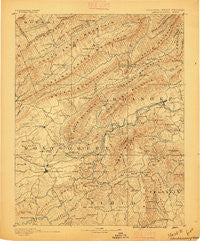
~ Christiansburg VA topo map, 1:125000 scale, 30 X 30 Minute, Historical, 1890, updated 1895
Christiansburg, Virginia, USGS topographic map dated 1890.
Includes geographic coordinates (latitude and longitude). This topographic map is suitable for hiking, camping, and exploring, or framing it as a wall map.
Printed on-demand using high resolution imagery, on heavy weight and acid free paper, or alternatively on a variety of synthetic materials.
Topos available on paper, Waterproof, Poly, or Tyvek. Usually shipping rolled, unless combined with other folded maps in one order.
- Product Number: USGS-5303792
- Free digital map download (high-resolution, GeoPDF): Christiansburg, Virginia (file size: 9 MB)
- Map Size: please refer to the dimensions of the GeoPDF map above
- Weight (paper map): ca. 55 grams
- Map Type: POD USGS Topographic Map
- Map Series: HTMC
- Map Verison: Historical
- Cell ID: 65201
- Scan ID: 188894
- Imprint Year: 1895
- Survey Year: 1887
- Datum: Unstated
- Map Projection: Unstated
- Map published by United States Geological Survey
- Map Language: English
- Scanner Resolution: 600 dpi
- Map Cell Name: Christiansburg
- Grid size: 30 X 30 Minute
- Date on map: 1890
- Map Scale: 1:125000
- Geographical region: Virginia, United States
Neighboring Maps:
All neighboring USGS topo maps are available for sale online at a variety of scales.
Spatial coverage:
Topo map Christiansburg, Virginia, covers the geographical area associated the following places:
- Conehurst - Bridlewood - Tindall - King - Walnut Grove - East Park Addition - Glenvar Heights - Glen Forest - Palmer Park - Mission Hills - Maggie - Arlington Hills - Victory Heights - Locust Grove Park - Blake Forest - Hidden Valley Estates - Brush Harbor - Alleghany Springs - Adam Acres - Orander Park - Blue Ridge Park - Mount Vernon Forest - Riverlee - Kimball Acres - Yellow Sulphur - Shamrock - Sowers - Airview Court - Vicker Heights - Dropmore - Boxwood Hills - Hidden Valley Court - Moneiro - Catawba - Crestmoor - Dickerson - Sugar Loaf Estates - Mockingbird Hill - Lee Hy Park - Green Hill - Waiteville - Hemlock - Windmill Hills - Laurel Ridge - Braxton Heights - Mount Tabor Village - Pheasant Run - Blue Ridge Court - Belmont - Sunset Hills - Southside Hills - Monticello Estates - Falling Branch - Mount Tabor - Wilmont Farms - Wynmere - Valley Mill - Canterbury - Cherry Hill - Lester Place - Farris Heights - Rosehill Addition - Hidden Acres - Meadow Wood Estates - Grandview - Salem Heights - Harmon Forest - Bent Mountain - Andrew Lewis - Evans Hill - Rolling Hills - Beverly Heights - Meadow Brook - Northside Park - Wyndale - Dundas Heights - Kings Forest - Mount Vernon Heights - Roland Terrace - Raintree Village - Clover Valley - Nottingham Heights - Sundance Ridge - Oak Manor - Elliston - Poages Mill - Western Hills - Airport Acres - Snidow Heights - Plainview - Blacksburg - Springlawn - Berwick Heights - Kingston Court - Karr Heights - DeHart Subdivision - Old Farm Village - Sherwood Forest - Middleton Gardens - Silver Lake Heights
- Map Area ID: AREA37.537-80.5-80
- Northwest corner Lat/Long code: USGSNW37.5-80.5
- Northeast corner Lat/Long code: USGSNE37.5-80
- Southwest corner Lat/Long code: USGSSW37-80.5
- Southeast corner Lat/Long code: USGSSE37-80
- Northern map edge Latitude: 37.5
- Southern map edge Latitude: 37
- Western map edge Longitude: -80.5
- Eastern map edge Longitude: -80


