
~ Ivor VA topo map, 1:62500 scale, 15 X 15 Minute, Historical, 1920, updated 1944
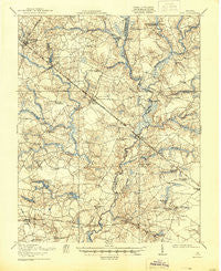
Ivor, Virginia, USGS topographic map dated 1920.
Includes geographic coordinates (latitude and longitude). This topographic map is suitable for hiking, camping, and exploring, or framing it as a wall map.
Printed on-demand using high resolution imagery, on heavy weight and acid free paper, or alternatively on a variety of synthetic materials.
Topos available on paper, Waterproof, Poly, or Tyvek. Usually shipping rolled, unless combined with other folded maps in one order.
- Product Number: USGS-5302966
- Free digital map download (high-resolution, GeoPDF): Ivor, Virginia (file size: 8 MB)
- Map Size: please refer to the dimensions of the GeoPDF map above
- Weight (paper map): ca. 55 grams
- Map Type: POD USGS Topographic Map
- Map Series: HTMC
- Map Verison: Historical
- Cell ID: 55820
- Scan ID: 188216
- Imprint Year: 1944
- Survey Year: 1919
- Datum: NAD
- Map Projection: Polyconic
- Map published by United States Army Corps of Engineers
- Map published by United States Department of War
- Map Language: English
- Scanner Resolution: 600 dpi
- Map Cell Name: Ivor
- Grid size: 15 X 15 Minute
- Date on map: 1920
- Map Scale: 1:62500
- Geographical region: Virginia, United States
Neighboring Maps:
All neighboring USGS topo maps are available for sale online at a variety of scales.
Spatial coverage:
Topo map Ivor, Virginia, covers the geographical area associated the following places:
- Whitley - Pulleys Crossroads - Oaks Mobile Estates - Black Creek - Sedley - Walters - Wakefield - Ivor - Warwick Corner - Rhodes - Guildfield Corner - Burdette - Zuni - Sycamore Crossroads - Collosse - Corinth - Leland Duck's Trailer Park - Raynor - Camp Corner - Unity - Turner - Clyde's Dale Mobile Community - Johnson Corner - Doles Crossroads - Stotts Crossroads - Saddlers Crossroads - Seacock Corner - Whitleys Crossroads - Berlin - Dwight - Booth Fork - Gwaltney Crossroads
- Map Area ID: AREA3736.75-77-76.75
- Northwest corner Lat/Long code: USGSNW37-77
- Northeast corner Lat/Long code: USGSNE37-76.75
- Southwest corner Lat/Long code: USGSSW36.75-77
- Southeast corner Lat/Long code: USGSSE36.75-76.75
- Northern map edge Latitude: 37
- Southern map edge Latitude: 36.75
- Western map edge Longitude: -77
- Eastern map edge Longitude: -76.75


