
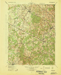
~ Fairfax VA topo map, 1:62500 scale, 15 X 15 Minute, Historical, 1944
Fairfax, Virginia, USGS topographic map dated 1944.
Includes geographic coordinates (latitude and longitude). This topographic map is suitable for hiking, camping, and exploring, or framing it as a wall map.
Printed on-demand using high resolution imagery, on heavy weight and acid free paper, or alternatively on a variety of synthetic materials.
Topos available on paper, Waterproof, Poly, or Tyvek. Usually shipping rolled, unless combined with other folded maps in one order.
- Product Number: USGS-5302878
- Free digital map download (high-resolution, GeoPDF): Fairfax, Virginia (file size: 8 MB)
- Map Size: please refer to the dimensions of the GeoPDF map above
- Weight (paper map): ca. 55 grams
- Map Type: POD USGS Topographic Map
- Map Series: HTMC
- Map Verison: Historical
- Cell ID: 54031
- Scan ID: 188111
- Woodland Tint: Yes
- Aerial Photo Year: 1943
- Survey Year: 1912
- Datum: NAD
- Map Projection: Polyconic
- Map published by United States Army Corps of Engineers
- Map published by United States Department of War
- Map Language: English
- Scanner Resolution: 600 dpi
- Map Cell Name: Fairfax
- Grid size: 15 X 15 Minute
- Date on map: 1944
- Map Scale: 1:62500
- Geographical region: Virginia, United States
Neighboring Maps:
All neighboring USGS topo maps are available for sale online at a variety of scales.
Spatial coverage:
Topo map Fairfax, Virginia, covers the geographical area associated the following places:
- Mosby Woods - Colchester Acres - Beau Ridge - Four Corners - Cobbdale - London Towne - Centreville Farms - Vannoy Park - Country Place - Elgin Corner - Glen Alden - Greenway Hills - Ardmore - Red Fox Forest - A Country Place - Doveville - West Gate - Hunts Village - Orchard Bridge - Stoneridge - Oak Grove - Fair Oaks - Pleasant Valley - Dixie Hill - Five Forks - Sully Plantation - Centreville Farms - Lewis Park - Little River Hills - Fairfax Forest - Greenbriar - Fairlee - Donovans Corner - Fairfax Woods - Holly Park - Legato - Matildaville (historical) - Penderlan - Sunset Hills - Ivakota - Country Club View - Lee Meadows - Fairview - Shirley Gate Park - Sunnybrook Estates - Fairwood Acres - Spring Ridge - Vale - Waples Mill - Yorkshire Acres - Fairfax Farms - Vannoy Acres - Comptons Corner - Lord Fairfax Estates - Great Falls - Loch Lomond - Joyce Heights - Sudley Square - Cobbs Corner - Manassas - Holly Park Estates - Bloom Crossing - Schneider Crossroads - Random Hills - Woods of Ilda - Cooktown - Avon Forest - Fairview - Blevinstown - Maple Hills - Oak Hill - Kiels Gardens - Centreville - Jermantown - Hattontown (historical) - Yorkshire Village - Towlston Meadow - Centre Heights - Robeys Mill - Mill Run Acres - Vienna - Floris - Fairfax Acres - Keene Mill Heights - Lee Forest - Clarks Crossing - Peacock - Oakton - Yorkshire Park - Sideburn - Hallmark Manor - Clifton - Makleys Corner - Stonewall Acres - Manassas Park - Warren Woods - Hunter - Ilda - Willard (historical) - Point of Woods
- Map Area ID: AREA3938.75-77.5-77.25
- Northwest corner Lat/Long code: USGSNW39-77.5
- Northeast corner Lat/Long code: USGSNE39-77.25
- Southwest corner Lat/Long code: USGSSW38.75-77.5
- Southeast corner Lat/Long code: USGSSE38.75-77.25
- Northern map edge Latitude: 39
- Southern map edge Latitude: 38.75
- Western map edge Longitude: -77.5
- Eastern map edge Longitude: -77.25


