
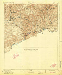
~ Coeburn VA topo map, 1:62500 scale, 15 X 15 Minute, Historical, 1920, updated 1924
Coeburn, Virginia, USGS topographic map dated 1920.
Includes geographic coordinates (latitude and longitude). This topographic map is suitable for hiking, camping, and exploring, or framing it as a wall map.
Printed on-demand using high resolution imagery, on heavy weight and acid free paper, or alternatively on a variety of synthetic materials.
Topos available on paper, Waterproof, Poly, or Tyvek. Usually shipping rolled, unless combined with other folded maps in one order.
- Product Number: USGS-5302750
- Free digital map download (high-resolution, GeoPDF): Coeburn, Virginia (file size: 7 MB)
- Map Size: please refer to the dimensions of the GeoPDF map above
- Weight (paper map): ca. 55 grams
- Map Type: POD USGS Topographic Map
- Map Series: HTMC
- Map Verison: Historical
- Cell ID: 52739
- Scan ID: 187995
- Imprint Year: 1924
- Survey Year: 1916
- Datum: NAD
- Map Projection: Polyconic
- Map published by United States Geological Survey
- Map Language: English
- Scanner Resolution: 600 dpi
- Map Cell Name: Coeburn
- Grid size: 15 X 15 Minute
- Date on map: 1920
- Map Scale: 1:62500
- Geographical region: Virginia, United States
Neighboring Maps:
All neighboring USGS topo maps are available for sale online at a variety of scales.
Spatial coverage:
Topo map Coeburn, Virginia, covers the geographical area associated the following places:
- Dungannon - Crackers Neck - Pine (historical) - Sun - Grassy Creek - Twin Springs - Stony - Stringtown - Riverview - Dry Fork - Point Truth - Trammel (historical) - Maytown - Bush Mill - John - Lonesome (historical) - Banners Corner - Rural - Crab Orchard - Dorado - Carfax - Hazel - Mew - Hamlin - Temple Hill - Masons Store (historical) - Vane (historical) - Boody - Vicco - Herald - Tumbez - Nickelsville - Toms Creek - Morefield - Banner - Bondtown - Cranes Nest - Dante - Grigbys Store - Coeburn - Franco - Virginia City - Dwina - Flatwoods - Castlewood - West Dante - Clinch - Burtons Ford - Bickley Mill - Saint Paul - Sunny Point
- Map Area ID: AREA3736.75-82.5-82.25
- Northwest corner Lat/Long code: USGSNW37-82.5
- Northeast corner Lat/Long code: USGSNE37-82.25
- Southwest corner Lat/Long code: USGSSW36.75-82.5
- Southeast corner Lat/Long code: USGSSE36.75-82.25
- Northern map edge Latitude: 37
- Southern map edge Latitude: 36.75
- Western map edge Longitude: -82.5
- Eastern map edge Longitude: -82.25


