
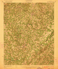
~ Chatham VA topo map, 1:62500 scale, 15 X 15 Minute, Historical, 1923
Chatham, Virginia, USGS topographic map dated 1923.
Includes geographic coordinates (latitude and longitude). This topographic map is suitable for hiking, camping, and exploring, or framing it as a wall map.
Printed on-demand using high resolution imagery, on heavy weight and acid free paper, or alternatively on a variety of synthetic materials.
Topos available on paper, Waterproof, Poly, or Tyvek. Usually shipping rolled, unless combined with other folded maps in one order.
- Product Number: USGS-5302712
- Free digital map download (high-resolution, GeoPDF): Chatham, Virginia (file size: 9 MB)
- Map Size: please refer to the dimensions of the GeoPDF map above
- Weight (paper map): ca. 55 grams
- Map Type: POD USGS Topographic Map
- Map Series: HTMC
- Map Verison: Historical
- Cell ID: 52452
- Scan ID: 187963
- Woodland Tint: Yes
- Survey Year: 1921
- Datum: NAD
- Map Projection: Polyconic
- Map published by United States Geological Survey
- Map Language: English
- Scanner Resolution: 600 dpi
- Map Cell Name: Chatham
- Grid size: 15 X 15 Minute
- Date on map: 1923
- Map Scale: 1:62500
- Geographical region: Virginia, United States
Neighboring Maps:
All neighboring USGS topo maps are available for sale online at a variety of scales.
Spatial coverage:
Topo map Chatham, Virginia, covers the geographical area associated the following places:
- Weal - Chatham - Greenfield - Redeye - Oakland - Woodlawn - Pickerel - Woodlawn Heights - Spring Garden - Hollywood - Newton (historical) - Pittsville - Sonans - Gilmer Terrace - Dry Fork - Gretna - Whittletown - Farmers - Coles Hill - Transco Village - Ridgeway - Motleys Mill - Sheva - Natal - Flint Hill - Beverly Heights - Climax - Pullens - Cedar Hill - Halifax Hills - Shockoe - Chalk Level - Smothers - Ray - Galveston - Whittles - Vadens Mill - Toshes - Jones Mill - Eldon Knolls
- Map Area ID: AREA3736.75-79.5-79.25
- Northwest corner Lat/Long code: USGSNW37-79.5
- Northeast corner Lat/Long code: USGSNE37-79.25
- Southwest corner Lat/Long code: USGSSW36.75-79.5
- Southeast corner Lat/Long code: USGSSE36.75-79.25
- Northern map edge Latitude: 37
- Southern map edge Latitude: 36.75
- Western map edge Longitude: -79.5
- Eastern map edge Longitude: -79.25


