
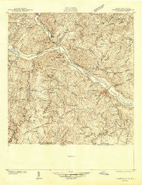
~ Clarksville VA topo map, 1:48000 scale, 15 X 15 Minute, Historical, 1941
Clarksville, Virginia, USGS topographic map dated 1941.
Includes geographic coordinates (latitude and longitude). This topographic map is suitable for hiking, camping, and exploring, or framing it as a wall map.
Printed on-demand using high resolution imagery, on heavy weight and acid free paper, or alternatively on a variety of synthetic materials.
Topos available on paper, Waterproof, Poly, or Tyvek. Usually shipping rolled, unless combined with other folded maps in one order.
- Product Number: USGS-5302500
- Free digital map download (high-resolution, GeoPDF): Clarksville, Virginia (file size: 12 MB)
- Map Size: please refer to the dimensions of the GeoPDF map above
- Weight (paper map): ca. 55 grams
- Map Type: POD USGS Topographic Map
- Map Series: HTMC
- Map Verison: Historical
- Cell ID: 52645
- Scan ID: 187678
- Survey Year: 1941
- Datum: NAD27
- Map Projection: Polyconic
- Advance: Yes
- Map published by United States Geological Survey
- Map Language: English
- Scanner Resolution: 600 dpi
- Map Cell Name: Clarksville
- Grid size: 15 X 15 Minute
- Date on map: 1941
- Map Scale: 1:48000
- Geographical region: Virginia, United States
Neighboring Maps:
All neighboring USGS topo maps are available for sale online at a variety of scales.
Spatial coverage:
Topo map Clarksville, Virginia, covers the geographical area associated the following places:
- Prestwould - High Hill - Hanford Crossroads - Clarksville - Mill Village - Fairview Acres - Blanks - Hitesburg - Pools Mill - Nelson - Aarons Creek - Bluestone - Orgainville - Sandy Fork - Fleming Corner - Midway - Oak Hills - Buffalo Junction - Carters Point - Dortch Store - Soudan - Averett - Perfect Point - Puryear Corner - Henrico - Siddon - Buffalo Springs - Rip Rap - Merifield Acres - White Wing - Laconia - Jeffress - Dryburg - Shiny Rock - Mooresville Estates
- Map Area ID: AREA36.7536.5-78.75-78.5
- Northwest corner Lat/Long code: USGSNW36.75-78.75
- Northeast corner Lat/Long code: USGSNE36.75-78.5
- Southwest corner Lat/Long code: USGSSW36.5-78.75
- Southeast corner Lat/Long code: USGSSE36.5-78.5
- Northern map edge Latitude: 36.75
- Southern map edge Latitude: 36.5
- Western map edge Longitude: -78.75
- Eastern map edge Longitude: -78.5


