
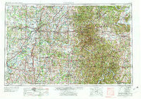
~ Vincennes IN topo map, 1:250000 scale, 1 X 2 Degree, Historical, 1956, updated 1978
Vincennes, Indiana, USGS topographic map dated 1956.
Includes geographic coordinates (latitude and longitude). This topographic map is suitable for hiking, camping, and exploring, or framing it as a wall map.
Printed on-demand using high resolution imagery, on heavy weight and acid free paper, or alternatively on a variety of synthetic materials.
Topos available on paper, Waterproof, Poly, or Tyvek. Usually shipping rolled, unless combined with other folded maps in one order.
- Product Number: USGS-5289264
- Free digital map download (high-resolution, GeoPDF): Vincennes, Indiana (file size: 21 MB)
- Map Size: please refer to the dimensions of the GeoPDF map above
- Weight (paper map): ca. 55 grams
- Map Type: POD USGS Topographic Map
- Map Series: HTMC
- Map Verison: Historical
- Cell ID: 69083
- Scan ID: 160321
- Imprint Year: 1978
- Woodland Tint: Yes
- Photo Revision Year: 1969
- Aerial Photo Year: 1956
- Edit Year: 1969
- Datum: Unstated
- Map Projection: Transverse Mercator
- Map published by United States Geological Survey
- Map Language: English
- Scanner Resolution: 600 dpi
- Map Cell Name: Vincennes
- Grid size: 1 X 2 Degree
- Date on map: 1956
- Map Scale: 1:250000
- Geographical region: Indiana, United States
Neighboring Maps:
All neighboring USGS topo maps are available for sale online at a variety of scales.
Spatial coverage:
Topo map Vincennes, Indiana, covers the geographical area associated the following places:
- Stringtown - Gatchel - Waco - Rhodelia - Murdock - Roland - Laconia - White Cloud - Westport - Pierceburg - Moberly - Decker - Hitchcock - Fredericksburg - Little Saint Louis - Crandall - Hickory Ridge - Otwell - Wynnsboro (historical) - Oakland City - Chandler - Beechwood - Union - Rolling Acres - Dixie - Wadesville - Washington - New Salisbury - Artist Point - Sumner - Lancaster - West Petersburg - Epsom - Bandmill - Mount Olive - Stanley - Glendale - Hillham - Port Jackson - Eames - Bicknell - Millersburg - Montgomery - Ragsdale - Corning - Rego - Organ Springs - Medora - Muren - Mauckport - Harwood - Mount Carmel - Stoy - Lyons - Fayetteville - New Hope (historical) - Jasper - Bloods Wood Crossing - Bromer - Scottsburg - Titus - Dickeyville - Oriole - Chandler - Ironton - Lamar - Stalcup Corner - Turleys - Old Pekin - Farabee - Richwoods - Decker Chapel - Fort Branch - Kellerville - Schrodts Station - Crane - Magnolia - Orrville - Mifflin - Rehoboth - Knob Hill - Hudsonville - Shawswick - Ranger - Helena - Millersburg - Carefree - Saint Joseph - Peerless - Cale - Willisville - Santa Fe - New Middletown - Gerald - Central Barren - Brimstone Corners - Rochester - Prowsville - Inglefield - Saint Wendel
- Map Area ID: AREA3938-88-86
- Northwest corner Lat/Long code: USGSNW39-88
- Northeast corner Lat/Long code: USGSNE39-86
- Southwest corner Lat/Long code: USGSSW38-88
- Southeast corner Lat/Long code: USGSSE38-86
- Northern map edge Latitude: 39
- Southern map edge Latitude: 38
- Western map edge Longitude: -88
- Eastern map edge Longitude: -86


