
~ Vincennes IN topo map, 1:250000 scale, 1 X 2 Degree, Historical, 1956, updated 1967
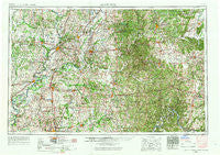
Vincennes, Indiana, USGS topographic map dated 1956.
Includes geographic coordinates (latitude and longitude). This topographic map is suitable for hiking, camping, and exploring, or framing it as a wall map.
Printed on-demand using high resolution imagery, on heavy weight and acid free paper, or alternatively on a variety of synthetic materials.
Topos available on paper, Waterproof, Poly, or Tyvek. Usually shipping rolled, unless combined with other folded maps in one order.
- Product Number: USGS-5289262
- Free digital map download (high-resolution, GeoPDF): Vincennes, Indiana (file size: 19 MB)
- Map Size: please refer to the dimensions of the GeoPDF map above
- Weight (paper map): ca. 55 grams
- Map Type: POD USGS Topographic Map
- Map Series: HTMC
- Map Verison: Historical
- Cell ID: 69083
- Scan ID: 160320
- Imprint Year: 1967
- Woodland Tint: Yes
- Visual Version Number: 2
- Photo Revision Year: 1966
- Aerial Photo Year: 1952
- Edit Year: 1966
- Field Check Year: 1956
- Datum: Unstated
- Map Projection: Transverse Mercator
- Map published by United States Geological Survey
- Map Language: English
- Scanner Resolution: 600 dpi
- Map Cell Name: Vincennes
- Grid size: 1 X 2 Degree
- Date on map: 1956
- Map Scale: 1:250000
- Geographical region: Indiana, United States
Neighboring Maps:
All neighboring USGS topo maps are available for sale online at a variety of scales.
Spatial coverage:
Topo map Vincennes, Indiana, covers the geographical area associated the following places:
- Mills Prairie (historical) - Folsomville - Marco - Selma (historical) - Gudgel - Carlisle - McKinley - Rumble - Mount Pleasant - Cuzco - Hadley - Lamar - Hemenway - Maysville - Giro - Shorts Corner - Bucktown - Grayville - Rabbitville - Plainville - Berryville - South Washington - Crossroads (historical) - Country Club Meadows - Oriole - Erie - Jericho - Bono - Rhodelia - Alton - Skelton - Terry - Stewartsville - Monte Cassino Shrine - Odgen - Johnson - Wheatland - Huron - Bryantsville - Fredonia - McCutchanville - Highland - Daylight - Natchez - Ayrshire - Whitfield - Beechland - Corydon - Francisco - Bartons Location - Turpin Hill - English - Pinhook - Andyville - Oil Grove - Syria - Saint Wendel - Dubois Crossroads - Palmyra - Stoy - Lyles - Decker - New Baltimore - Westport - Loogootee - Pleasant Valley - Milltown - Martinsburg - Becks Mill - Lancaster - Braxtons Siding - Beehunter - Wolf Creek - Graham Valley - Doolittle Mills - Chapel Hill - Farabee - Mount Olive - Chandler - Campbelltown - Ragsdale - Pikeville - Woodlawn Grove - Kratzville - Elberfeld - Switzer Crossroads - Schooler Point Landing - Freelandville - Glezen - Riverview - Gray Junction - Cedar Flat - Newtonville - Scottsburg - Sandy Hook - Popcorn - Lynnville - Rosebud - Claysville - West Petersburg
- Map Area ID: AREA3938-88-86
- Northwest corner Lat/Long code: USGSNW39-88
- Northeast corner Lat/Long code: USGSNE39-86
- Southwest corner Lat/Long code: USGSSW38-88
- Southeast corner Lat/Long code: USGSSE38-86
- Northern map edge Latitude: 39
- Southern map edge Latitude: 38
- Western map edge Longitude: -88
- Eastern map edge Longitude: -86


