
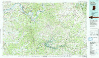
~ Tell City IN topo map, 1:100000 scale, 30 X 60 Minute, Historical, 1991, updated 1991
Tell City, Indiana, USGS topographic map dated 1991.
Includes geographic coordinates (latitude and longitude). This topographic map is suitable for hiking, camping, and exploring, or framing it as a wall map.
Printed on-demand using high resolution imagery, on heavy weight and acid free paper, or alternatively on a variety of synthetic materials.
Topos available on paper, Waterproof, Poly, or Tyvek. Usually shipping rolled, unless combined with other folded maps in one order.
- Product Number: USGS-5289198
- Free digital map download (high-resolution, GeoPDF): Tell City, Indiana (file size: 25 MB)
- Map Size: please refer to the dimensions of the GeoPDF map above
- Weight (paper map): ca. 55 grams
- Map Type: POD USGS Topographic Map
- Map Series: HTMC
- Map Verison: Historical
- Cell ID: 68445
- Scan ID: 156148
- Imprint Year: 1991
- Woodland Tint: Yes
- Aerial Photo Year: 1988
- Edit Year: 1991
- Datum: NAD27
- Map Projection: Universal Transverse Mercator
- Map published by United States Geological Survey
- Map Language: English
- Scanner Resolution: 600 dpi
- Map Cell Name: Tell City
- Grid size: 30 X 60 Minute
- Date on map: 1991
- Map Scale: 1:100000
- Geographical region: Indiana, United States
Neighboring Maps:
All neighboring USGS topo maps are available for sale online at a variety of scales.
Spatial coverage:
Topo map Tell City, Indiana, covers the geographical area associated the following places:
- Buford - Pierce Mill - Bethlehem (historical) - Fisher - Custer - Haysville - Addison - Magan - McQuady - Cannelton - Ellmitch - Flaherty - Ammons - Cloverport - High Plains - Dyer - Oklahoma - Beda - Weberstown - Bewleyville - Olaton - Locust Hill - Cabot - Chestnut Grove (historical) - Woodrow - Haynesville - Eastview - Tobinsport - Cave Spring - Garrett - Fentress McMahan - Garfield - Tar Hill - McCoy - Davidson - Stinnettsville - Tar Fork - Gurley Landing - Rockvale - Tousey - Fenn Haven - Glen Dean - Shreve - Patesville - Lilmay (historical) - Big Spring - Herbert - Dundee - Hudson - White Mills - Roseville - Brandenburg - Sunny Corner - Arnold (historical) - Kingswood - Sulphur Springs - Pellville - Hinton Hills - Maples Corner - Cannons Point - Cedar Farm Landing - Hardinsburg - Big Clifty - Limp - Webster - Cobblers Knob - Scythia - Laffoon - Tell City - Hillgrove - Concord - Howe Valley - Horns Place (historical) - Lickskillet - Solway - Corners - Union Star - Hawesville - Mook - Chambers - Askin - Fordsville - Buras - Westview - Kirk - Grandview - Fairfield - Falling Branch - Skillman - Mystic - Spice Knob - Combs Ford - Victoria Crossroads - Lee (historical) - Maceo - Vertrees - Sample - Lilac - Yeaman - McDaniels
- Map Area ID: AREA3837.5-87-86
- Northwest corner Lat/Long code: USGSNW38-87
- Northeast corner Lat/Long code: USGSNE38-86
- Southwest corner Lat/Long code: USGSSW37.5-87
- Southeast corner Lat/Long code: USGSSE37.5-86
- Northern map edge Latitude: 38
- Southern map edge Latitude: 37.5
- Western map edge Longitude: -87
- Eastern map edge Longitude: -86


