
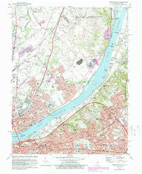
~ Jeffersonville IN topo map, 1:24000 scale, 7.5 X 7.5 Minute, Historical, 1982, updated 1987
Jeffersonville, Indiana, USGS topographic map dated 1982.
Includes geographic coordinates (latitude and longitude). This topographic map is suitable for hiking, camping, and exploring, or framing it as a wall map.
Printed on-demand using high resolution imagery, on heavy weight and acid free paper, or alternatively on a variety of synthetic materials.
Topos available on paper, Waterproof, Poly, or Tyvek. Usually shipping rolled, unless combined with other folded maps in one order.
- Product Number: USGS-5286286
- Free digital map download (high-resolution, GeoPDF): Jeffersonville, Indiana (file size: 15 MB)
- Map Size: please refer to the dimensions of the GeoPDF map above
- Weight (paper map): ca. 55 grams
- Map Type: POD USGS Topographic Map
- Map Series: HTMC
- Map Verison: Historical
- Cell ID: 22498
- Scan ID: 159979
- Imprint Year: 1987
- Woodland Tint: Yes
- Photo Revision Year: 1987
- Aerial Photo Year: 1984
- Edit Year: 1987
- Datum: NAD27
- Map Projection: Polyconic
- Map published by United States Geological Survey
- Map Language: English
- Scanner Resolution: 600 dpi
- Map Cell Name: Jeffersonville
- Grid size: 7.5 X 7.5 Minute
- Date on map: 1982
- Map Scale: 1:24000
- Geographical region: Indiana, United States
Neighboring Maps:
All neighboring USGS topo maps are available for sale online at a variety of scales.
Spatial coverage:
Topo map Jeffersonville, Indiana, covers the geographical area associated the following places:
- Woodside - Glenview Manor - Merrifield - Brownsboro Village - Oak Park - Gulthrie Beach - Maryhill Estates - Arctic Springs - Glenview Heights - Rolling Fields - Indian Hills - Richlawn - Harrods Creek - Saint Matthews - Robinswood - Thornhill - Cliftons - Riverwood - Glenview - Goose Creek - Indian Hills Cherokee Section - Longview Beach - Utica - Juniper Beach - Cementville - Winding Falls - Port Fulton - Jeffersonville - Transylvania Beach - Cherrywood Village - Glenview Acres - Woodlawn Park - Mockingbird Valley - Windy Hills - Beechland Beach - Crossgate - Druid Hills - Beechwood Village - Riverside Beach - Longview - Glenview Hills - Northfield - Watson - Bellewood - Seminary Village
- Map Area ID: AREA38.37538.25-85.75-85.625
- Northwest corner Lat/Long code: USGSNW38.375-85.75
- Northeast corner Lat/Long code: USGSNE38.375-85.625
- Southwest corner Lat/Long code: USGSSW38.25-85.75
- Southeast corner Lat/Long code: USGSSE38.25-85.625
- Northern map edge Latitude: 38.375
- Southern map edge Latitude: 38.25
- Western map edge Longitude: -85.75
- Eastern map edge Longitude: -85.625


