
~ El Paso Gap NM topo map, 1:24000 scale, 7.5 X 7.5 Minute, Historical, 2011
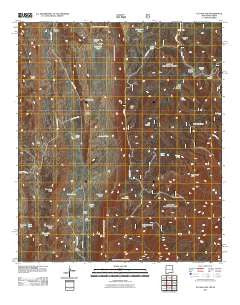
El Paso Gap, New Mexico, USGS topographic map dated 2011.
Includes geographic coordinates (latitude and longitude). This topographic map is suitable for hiking, camping, and exploring, or framing it as a wall map.
Printed on-demand using high resolution imagery, on heavy weight and acid free paper, or alternatively on a variety of synthetic materials.
Topos available on paper, Waterproof, Poly, or Tyvek. Usually shipping rolled, unless combined with other folded maps in one order.
- Product Number: USGS-5246922
- Free digital map download (high-resolution, GeoPDF): El Paso Gap, New Mexico (file size: 27 MB)
- Map Size: please refer to the dimensions of the GeoPDF map above
- Weight (paper map): ca. 55 grams
- Map Type: POD USGS Topographic Map
- Map Series: US Topo
- Map Verison: Historical
- Cell ID: 13819
- Datum: North American Datum of 1983
- Map Projection: Transverse Mercator
- Map Cell Name: El Paso Gap
- Grid size: 7.5 X 7.5 Minute
- Date on map: 2011
- Map Scale: 1:24000
- Geographical region: New Mexico, United States
Neighboring Maps:
All neighboring USGS topo maps are available for sale online at a variety of scales.
Spatial coverage:
Topo map El Paso Gap, New Mexico, covers the geographical area associated the following places:
- Hog Spring - Shattuck Valley - Helper Ranch - White Mule Ridge - Trail Canyon - El Paso Gap Church - Hughes Ranch - Effendale Tank - Owens Tank - Fir Canyon - Martine Ridge - Plowman Peak - Black River Storage Tank - Hughes Ranch - Black River Spring - El Paso Gap Post Office (historical) - Soldier Well - McCollum Ranch - Hooper Canyon - Black Lake - Hughes Ranch - Stone Canyon - Upper McKittrick Canyon Research Natural Area - Manzanita Ridge - Midwater Spring - Devils Den Canyon Wilderness Study Area - Monzarita Tank - Big Canyon Ridge - JRC Canyon - Camp Wilderness Ridge - Hollan Tank - Devils Den Spring - McKittrick Canyon Wilderness Study Area - Dirt Tank - Todd Tank - Devils Den Canyon - Magby Ranch - Klondike Gap - Guadalupe Escarpment Wilderness Study Area - El Paso Ridge - Kuykendal Tank - Hatchet Spring - Panorama Peak - Trail Canyon - Soldier Spring - Guadalupe Mine - Hog Spring Canyon - Deer Hill - Jackson Tank - El Paso Gap - Black River Water Storage - JRC Spring
- Map Area ID: AREA32.12532-104.875-104.75
- Northwest corner Lat/Long code: USGSNW32.125-104.875
- Northeast corner Lat/Long code: USGSNE32.125-104.75
- Southwest corner Lat/Long code: USGSSW32-104.875
- Southeast corner Lat/Long code: USGSSE32-104.75
- Northern map edge Latitude: 32.125
- Southern map edge Latitude: 32
- Western map edge Longitude: -104.875
- Eastern map edge Longitude: -104.75


