
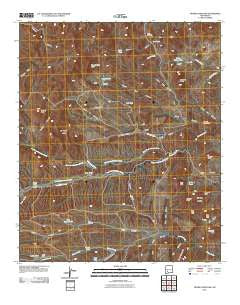
~ Thumb Tank Peak NM topo map, 1:24000 scale, 7.5 X 7.5 Minute, Historical, 2010
Thumb Tank Peak, New Mexico, USGS topographic map dated 2010.
Includes geographic coordinates (latitude and longitude). This topographic map is suitable for hiking, camping, and exploring, or framing it as a wall map.
Printed on-demand using high resolution imagery, on heavy weight and acid free paper, or alternatively on a variety of synthetic materials.
Topos available on paper, Waterproof, Poly, or Tyvek. Usually shipping rolled, unless combined with other folded maps in one order.
- Product Number: USGS-5235022
- Free digital map download (high-resolution, GeoPDF): Thumb Tank Peak, New Mexico (file size: 22 MB)
- Map Size: please refer to the dimensions of the GeoPDF map above
- Weight (paper map): ca. 55 grams
- Map Type: POD USGS Topographic Map
- Map Series: US Topo
- Map Verison: Historical
- Cell ID: 45041
- Datum: North American Datum of 1983
- Map Projection: Transverse Mercator
- Map Cell Name: Thumb Tank Peak
- Grid size: 7.5 X 7.5 Minute
- Date on map: 2010
- Map Scale: 1:24000
- Geographical region: New Mexico, United States
Neighboring Maps:
All neighboring USGS topo maps are available for sale online at a variety of scales.
Spatial coverage:
Topo map Thumb Tank Peak, New Mexico, covers the geographical area associated the following places:
- Pinatosa Well - Cross O Spring - Cross O Canyon - Trap Peak - Aragon Spring - Cross O Well - Apodaca Spring - Avilas Camp - Grandview Mesa - Quail Canyon - Kelly Peak - Cactus Flat - East Avilas Tank - Fox Canyon - No Mans Land - Marshall Gap - North Fork Palomas Creek - Joe Tank - Buck Canyon - Goat Camp Canyon - Spring Canyon - Reno Windmill - Garcia Peaks - Polo Tank - Bear Canyon - High Trail Peak - Thumb Tank Peak - Bulldozer Spring - Yellow Mountain - Thumb Tank Canyon - Evans Ranch - Cross O Peak - Gallina Spring - Dry Tank - Deadman Canyon - Granite Peak - Double S Peaks - Camp Water Tank - Lard Tank - Oak Well - Martin Tank - Lobo Camp - Yellow Spring - Sophio Spring - South Fork Palomas Creek - Chris Tank - Thumb Tank - Spur Peak - Salado Well - Panther Peak - Kelly Tank - Avilas Canyon - Clay Tank Canyon - Nation Well - Lobo Tank - Antelope Canyon - Deep Tank - Salado Wind Mill Water Well - Lee Windmill
- Map Area ID: AREA33.2533.125-107.625-107.5
- Northwest corner Lat/Long code: USGSNW33.25-107.625
- Northeast corner Lat/Long code: USGSNE33.25-107.5
- Southwest corner Lat/Long code: USGSSW33.125-107.625
- Southeast corner Lat/Long code: USGSSE33.125-107.5
- Northern map edge Latitude: 33.25
- Southern map edge Latitude: 33.125
- Western map edge Longitude: -107.625
- Eastern map edge Longitude: -107.5


