
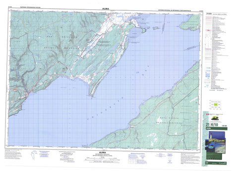
021H10 Alma Canada topo map, 1:50,000 scale
021H10 Alma NRCAN topographic map.
Includes UTM and GPS geographic coordinates (latitude and longitude). This 50k scale map is suitable for hiking, camping, and exploring, or you could frame it as a wall map.
Printed on-demand using high resolution, on heavy weight and acid free paper, or as an upgrade on a variety of synthetic materials.
Topos available on paper, Waterproof, Poly, or Tyvek. Usually shipping rolled, unless combined with other folded maps in one order.
- Product Number: NRCAN-021H10
- Parent Topo: TOPO-021H
- Map ID also known as: 021H10, 21H10
- Unfolded Size: Approximately 26" high by 36" wide
- Weight (paper map): ca. 55 grams
- Map Type: POD NRCAN Topographic Map
- Map Scale: 1:50,000
- Geographical region: New Brunswick, Canada
Neighboring Maps:
All neighboring Canadian topo maps are available for sale online at 1:50,000 scale.
Purchase the smaller scale map covering this area: Topo-021H
Spatial coverage:
Topo map sheet 021H10 Alma covers the following places:
- Birch Cove - Chignecto Bay - Chignecto Bay - Clam Cove - Herring Cove - Indian Cove - Marys Cove - Rocher Bay - Salisbury Bay - Sand Cove - Shepody Bay - Slacks Cove - Two Rivers Inlet - Big Bar - Bray Beach - Dennis Beach - Maringouin Flats - New Horton Flats - Shepody Flats - Waterside Beach - Birch Cove Head - Cape Enrage - Cape Enragé - Cape Maringouin - Cranberry Head - Inner Head - Joel Head - Lower Point - Mary Point - Marys Point - Matthews Head - Outer Head - Owl Head - Owls Head - Ragged Point - Raven Head - Red Head - South Channel - Devils Half Acre - Dickson Falls - Match Factory Falls - Third Vault Falls - Albert - Alma - Cumberland - Elgin - Harvey - Hopewell - Sackville - Saint Martins - Westmorland - Barn Marsh Island - Grindstone Island - Indian Island - Long Island - Squaws Cap - Tom Island - Toms Island - Alcorn Pond - Apple River Lake - Beaver Pond - Beaverdam Lake - Fenton Lake - Fenton Pond - Livingstone Lake - Lockhart Lake - Long Marsh Lake - McFadden Lake - McLaren Pond - New Horton Lake - Priest Lake - Richardson Lake - Sloan Lake - Square Lake - Taylor Lake - Bucket Hill - Casey Hill - Devils Hill - Doyle Hill - Hastings Hill - Little Ridge - Mount Gideon - Sinclair Hill - Squaw Cap - West River Mountain - Cumberland - Chignecto Game Sanctuary - Fundy National Park of Canada - Parc national du Canada Fundy - Réserve nationale de faune de Shepody - Shepody National Wildlife Area - Tompkin Plains - New Brunswick - Nouveau-Brunswick - Nouvelle-Écosse - Nova Scotia - Alcorn Brook - Anderson Hollow Brook - Apple Creek - Ash Brook - Barn Marsh Creek - Barrett Brook - Bearden Brook - Beaver Brook - Birch Cove Brook - Broad River - Chapman Creek - Cherry Brook - Cleveland Brook - Comstock Creek - Crank Brook - Crooked Creek - Daley Brook - Dickson Brook - Duffy Brook - Duffys Millstream - East Branch Sand River - Fairy Creek - Fall Brook - Fall Down Brook - Fitzgibbon Brook - Flat Brook - Flat Brook - Forty Five River - Fortyfive River - Greenough Brook - Halfway River - Hay Brook - Horn Brook - Hueston Brook - Keirstead Brook - Kelley River - Kelley River (Mill Creek) - Kelly River - Kinnie Brook - Lake Brook - Little Shulie River - Little Stream - Long Marsh Creek - Long Reach Brook - Lower Maple Creek - Lower Vault Brook - Macaloney Brook - McGee Brook - McGee Brook - Mill Creek - Mitchell Mills Brook - New Horton Creek - Newfoundland Creek - North River - One Mile Brook - Paint Mine Brook - Pine Brook - Priest Brook - Rocher Horn Creek - Sand River - Sawmill Creek - Second Vault Brook - Shepody River - Shepody River - Shulie River - Spring Brook - Third Vault Brook - Tingley Brook - Toms Brook - Two Mile Brook - Two Rivers Creek - Twomile Brook - Upper Maple Creek - Upper Salmon (Alma) River - Upper Salmon River - Upper Vault Brook - West River - Wilson Brook - Grindstone Shoal - Jones Ledge - Jones's Ledge - Maringouin Shoal - Marys Point Reef - Middle Ground - St. Mary Ledge - Beaver Brook - Brookville - Cape Enrage - Cape Enragé - Derrys Corner - Germantown - Harvey - Harvey Bank - Hebron - Little Ridge - Little Rocher - Lower Rockport - Midway - New Horton - Point Wolf - Rockport - Sand River - Shulie - Teahans Corner - Upper New Horton - Waterside - West River - Anderson Hollow - Hells Kitchen - Hums Hollow - Apple River Bog - Barn Marsh - Beaver Brook Marsh - Bucktagen Barrens - Germantown Marsh - Jacksonville Swamp - Jenks Meadow - Long Marsh - Mitchell Meadows - Muddy Plains - New Horton Marsh - Point Marsh - Shepody Marsh - Waterside Marsh - Alma - Riverside-Albert


