
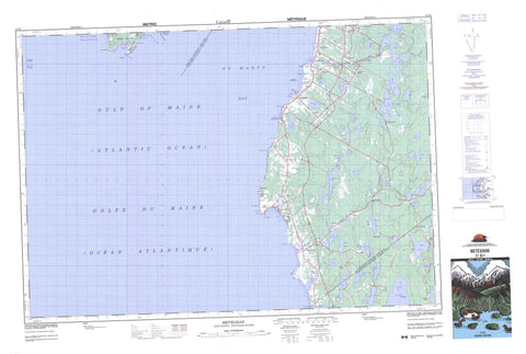
021B01 Meteghan Canada topo map, 1:50,000 scale
021B01 Meteghan NRCAN topographic map.
Includes UTM and GPS geographic coordinates (latitude and longitude). This 50k scale map is suitable for hiking, camping, and exploring, or you could frame it as a wall map.
Printed on-demand using high resolution, on heavy weight and acid free paper, or as an upgrade on a variety of synthetic materials.
Topos available on paper, Waterproof, Poly, or Tyvek. Usually shipping rolled, unless combined with other folded maps in one order.
- Product Number: NRCAN-021B01
- Parent Topo: TOPO-021B
- Map ID also known as: 021B01, 21B1, 21B01
- Unfolded Size: Approximately 26" high by 36" wide
- Weight (paper map): ca. 55 grams
- Map Type: POD NRCAN Topographic Map
- Map Scale: 1:50,000
- Geographical region: Nova Scotia, Canada
Neighboring Maps:
All neighboring Canadian topo maps are available for sale online at 1:50,000 scale.
Purchase the smaller scale map covering this area: Topo-021B
Spatial coverage:
Topo map sheet 021B01 Meteghan covers the following places:
- Anse Amirault - Baie de Fundy - Bay of Fundy - Bear Cove - Big Pond Cove - Cape Cove - Comeau Cove - Grande Anse - Hog Yard Cove - Hog-yard Cove - L'Anse des Maréchal - Lighthouse Cove - Little Pond Cove - New Road Cove - Olivers Cove - Olives Cove - Pond Cove - Sheep Cove - St. Mary Bay - St. Marys Bay - St. Mary's Bay - The Two Gullies - Barre à Tico - Barre au Saumon - Barres à Pointe Noire - Bartletts Beach - Deveaus Shore - Bear Cove Point - Black Point - Cape St. Mary - Cape St. Marys - Dartmouth Point - Davids Point - Flemish Cap - Green Head - Horses Rump - Light Point - Pointe à la Grande Anse - Pointe à Tom - Pointe des Maréchal - Pointe Noire - Sea Kings Point - Whipple Point - Grand Passage - Indian Falls - Digby - Yarmouth - Brier Island - Green Island - Gull Island - Long Island - Ash Lake - Bartletts River Pond - Beaver Lake - Beaver Lake - Big Pond - Bonaventure Lake - Brazil Lake - Cedar Lake - Churchills Lake - Clare Lake - Clearwater Lake - Cornings Lake - Cranberry Lake - Crosbys Lake - Doctors Lake - Eel Lake - English Lake - Farish Lake - Finck Lake - Gaspereau Lake - Germain Lake - Grass Lake - Guillot Lake - Hectanooga Lake - Heron Lake - Indian Pond - Jennys Lake - Jesse Lake - Killam Lake - Killams Lake - Lac à Pecee - Lac à Pierre - Lac de Gruau - Lac des Tom - Lake Annis - Lake Doucette - Lake George - Lake Jesse - Leapfrog Lake - Little Lake Doucette - Little Pond - Little Tedford Lake - Longboat Lake - Lower Corning Lake - Lower Doucette Lake - Mardi Gras Lake - Melanson Lake - Moosehorn Lake - Negro Lake - Norwood Clearwater Lake - Oakleaf Lake - Peter Lake - Pierce Lake - Salmon River Lake - Salmon-river Lake - Sandyland Ponds - Seth Lake - South Corning Lake - South Doucette Lake - Spectacle Lake - Swallow Lake - Tedford Lake - Third Lake - Three Island Lake - Three-island Lake - Thunder Lake - Two Island Lake - Upper Corning Lake - Upper Doucette Lake - Ridge of Rocks - Clare - Digby - Yarmouth - Mavilette Beach Provincial Park - Smugglers Cove Provincial Park - Annis River - Bartlett Brook - Bartletts River - Black Brook - Blackadar Brook - Blackwater Brook - Corning Brook - Dean Brook - Felix Mill Brook - Freshwater Stream - Indian River - Jennys Brook - Meteghan River - Ruisseau à Charles Black - Ruisseau à Pierre - Ruisseau des Boudreau - Ruisseau des Irlandais - Salmon River - Salmon River - Snare Lake Brook - Swallow Lake Brook - Whitewater Brook - Cape Rip - Bosse à Christine - Bosse à Jean - Brier Island Southwest Ledge - Flat Grounds - Fond de Belliveau - Fond des Lazare - Gull Rock - Gull Rock Bars - La Haute Femme - L'Hôpital - Long Bar - Man of War Rock - Mavillette Shoal - McDormand Patch - Round Rocks - Bangor - Bear Cove - Beaver River - Brazil Lake - Cape St. Mary - Cape St. Marys - Cedar Lake - Cleland Corner - Harrington - Hectanooga - Lake Annis - Lake Doucette - Lake George - Lower Concession - Lower Saulnierville - Mavillette - Maxwellton - Maxwellton Station - Maxwelton Station - Mayflower - Meteghan - Meteghan Centre - Meteghan River - Meteghan Station - Norwood - Robicheau - Salmon River - Saulnierville Station - Sigogne - Springdale - St. Alphonse - St. Alphonse de Clare - St. Alphonse-de-Clare - St. Benoni - St. Martin - St. Martin de Clare - St. Martin-de-Clare - St-Alphonse-de-Clare - St-Benoni - St-Martin-de-Clare - Woodvale - Cape St. Marys Marsh - South Bog - West Bog


