
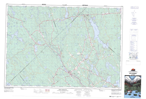
021A10 New Germany Canada topo map, 1:50,000 scale
021A10 New Germany NRCAN topographic map.
Includes UTM and GPS geographic coordinates (latitude and longitude). This 50k scale map is suitable for hiking, camping, and exploring, or you could frame it as a wall map.
Printed on-demand using high resolution, on heavy weight and acid free paper, or as an upgrade on a variety of synthetic materials.
Topos available on paper, Waterproof, Poly, or Tyvek. Usually shipping rolled, unless combined with other folded maps in one order.
- Product Number: NRCAN-021A10
- Parent Topo: TOPO-021A
- Map ID also known as: 021A10, 21A10
- Unfolded Size: Approximately 26" high by 36" wide
- Weight (paper map): ca. 55 grams
- Map Type: POD NRCAN Topographic Map
- Map Scale: 1:50,000
- Geographical region: Nova Scotia, Canada
Neighboring Maps:
All neighboring Canadian topo maps are available for sale online at 1:50,000 scale.
Purchase the smaller scale map covering this area: Topo-021A
Spatial coverage:
Topo map sheet 021A10 New Germany covers the following places:
- Allies Cove - Boat Cove - Browns Cove - Bull Cove - Deep Cove - Grimms Cove - Kill Dog Cove - Milbury Cove - Peter Veinot Cove - Russells Cove - Sand Cove - Saulnier Cove - Sherbrooke Cove - Silver Cove - Stoddart Cove - Trout Cove - Cushing Point - Eisnors Point - Fox Point - Owls Head - Russells Point - The Peninsula - Turners Point - Wentzells Point - The Narrows - The Narrows - The Narrows - West Cliff - Apron Falls - Dog Falls - Glodes Falls - Indian Falls - James Falls - Lantz Falls - Morgans Falls - Mountain Dam Falls - Sheridan Falls - Whalesback Falls - Wheelock Falls - Zwicker Falls - Annapolis - Kings - Lunenburg - Queens - Flat Island - Levys Island - Loon Island - Partridge Island - Penaul Island - Silver Island - Silvers Island - Wentzells Island - Ashland Lake - Bagpipe Lake - Bear Lake - Bear Marsh Lake - Beaver Lake - Bezant Lake - Big La Have Lake - Big LaHave Lake - Big Lahave Lake - Big Mushamush Lake - Black Duck Lake - Black Lake - Burke Lake - Butler Lake - Canoran Lake - Caribou Lake - Central Lake - Church Lake - Cliff Lake - Cornwall Lake - Cranberry Lake - Crouses Lake - Deerland Lake - Doreys Lake - Duck Lake - Dunn Lake - Durland Lake - Ell Lake - Feindel Lake - First Pond - Folly Lake - Franey Lake - Frank Lake - Grandmother Head Lake - Grant Lake - Grassy Lake - Gully Lake - Haddock Lake - Haley Lake - Harlow Lake - Hawk Lake - Holbert Lake - Hornet Lake - Indian Lake - Indian Lake - Indian Pond - Joe Simon Lake - Johnson Lake - Juniper Lake - Keyhole Lake - Keyhole Lakes - Lake Harlow - Lake Misery - Lake Peter - Lake Pleasant - Lake Ramsay - Lake Torment - Lake William - Lily Lake - Lily Lake - Little Lake - Little Long Lake - Little Mushamush Lake - Little Round Lake - Lohnes Lake - Lonesome Lake - Lower Sixty Lake - Lower Thirty Lake - Mack Lake - McGill Lake - Miletree Lake - Misery Lake - Moose Snare Lake - Morris Old Mill Pond - Mud Lake - Mud Lake - Mud Lakes - Mushamush Lake - Nass Lake - New Germany Lake - Northfielders Lake - Otter Lake - Otter Lake - Otter Lake - Owen Lake - Pear Lake - Pine Lake - Pleasant River Lake - Rae Lake - Rainbow Lake - Rocky Lake - Rocky Lake - Rocky Lake - Rocky Pond - Round Lake - S Lake - Saturday Lake - Scrag Lake - Second Pond - Shannon Lake - Sherbrooke Lake - Shingle Lake - Simon Lake - Skull Lake - Skunk Lake - Smith Camp Lake - Smiths Camp Lake - Spectacle Lake - Springfield Lake - Sproul Lake - Stoddart Lake - Sugar Lake - Swallow Lake - Tanner Lake - Tener Lake - Texas Lake - Third Pond - Tommy Lake - Twin Lakes - Twin Lakes - Upper Thirty Lake - Veinot Lake - Waterloo Lake - West Lake - West Lake - West Whale Lake - Whale Lake - Whetstone Lake - White Gull Lake - Wild Duck Lake - Wildcat Lake - Charles Hill - Dorey Hill - Franey Hill - Keddys Hill - Little Bluff - Reeves Hill - Sherbrooke River Hill - The Bluff - The Varner Mountain - Walker Hill - Annapolis - Chester - Kings - Lunenburg - Queens - Black Rattle - Black Run - Demones Eddy - Moosehorn Eddy - Shoal Grounds - Whynachts Eddy - Zinck Spout - Beaver Brook - Bezant Lake Brook - Big North Brook - Birch Brook - Biscuit Brook - Black Brook - Black Duck Lake Brook - Bob and Joan Brook - Bog Brook - Butler Lake Brook - Camp Four Lake Brook - Cape Marsh Brook - Caribou Brook - Church Lake Brook - Crooked Brook - Crossburn Brook - Crotch Brook - Dawson Brook - Demones Brook - Dexter Brook - Ell Lake Brook - Falkenham Run - Forties River - Forty River - Franey Brook - Franey Brook - Franey Lake Brook - Franey Run - Gully Brook - Gully River - Harlow Brook - Hemlock Run - Hirtle Brook - Hornet Brook - Indian Brook - Johnson Brook - Johnson Brook - Jonah Brook - Kelley Brook - Keyhole Brook - King Brook - La Have River - LaHave River - Lahave River - Lake Misery Brook - Lake Run - Larder River - Little North Brook - Little River - MacKay Brook - MacKays Brook - Manning Brook - Martin River - Martins River - Mason Brook - Mason Meadow Brook - McClearns Brook - McClearn's Brook - McClintock Brook - McLearns Brook - Mud Lake Brook - Mushamush River - Nelson Brook - North Branch Lahave River - North Branch LaHave River - North Brook - North La Have River - North Lahave River - North River - Ohio River - Ozie Meadow Brook - Papermill Brook - Patten Brook - Peter Veinot Brook - Pine Brook - Pine Lake Brook - Pleasant River - Princess Brook - Robar Brook - Roop Brook - Ross Brook - Ross Brook - Ross Meadow Brook - Sand Brook - Sarty Brook - Saturday Lake Brook - Scattering Brook - Shannon River - Sherbrooke River - Sheridan Brook - Shingle Brook - Shinglemill Brook - Sixty Brook - Smith Brook - Solomon Brook - Sucker Brook - Sucker Brook - Sucker Brook - Tea Brook - Tea Brook - The Gully - Thirty Brook - Twenty Brook - Varner Brook - Waterloo River - Watermans Meadow Brook - West River - Wildcat Brook - Wildcat River - William Ross Brook - Zwicker Brook - Allen Meadows Stillwater - Blue Ledge Pool - Chute Stillwater - Clifford Moore Stillwater - Devils Elbow - Devils Elbow - Devils Hook - Easter Stillwater - Eel Weir Hole - Enoch Stillwater - Fancys Pool - Feeners Pool - Feindels Bridge Pool - Fishpot Hole - Gerry Stillwater - Harper Stillwater - Hartland Stillwater - Hick Smith Stillwater - Hogans Dump - Indian Falls Pool - Joudreys Bridge Pool - Long Pool - Lower Stillwater - MacKays Bridge Pool - Mill Pond - Peter Veinot Stillwater - Peters Stillwater - Peter's Stillwater - Pleasant River Stillwaters - Sanfords Intervale Pool - Slippery Ledge Pool - Texas Lake Pool - Upper Stillwater - Apron Rock - County Line Reef - Barss Corner - Barss Corners - Barss' Corners - Caledonia Junction - Cherryfield - Cherryfield Road - Church Lake - Crossburn - Dale - Dalhousie - Dalhousie Crossing - Dalhousie East - Dalhousie Road - East Dalhousie - Elmwood - Falkland Ridge - Farmington - Forties - Forties Settlement - Franey Corner - Hastings - Hemford - Lake Pleasant - Lake William - Lantz - Maplewood - Meiseners - Meisener's - Meiseners Section - Middle New Cornwall - Morton Corner - Mortons Corner - Morton's Corner - New Cornwall - New Germany - Newburn - Newburne - North River - Parkdale - Privett - Ridge Road - Sartys - Sarty's - Scarborough - Scarsdale - Scarsdale - Simpson Corner - Simpsons Corner - Springfield - Stanburn - Stanburne - Stanley Section - Stoddarts - Union Square - Upper New Cornwall - Upper Northfield - Walden - Watford - Allen Meadows - Bear Marsh - Bob and Joan Meadow - Caribou Bog - Cranberry Bog - Harlow Meadow - Holland Bog - Lantz Meadows - Leadbetters Meadow - Mason Meadow - Nevertell Meadows - Peter Veinot Bog - Robar Bog - Stoddart East Meadows - Stoddart West Meadows - Thousand Acre Bog - Vacant Land Meadows - Veinot Bog - Watermans Meadows - Wrights Meadow


