
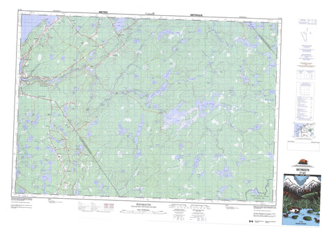
021A05 Weymouth Canada topo map, 1:50,000 scale
021A05 Weymouth NRCAN topographic map.
Includes UTM and GPS geographic coordinates (latitude and longitude). This 50k scale map is suitable for hiking, camping, and exploring, or you could frame it as a wall map.
Printed on-demand using high resolution, on heavy weight and acid free paper, or as an upgrade on a variety of synthetic materials.
Topos available on paper, Waterproof, Poly, or Tyvek. Usually shipping rolled, unless combined with other folded maps in one order.
- Product Number: NRCAN-021A05
- Parent Topo: TOPO-021A
- Map ID also known as: 021A05, 21A5, 21A05
- Unfolded Size: Approximately 26" high by 36" wide
- Weight (paper map): ca. 55 grams
- Map Type: POD NRCAN Topographic Map
- Map Scale: 1:50,000
- Geographical region: Nova Scotia, Canada
Neighboring Maps:
All neighboring Canadian topo maps are available for sale online at 1:50,000 scale.
Purchase the smaller scale map covering this area: Topo-021A
Spatial coverage:
Topo map sheet 021A05 Weymouth covers the following places:
- Gilbert Cove - Gilberts Cove - Oak Bay - Sears Bay - St. Mary Bay - St. Marys Bay - St. Mary's Bay - The Creek - Brooks Beach - Kenney Shore - Kinney Shore - Gilbert Point - Gilberts Point - Schooner Passage - Annapolis - Digby - Devils Island - Aceys Lake - Ameros Lake - Amirault Lake - Andrews Lake - Anselme Lake - Arthur Lake - Arthurs Lake - Barn Lake - Bear Lake - Beartrap Lake - Beaverdam Lake - Beaver-dam Lake - Beavertail Lake - Big Pine Lake - Big Tom Wallace Lake - Big Uniacke Lake - Bill Lake - Birch Lake - Bourneuf Lake - Brights Lake - Burntland Lake - Caribou Lake - Clearwater Lake - Colibri Lake - Comeau Lake - Cranberry Lake - Crouse Lake - Daniels Lake - Danvers Lake - Deadwater Lake - Delap Lake - Delaps Lake - Dish Lake - Doyle Lake - Doyles Lake - Duck Lake - Duck Pond - Duck Pond Lake - Dugas Lake - Dunbar Lake - East Cranberry Lake - East Spectacle Lakes - Eighth Lake - Everitt Lake - Everitts Lake - Fifth Lake - Fifth Lake Flowage - Firmain Lake - First Chub Lake - First Daniels Lake - Flagstaff Lake - Fourth Lake - Fourth Lake Flowage - Gehue Lake - Gilbert Lake - Granite Lake - Griffith Lake - Griffiths Lake - Gullhead Lake - Hackmatack Lake - Hardwood Lake - Hourglass Lake - Jerome Lake - Jeromes Lake - Jib Lake - Johnson Lake - Knockwood Lake - Lac des Castors - Lac Le Marchant - Lake Franklin - Lake Joli - Lake Jolly - Lake Mulgrave - Langford Lake - Lint Lake - Little Cranberry Lake - Little Dish Lake - Little Lake - Little Pine Lake - Little Tom Wallace Lake - Little Tusket Lake - Little Uniacke Lake - Little Wallace Lake - Long Lake - Long Tusket Lake - Loon Lake - Loonfoot Lake - Lower Daniels Lake - Mallette Lake - McKeene Lake - Mistake Lake - Moosehead Lake - Moosehide Lake - Mud Lake - Muddy Lake - Mulgrave Lake - Musquash Lake - Ninth Lake - Nowlan Lake - Nowlans Lake - Oak Lake - Oakland Lake - Oliver Lake - Partridge Island Lake - Partridge Lake - Paul Lake - Peter Paul Lake - Petit Lac Long - Phillip Lake - Pine Lake - Placid Lake - Placides Lake - Plympton Lake - Porcupine Lake - Porters Lake - Porter's Lake - Prime Lake - Provost Lake - Range Corner Lake - Range-corner Lake - Robart Lake - Rocky Daniels Lake - Rockypoint Lake - Rollers Lake - Rush Lake - Rushy Lake - Scotts Lake - Second Chub Lake - Second Daniels Lake - Second Lake - Seventh Lake - Shortliff Lake - Silas Lake - Simonds Lake - Sissiboo Grand Lake - Sissiboo Lake - Sixth Lake - Small Sprague Lake - Sporting Lake - Sprague Lake - Stony Pond - Sturk Lake - Sturk Lake - Sullivan Lakes - Sullivans Lake - Sullivans Lakes - Thibeault Lake - Third Chub Lake - Third Daniels Lake - Third Lake - Tobacco Lake - Tusket Lake - Uniacke Lake - Upper Daniels Lake - Upper Lake - Van Buskirk Lakes - Wagner Lake - Wallace Lake - Weaver Lake - Weavers Lake - Western Lake - Whitesand Lake - Wright Lake - Claytons Hill - Pine Hill - Annapolis - Clare - Digby - Tobeatic Wildlife Management Area - Five Islands Rip - Gannet Rip - Maple Rips - Moose Rip - Third Lake Rip - Wagners Ledge - Barn Brook - Beaverdam Brook - Beaver-dam Brook - Buckley Brook - Campsite Brook - Caribou River - Chisholm Meadow Brook - Chub Brook - Church Brook - Comeaus Mill Brook - Cranberry Brook - Daniels Brook - Dexter Brook - Dexters Brook - Dish Lake Stream - Dugas Lake Brook - Dunbar Brook - Franklin River - Gilbert Brook - Kempton Brook - Kenney Brook - Kinney Brook - Lake Franklin Brook - Lint Lake Brook - Loon Lake Stream - Maple Land Brook - McCullough Brook - McDonald Brook - McManns Brook - Meteghan River - Mill Brook - Mistake River - Moosehead Stream - Morrisseys Brook - Mullen Brook - Obed Miller Brook - Perrys Brook - Pine Brook - Pine Lake Stream - Primes Brook - Rocky Brook - Rocky Brook - Saulnier Brook - Seven Pence Halfpenny Brook - Shelburne River - Silver River - Simes Brook - Sissiboo River - South Stillwater Brook - Sporting Lake Stream - Stoney Brook - Sullivan Brook - Sullivans Brook - Thibault Brook - Wallace Branch Sissiboo River - Wallace River - Wentworth Brook - Wentworth River - West Branch Bear River - White Brook - White Sand Stream - Whitesand Stream - Barn Pool - Big Bend - Big Crown Deadwater - Big Deadwater - Big Pine Stillwater - Daniels Brook Deadwater - Little Crown Deadwater - The Bend - The Stillwater - Third Lake Flumes - Uniacke Deadwater - Uniake Deadwater - Amiraults Corner - Ashmore - Danvers - Doucetteville - Easton - Gilbert Cove - Gilberts Cove - Hassett - Havelock - Hilltown - Lewistown - Margo - New France - New Tusket - North Range - Oakland Lake - Ohio - Plympton Station - Plymton Station - Riverdale - Sissiboo - Sissiboo Falls - Sissiboo Falls - South Range - South Range Corner - Southville - Weaver Settlement - Weaver Settlement - Weymouth Falls - Weymouth Mills - Weymouth North - Baboon Bog - Branch Meadows - Caribou Plains - Chub Meadows - Gates Meadow - Horseshoe Bog - Langford Bog - Mallettes Meadow - Newell Bog - Payson Meadow - Simons Meadow - Snell Meadow - Sullivans Meadows - Weymouth


