
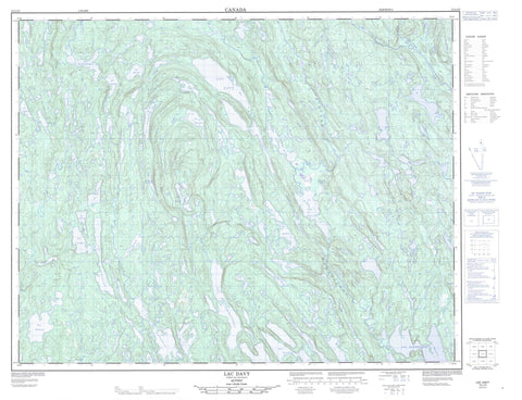
012L15 Lac Davy Canada topo map, 1:50,000 scale
012L15 Lac Davy NRCAN topographic map.
Includes UTM and GPS geographic coordinates (latitude and longitude). This 50k scale map is suitable for hiking, camping, and exploring, or you could frame it as a wall map.
Printed on-demand using high resolution, on heavy weight and acid free paper, or as an upgrade on a variety of synthetic materials.
Topos available on paper, Waterproof, Poly, or Tyvek. Usually shipping rolled, unless combined with other folded maps in one order.
- Product Number: NRCAN-012L15
- Parent Topo: TOPO-012L
- Map ID also known as: 012L15, 12L15
- Unfolded Size: Approximately 26" high by 36" wide
- Weight (paper map): ca. 55 grams
- Map Type: POD NRCAN Topographic Map
- Map Scale: 1:50,000
- Geographical region: Quebec, Canada
Neighboring Maps:
All neighboring Canadian topo maps are available for sale online at 1:50,000 scale.
Purchase the smaller scale map covering this area: Topo-012L
Spatial coverage:
Topo map sheet 012L15 Lac Davy covers the following places:
- Lac Apvril - Lac Auberive - Lac Béland - Lac Blondin - Lac Bochier - Lac Bonnerme - Lac Caché - Lac Claveau - Lac Coumyn - Lac Davy - Lac du Cométique - Lac Faucher - Lac Forgues - Lac François - Lac Gendron - Lac Guénard - Lac Harvey - Lac Jobidon - Lac La Taille - Lac Lebrun - Lac Longley - Lac Marquis - Lac Muriel - Lac Nesmy - Lac Pauline - Lac Pet-a-Shoo - Lac Petashou - Lac Pinet - Lac Plat - Lac Stephenson - Lac Taille - Lac Thibaudeau - Lac Vigneault - Lac Wakeham - Lac Watshishou - Rivière Nabisipi - Rivière Plate - Rivière Watshishou


