
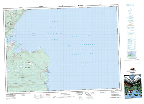
011K16 Dingwall Canada topo map, 1:50,000 scale
011K16 Dingwall NRCAN topographic map.
Includes UTM and GPS geographic coordinates (latitude and longitude). This 50k scale map is suitable for hiking, camping, and exploring, or you could frame it as a wall map.
Printed on-demand using high resolution, on heavy weight and acid free paper, or as an upgrade on a variety of synthetic materials.
Topos available on paper, Waterproof, Poly, or Tyvek. Usually shipping rolled, unless combined with other folded maps in one order.
- Product Number: NRCAN-011K16
- Parent Topo: TOPO-011K
- Map ID also known as: 011K16, 11K16
- Unfolded Size: Approximately 26" high by 36" wide
- Weight (paper map): ca. 55 grams
- Map Type: POD NRCAN Topographic Map
- Map Scale: 1:50,000
- Geographical region: Nova Scotia, Canada
Neighboring Maps:
All neighboring Canadian topo maps are available for sale online at 1:50,000 scale.
Purchase the smaller scale map covering this area: Topo-011K
Spatial coverage:
Topo map sheet 011K16 Dingwall covers the following places:
- Aspy Bay - Avril Cove - Back Cove - Big Burnt Head Cove - Black Brook Cove - Black Head Cove - Burnt Head Cove - Dingwall Harbour - Doyles Cove - Duggans Cove - Green Cove - Green Cove - Haystack Cove - Hungry Cove - Jigging Cove - Little Burnt Head Cove - Long Point Cove - MacKinnons Cove - Middle Harbour - Neil Harbour - Neils Harbour - New Haven Cove - North Harbour - Ramseys Cove - Scotch Cove - Smelt Brook Cove - South Harbour - Squeaker Hole - The Gulch - Yellow Head Cove - MacKinnons Breaker - Middle Harbour Beach - Neils Harbour Breaker - North Harbour Beach - North Harbour Breaker - Ringing Beach - Smelt Brook Shore - South Harbour Beach - South Point Breaker - Victoria Beach - Wreck Beach - Black Head - Black Point - Blue Point - Bluff Head - Boiler Point - Burnt Head - Burnt Head - Cape Egmont - Coffins Point - Cornelius Head - Green Cove Head - Green Point - Halibut Head - Hatchers Point - Long Point - MacKinnons Point - Neil Head - Neils Harbour Point - Scotch Head - Shoal Point - Shoal Point - South Point - Spruce Point - Stave Point - White Point - Yellow Head - Yellow Plaster Head - Cabot Strait - Cabot Strait - Détroit de Cabot - Détroit de Cabot - French Gulch - Aspy Scarp - Mary Ann Falls - Victoria - Cape Breton Island - Carters Island - Cat Island - Cranberry Marsh Island - Daisleys Island - Dees Island - Donalds Island - Île du Cap-Breton - Lead Island - Maloneys Island - Ramseys Island - Sheep Island - White Point Island - Burtons Pond - Daisleys Lake - Deadmans Pond - Effies Lake - Glasgow Lakes - Griffins Lake - Groth Lakes - Jigging Cove Lake - Lily Pond - Lone Lake - Long Lake - McDougall Pond - Mica Hill Lake - Middle Pond - Mink Lake - Neils Harbour Pond - North Pond - Paquets Lake - South Pond - Three Mile Lake - Wreck Beach Pond - Mica Hill - North Mountain - Sams Mountain - South Mountain - Wilkie Sugar Loaf - Victoria - Cabot's Landing Provincial Park - Cape Breton Highlands National Park of Canada - Parc national du Canada des Hautes-Terres-du-Cap-Breton - Black Brook - Christies Brook - Crawleys Brook - Donovan Brook - Effies Brook - Glasgow Brook - Gulch Brook - Halfway Brook - Mary Ann Brook - Middle Aspy River - Middle Brook - Neil Brook - Neils Brook - Peters Brook - Phils Brook - Pollys Brook - Rachel Brook - Salmon River - Smelt Brook - South Aspy River - Sparlings Brook - Still Brook - Tongue Brook - Trout Brook - Wilkie Brook - Zwicker Brook - The Tittle - Boat Rock - Bonona Rock - Doyles Rock - Murdochs Rock - Panama Rock - Red Rocks - Shoal Point Shoals - The Old Man - The Old Woman - Aspy Bay - Bay Road Valley - Bay St. Lawrence - Cape North - Dingwall - Neil Harbour - Neils Harbour - Neil's Harbour - New Haven - Smelt Brook - South Harbour - St. Margaret Village - Sugar Loaf - Sunset Cape North - White Point


