
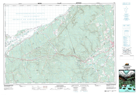
011E09 Merigomish Canada topo map, 1:50,000 scale
011E09 Merigomish NRCAN topographic map.
Includes UTM and GPS geographic coordinates (latitude and longitude). This 50k scale map is suitable for hiking, camping, and exploring, or you could frame it as a wall map.
Printed on-demand using high resolution, on heavy weight and acid free paper, or as an upgrade on a variety of synthetic materials.
Topos available on paper, Waterproof, Poly, or Tyvek. Usually shipping rolled, unless combined with other folded maps in one order.
- Product Number: NRCAN-011E09
- Parent Topo: TOPO-011E
- Map ID also known as: 011E09, 11E9, 11E09
- Unfolded Size: Approximately 26" high by 36" wide
- Weight (paper map): ca. 55 grams
- Map Type: POD NRCAN Topographic Map
- Map Scale: 1:50,000
- Geographical region: Nova Scotia, Canada
Neighboring Maps:
All neighboring Canadian topo maps are available for sale online at 1:50,000 scale.
Purchase the smaller scale map covering this area: Topo-011E
Spatial coverage:
Topo map sheet 011E09 Merigomish covers the following places:
- Back Harbour - Camerons Cove - Golfe du Saint-Laurent - Gulf of St. Lawrence - Hogan Gut - Huggans Gut - Merigomish Harbour - Robinson Cove - Roys Gut - Savage Cove - Smith Gut - Big Island Beach - Chisholms Beach - Melmerby Beach - Barney Point - Barneys Point - Betty Point - Burying Ground Point - Cemetery Point - Coal Point - French Point - Governor Head - Grave Head - Hardwood Point - Kerr Point - Kings Head - Knoydart Point - Merigomish Point - Moydart Point - Murray Point - Murrays Point - Paterson Point - Patterson Point - Pattersons Point - Point Betty - Robinson Point - Savage Point - Smashem Head - Smith Point - Détroit de Northumberland - French Channel - Northumberland Strait - Antigonish - Pictou - Sydney - Merigomish Harbour 31 - Big Merigomish Island - Burnt Island - Finlaysons Island - Indian Island - Merigomish Island - Morrison Island - Muless Island - Olding Island - Pig Islands - Quarry Island - Sutherland Islands - Cameron Lakes - Camerons Lakes - Carews Lake - Crosby Lake - Deadman Lake - Duck Ponds - Forbes Lake - Galt Pond - Gaspereaux Lake - Indian Lake - Leech Lake - MacEacherns Lake - MacInnis Lake - Malcolms Lake - Mannings Lake - Manning's Lake - McIsaac Lake - Robertsons Lake - Robinsons Lake - St. Josephs Lake - St. Joseph's Lake - Vameys Lake - Vincents Lake - Weavers Lake - Aulds Mountain - Beaver Mountain - Browns Mountain - Eigg Mountain - Germaines Mountain - The Keppoch - Antigonish - Pictou - Beaver Mountain Provincial Park - Melmerby Beach Provincial Park - Anderson Brook - Arisaig Brook - Baileys Brook - Bailey's Brook - Baillie Brook - Balmoral Brook - Barneys River - Barney's River - Baxter Brook - Bear Brook - Beaver Brook - Beaver River - Black Brook - Brierly Brook - Browning Brook - Camerons Brook - Chisholm Brook - Doctors Brook - East Branch French River - East Doctors Brook - East French River - Frasers Brook - French River - French River - Garden River - Gordon Brook - Hartshorn Brook - Hogan Brook - Huggans Brook - Iron Brook - James River - Keppoch Brook - Knoydart Brook - MacDonalds Brook - MacIsaacs Brook - MacPherson Brook - Malignant Brook - McAdam Brook - McArras Brook - McIver Brook - Meadow Brook - Middle Brook - Moose River - North River St. Marys - North River St. Mary's - Ohio River - Poor Farm Brook - Powers Brook - Pushies Brook - Rights River - Russell Brook - Salt Springs Brook - Smith Brook - South Malignant Brook - South Rights River - Sutherland River - Sutherlands Brook - Sutherlands River - Vamey Brook - Vameys Brook - Wallace Brook - Wallace Brook - West Barneys River - West Barney's River - West Branch French River - West River - Willies Brook - Indian Lake Stillwaters - Dulse Rocks - Middle Ground - Rocky Patch - Warrior Reef - Antigonish - Addington Forks - Ardness - Ashdale - Avondale - Avondale Station - Bailey Brook - Baileys Brook - Bailey's Brook - Barneys River - Barney's River - Barneys River Station - Barney's River Station - Beaver Meadow - Beaver Mountain - Big Island - Big Marsh - Brierly Brook - Brierly Brook Back Road - Broadway - Browns Mountain - Brown's Mountain - Brownsville - Cloverville - Clydesdale - Dunmaglass - Egerton - French River - Gaspereaux Lake - Glen Bard - Glen Road - Greenvale - Highfield - James River - James River Station - Kenzieville - Keppoch Mountain - Knoydart - Laggan - Lismore - Lower Barneys River - Lower Barney's River - Lower North Grant - Lower West River - Maple Ridge - Marsh - Marshy Hope - Maryvale - Mayfield - McArras Brook - McGrath Mountain - McGraths Mountain - Meadow Springs - Meiklefield - Merigomish - Middle Barneys River - Middle Barney's River - North Bloomfield - North Grant - North Meiklefield - Ohio - Piedmont - Pinkietown - Pleasant Valley - Ponds - Post Road - Purlbrook - Rossfield - Salt Springs - South Salt Springs - St. Joseph - Sutherland River - Sutherlands River - Sylvan Valley - Sylvan Valley - Telford - West River - Woodfield - Keppoch Gulch - Piedmont Valley - Beaver Meadow


