
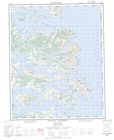
003D12 Francis Harbour Canada topo map, 1:50,000 scale
003D12 Francis Harbour NRCAN topographic map.
Includes UTM and GPS geographic coordinates (latitude and longitude). This 50k scale map is suitable for hiking, camping, and exploring, or you could frame it as a wall map.
Printed on-demand using high resolution, on heavy weight and acid free paper, or as an upgrade on a variety of synthetic materials.
Topos available on paper, Waterproof, Poly, or Tyvek. Usually shipping rolled, unless combined with other folded maps in one order.
- Product Number: NRCAN-003D12
- Parent Topo: TOPO-003D
- Map ID also known as: 003D12, 03D12, 3D12
- Unfolded Size: Approximately 26" high by 36" wide
- Weight (paper map): ca. 55 grams
- Map Type: POD NRCAN Topographic Map
- Map Scale: 1:50,000
- Geographical region: Newfoundland and Labrador, Canada
Neighboring Maps:
All neighboring Canadian topo maps are available for sale online at 1:50,000 scale.
Purchase the smaller scale map covering this area: Topo-003D
Spatial coverage:
Topo map sheet 003D12 Francis Harbour covers the following places:
- Alexis Bay - Arch Cove - Backside of Hell Cove - Barnes Cove - Barns Cove - Bartlett Cove - Big Cove - Blackguard Bay - Blackguard Bight - Bobs Cove - Bowring Cove - Cape Cove - Caplin Bay - Clark Cove - Cogan Cove - Cole Cove - Crow Gulch - Crusty Cove - Deer Park - Delaney Cove - Fannys Cove - Fish Cove - Fox Cove - French Cove - George Cove - Georges Cove - Gilbert Bay - Good Cove - Green Cove - Green Cove - Hell Cove - Hole in the Wall Cove - Honeyfly Cove - Indian Bight - Island Cove - Island Harbour - Johnny Mews Cove - Kelpy Cove - Kennedy Cove - Kerry Cove - Lady Gulch - Lance Cove - Long Arm - Long Gulch - Melton Cove - Merchantman Harbour - Northwest Arm - Occasional Harbour - Pancake - Peckham Cove - Pigeon Gulches - Pinsent Arm - Red Bay - Redman Cove - Rexons Cove - Round Harbour - Round Harbour - Russell Cove - Schooner (Deep) Cove - Schooner Cove - Scrammy Bay - Ship Harbour - Ship Harbour - Sloop Cove - Southwest Bight - Square Island Harbour - St Francis Harbour Bight - St. Francis Harbour - St. Michaels Bay - Starvation Cove - Tabbeys Harbour - Tobys Harbour - Trout Cove - Watering Cove - Wells Cove - Wild Bight - Williams Harbour - Burnell Beach - Back Head - Black Head - Black Point - Bull Point - Cape St. Francis - Cape St. Michaels - Crowsnest - Dead Mans Point - Dickies Head - False Cape - First Point - Fox Cove Head - Georges Cove Head - Georges Cove Point - Green Cove Point - Halfway Point - Harbour Point - Hole in the Wall - Indian Point - Long Point - Main Cape - Man O'War Head - Mussel Cove Point - Mussel Point - Northern Head - Northern Head - Old Mans Head - Parsons Point - Point of the Bay - Point of the Island - Red Point - Red Point - Red Point - Redman Point - Rexons Point - Sailors Point - Salmon Point - Salmon Point - Salmon Point - Shinneys Point - Ship Harbour Head - Ship Harbour Head - Shoal Point - Shoal Point - Sleepy Point - Sloop Cove Head - Southern Point - Southern Point - Sunday Gulch Point - Swirlers Point - Terra Nova Point - The Bangers - Whaleback Point - White Point - Wild Bight Point - Ballast Island Tickle - Barns Cove Water - Bear Gulch - Blind Tickle - Boyeans Tickle - Cape Tickle - Captain Jacks Tickle - Georges Cove Run - Jersey Tickle - Main Tickle - Mungo Run - Muskrat Tickle - Northern Ships Run - Parsons Tickle - Pipers Tickle - Salmon Gulch - Ships Tickle - Shoal Tickle - Shoal Tickle - Taylor Tickle - Welshes Tickle - Williams Harbour Run - Williams Harbour Run - Winter Tickle - Ball Island - Ballast Island - Big Island - Birchy Narrows Island - Bloody Bag Island - Bobby Duck Island - Bobs Island - Bold Island - Bottle Island - Bull Island - Burke Island - Burnt Island - Cartwright Island - Copper Island - Curlew Island - Deepwater Island - Denbigh Island - Duck Island - East Island - Fishing Islands - Flat Island - Goat Island - Granby Island - Hare Island - Jacket Island - Job Island - Juniper Island - Killey Island - Lazyman Island - Leg Island - Little Copper Island - Long (Fox) Island - Long Island - Long Island - Mercer Island - Middle Island - Mongo Islands - Motion Island - Narrows Island - Olive Stone Island - Otter Island - Pigeon Island - Pigeon Island - Pigeon Island - Pinsent Island - Raft Islet - Red Island - Rexons Island - Roundhill Island - Saddle Island - Sandy Cove Island - Sandy Island - Shinney Island - Ships Tickle Island - Skinny Island - Sodpy Island - Spratt Island - Square Island - Staring Island - Sub Islet - The Sisters - Twin Islands - West Island - Whitefish Island - Whitely Island - Wild Bight Island - Yellow Fox Island - Beaver Pond - Big Pond - Big Pond - Long Pond - Sandy Pond - Break-Heart Hill - Round Hill - Labrador Sea - Mer du Labrador - Black Rock - Cape Bank - Chain Rocks - Dickies Rocks - Fish Rock - Gull Rock - Hampton Bank - Harbour Rock - Mad Moll Rocks - Main Cape Bank - Offer Shoal - Pensons Rock - Pigeon Banks - Pigeon Island Rock - Red Island Shoal - Red Point Bank - Shinney Rock - The Chimney - The Cow - The Ribs - The Sinker - The Skerries - Fishing Ships Harbour - Francis Harbour - Georges Cove - Kings Cove - Pensons Arm - Pinsents Arm - Rexons Cove - Sandy Hook - Square Islands - Williams Harbour


