
002M05 St Anthony Canada topo map, 1:50,000 scale
002M05 St Anthony NRCAN topographic map.
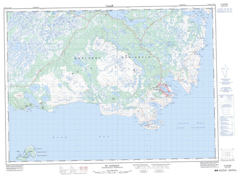
Includes UTM and GPS geographic coordinates (latitude and longitude). This 50k scale map is suitable for hiking, camping, and exploring, or you could frame it as a wall map.
Printed on-demand using high resolution, on heavy weight and acid free paper, or as an upgrade on a variety of synthetic materials.
Topos available on paper, Waterproof, Poly, or Tyvek. Usually shipping rolled, unless combined with other folded maps in one order.
- Product Number: NRCAN-002M05
- Parent Topo: TOPO-002M
- Map ID also known as: 002M05, 02M5, 2M5, 02M05, 2M05
- Unfolded Size: Approximately 26" high by 36" wide
- Weight (paper map): ca. 55 grams
- Map Type: POD NRCAN Topographic Map
- Map Scale: 1:50,000
- Geographical region: Newfoundland and Labrador, Canada
Neighboring Maps:
All neighboring Canadian topo maps are available for sale online at 1:50,000 scale.
Purchase the smaller scale map covering this area: Topo-002M
Spatial coverage:
Topo map sheet 002M05 St Anthony covers the following places:
- Big Cove - Bobbys Cove - Cigale Cove - Cod Seine Cove - Cow Cove - Crémaillère Harbour - Eye Glass Bay - Fishing Point Cove - French Bay - Goose Cove - Great Brehat Bay - Green Bay - Green Cove - Greenwood Cove - Hare Bay - Haul Up Cove - Hodidou Bay - Howe Harbour - Ireland's Bight - L'Anse à Jean - Line Head Cove - Little Brehat Bay - Lock's Cove - Long Cove - Marguerite Bay - Milan Arm - Northwest Bay - Oil Jacket Cove - Partridge Cove - Persil Cove - Pistolet Bay - Savage Bay - Savage Cove - Sea Wolf Bay - Southwest Bay - Square Bay - St. Anthony Bight - St. Anthony Harbour - St. Lunaire Bay - St. Lunaire Road - Starks Bight - Swoilers Cove - Three Mountain Harbour - Vierge Cove - Western Cove - Anchor Point - Cape Haut-et-Bas - Cape St. Anthony - Cartreau Point - Cigale Point - Cranky Point - Croix Point - Crow Head - Crow Head (French Point) - Deep Water Point - Duck Point - Falaise Point - Fishing Point - Fishing Point Head - Flat Point - Goose Cape - Goose Cape Peninsula - Hodidou Point - Ireland's Point - Lamage Point - Line Head - Lion Point - Little Round Mount Point - Lobster Point - Loup Marin Point - Mamelon Point - Marguerite Point - Moores Point - Norcat Point - Northern Peninsula - Nymph Point - Observation Point - Old Man's Head - Old Man's Neck - Partridge Point - Pointe Fendue - Rets Point - Roland Point - Savage Point - Seal Point - Silver Point - Trawl Cove Point - Upper Cranky Point - Vierge Point - White Dog Point - Wolf Point - The Grotto - Whale Grotto - Ant Island - Brent Islands - Coq Island - Croix Island - Dog Island - Grassy Island - Green Island - Henry Island - Lock's Island - Micmac Island - Mouse Island - Northeast Island - Northwest Island - Notre Dame Island - Nymph Island - Red Island - Rond Island - Salut Island - Strawberry Island - Vert Island - Bartletts Pond - Bartletts Steady Pond - Brimstone Pond - Brimstone Ponds - Compions Steady Pond - Eastern Long Pond - First Pond - Frenchman's Pond - Goose Cove Pond - Grassy Pond - Island Pond - Jacks Pond - Long Pond - Long Pond - Long Steady Pond - Otter Pond - Pinsents Pond - Round Pond - Second Pond - St. Anthony Pond - Starkes Pond - Stock Pond - Three Brooks Pond - Western Long Pond - Western Long Pond - Bight Summit - Crémaillère Hill - Daniels Lookout - Direction Mountain - Green Hill - Green Ridge - Little Round Mount - Lock's Mountain - Mount Galiber - Mount Mer - Mount Roland - St. Anthony Hill - St. Lunaire Peak - Sugarloaf Hill - Three Mountain Summits - White Hills - Hare Bay Ecological Reserve - Hare Bay Seabird Ecological Reserve - Hare Bay Seabird Sanctuary - Pistolet Bay Provincial Park - Bartletts River - Ireland's Brook - Northwest Brook - Outardes River - Parker River - Bear Bank - Estaing Shoal - Flat Rock - Harbour Rock - Ledret Shoal - Lobster Shoal - Mad Moll Rock - Middle Bank - Needles Rocks - Notre Dame Shoal - Vanguard Shoal - Goose Cove East - St. Anthony - St. Lunaire-Griquet - Goose Cove - Great Brehat - Ireland's Bight - Little Brehat - Lock's Cove - Pateyville - St. Anthony Bight - St. Carols


