
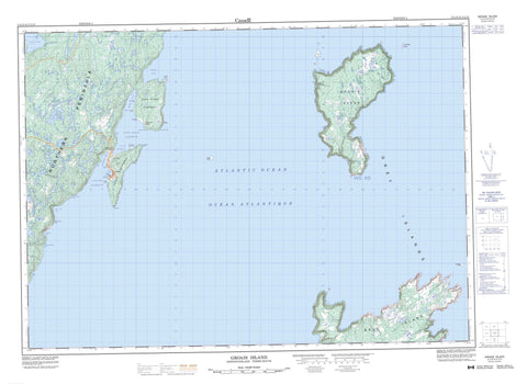
002L13 Groais Island Canada topo map, 1:50,000 scale
002L13 Groais Island NRCAN topographic map.
Includes UTM and GPS geographic coordinates (latitude and longitude). This 50k scale map is suitable for hiking, camping, and exploring, or you could frame it as a wall map.
Printed on-demand using high resolution, on heavy weight and acid free paper, or as an upgrade on a variety of synthetic materials.
Topos available on paper, Waterproof, Poly, or Tyvek. Usually shipping rolled, unless combined with other folded maps in one order.
- Product Number: NRCAN-002L13
- Parent Topo: TOPO-002L
- Map ID also known as: 002L13, 02L13, 2L13
- Unfolded Size: Approximately 26" high by 36" wide
- Weight (paper map): ca. 55 grams
- Map Type: POD NRCAN Topographic Map
- Map Scale: 1:50,000
- Geographical region: Newfoundland and Labrador, Canada
Neighboring Maps:
All neighboring Canadian topo maps are available for sale online at 1:50,000 scale.
Purchase the smaller scale map covering this area: Topo-002L
Spatial coverage:
Topo map sheet 002L13 Groais Island covers the following places:
- Bear Cove - Biche Arm - Big Wild Cove - Cape Rouge Harbour - Chimney Cove - Conche Harbour - Crouse Harbour - Little Wild Cove - Mare Cove - Martinique Bay - Pilier Bay - Priest Cove - Silver Cove - Stag Cove - Upper Chimney Cove - Bluff Point - Cape Fox - Cape Rouge - Cape Rouge Peninsula - Chest Head - Conche Peninsula - Frauderesse Point - Goguelin Point - Gronde Point - Latin Point - Northern Peninsula - Partridge Point - Point Dos de Cheval - Pyramid Point - Saut du Chien Point - Silver Point - Truite Point - White Horse Head - Le Champ Paga - Bell Island - Grey Islands - Groais Island - Rouge Island - Coles Pond - Northeast Rock - Souris Shoal - The Sisters Rocks - Conche - Northeast Crouse - Southwest Crouse


