
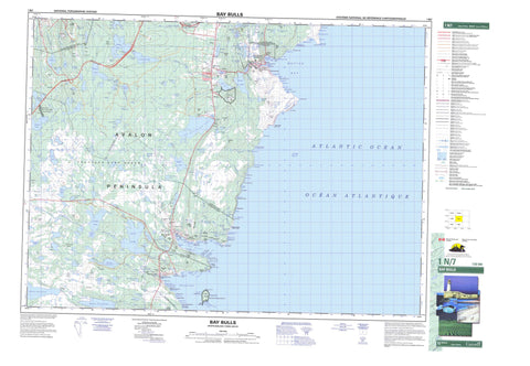
001N07 Bay Bulls Canada topo map, 1:50,000 scale
001N07 Bay Bulls NRCAN topographic map.
Includes UTM and GPS geographic coordinates (latitude and longitude). This 50k scale map is suitable for hiking, camping, and exploring, or you could frame it as a wall map.
Printed on-demand using high resolution, on heavy weight and acid free paper, or as an upgrade on a variety of synthetic materials.
Topos available on paper, Waterproof, Poly, or Tyvek. Usually shipping rolled, unless combined with other folded maps in one order.
- Product Number: NRCAN-001N07
- Parent Topo: TOPO-001N
- Map ID also known as: 001N07, 01N7, 1N7, 01N07, 1N07
- Unfolded Size: Approximately 26" high by 36" wide
- Weight (paper map): ca. 55 grams
- Map Type: POD NRCAN Topographic Map
- Map Scale: 1:50,000
- Geographical region: Newfoundland and Labrador, Canada
Neighboring Maps:
All neighboring Canadian topo maps are available for sale online at 1:50,000 scale.
Purchase the smaller scale map covering this area: Topo-001N
Spatial coverage:
Topo map sheet 001N07 Bay Bulls covers the following places:
- Allens Cove - Angel Cove - Back of Cape Boone Cove - Bay Bulls - Bear Cove - Big Cove - Bread and Cheese Cove - Broad Cove - Bulgers Cove - Bull Cove - Cape Boone Cove - Caplin Cove - Carpenters Cove - Chaver - Chimney Cove - Connors Gulch - Council Cove - Dollar Cove - Drop Cove - Dungeon Cove - Empty Basket Cove - Freshwater - Freshwater Cove - Front Door - Gallows Cove - Grass Cove - Gunners Hole - Herring Cove - Hole in the Head - Horses Back - Island Cove - Island Cove - Kellis Cove - Landing Place - Long Harry Cove - Lower Cove - Mad Cove - Madam Cove - Maddox Cove - Maggotty Cove - Mahers Cove - Monahans Gulch - Monkey Cove - Motion Bay - Mutton Cove - Otter Cove - Peters Cove - Petty Harbour - Pounce Cove - Pulpit Cove - Ragged Cove - Red Cove - Seal Cove - Seven Island Cove - Shoal Bay - Southern Cove - The Bight - The Pound - The Spout - Turn of Bald Head - Upper Red Cove - Useless Bay - White Horse Cove - Whiteways Cove - Williams Cove - Williams Cove - Witless Bay - Camel Beach - Gravelly Bank - Long Beach - Ragged Beach - Twelve O'Clock Beach - Avalon Peninsula - Back of the Point - Bald Head - Bear Cove Head - Bear Cove Point - Big Black Head - Big Cove Point - Boone Point - Breach Head - Bread and Cheese Point - Bull Head - Camel Head - Cape Boone - Chapel Head - Cheese Cove Point - Columbine Point - Dennis Point - Flat Point - Gallows Cove Point - Heart Point - Hearts Point - Henleys Head - Inside Point of Cape Boone Cove - Inside Point of Island Cove - Jimmy Dinns Point - Kate Point - Kellis Point - Key Point - Lady Point - Little Bald Head - Long Harry - Long Point - Long Point - Long Point - Long Point of North Head - Mays Point - Merrymeeting Point - Miner Point - Miners Point - Motion Head - North Head - North Head - Nulma Head - Outside Point of Island Cove - Pepperelli Point - Pierced Point - Quail Point - Ragged Point - Sculpin Island - Seal Cove Point - Sharks Point - Sleepy Point - Small Black Head - South Head - The Kettle - The Minister - Tinkers Point - Long Gulch - Main River Gut - Old Woman Gulch - Raymonds Gulch - The Chaver - The Thoroughfare - Whittens Gulch - Mount Pearl - St. John's - Horseshoe Cliff - Iron Door - The Cliff - The Flats - Gull Island - Harbour House - Spoon Island - Bald Head Pond - Bathers Pond - Bay Bulls Big Pond - Beaver House Pond - Beaver Pond - Beer Pond - Big Fish Pond - Big Northern - Big Northern Pond - Big Northern Pond - Big Pond - Big Pond - Big Roundabout - Bill Hazels Pond - Birchy Pond - Black Duck Gully - Black Duck Pond - Black Hill Pond - Bread and Cheese Pond - Broad Gully - Chambers Ponds - Cochrane Pond - Conways Pond - Country Pond - Cow Pond - Crooked Gullies - Deadmans Pond - Deep Gullies - Dog Pond - Double Loon Pond - Duck Pond - Duck Pond - Fir Bush Pond - First Pond - First Pond - Fletchers Pond - Forest Pond - Fourth Pond - Freshwater Pond - Gear Gullies - Gear Pond - George Hearns Pond - George Norris Pond - Goose Pond - Grassy Gullies - Gull Pond - Gull Pond - Hennesseys Pond - Herring Cove Pond - Holystone Gullies - Horse Gullies - Jakes Gully - Jakes Pond - Jews Harp - Johnnies Pond - Larry Neals Pond - Little Country Pond - Little Gullies - Little Northern - Little Northern Pond - Little Pond - Little Pond - Little Roundabout - Little Soldiers Pond - Long Gully - Long Pond - Long Pond - Long Pond - Loo Pond - Lookout Pond - Loon Pond - Lords Pond - Lower Pond - Lower Pond Gullies - Maddox Cove Pond - Maddox Pond - Maggotty Cove Pond - Maggotty Pond - Martins Gully - Middle Pond - Miners Pond - Mobile Big Pond - Mobile First Pond - Mudholes - Mundy Pond - Murphys Pond - Northern Pond - Paddys Pond - Petty Harbour Long Pond - Petty Harbour Ponds - Peytons Pond - Ploughmans Pond - Pond in the Passage - Pond on the Lookout - Pond on the Ridge - Princes Pond - Pulpit Pond - Punch Mile Gullies - Rocky Path Pond - Rocky Pond - Rocky Pond - Rocky Pond - Roundabout Pond - Scotsmans Gully - Sculpin Island Pond - Second Pond - Second Pond - Small Northern Pond - Soldiers Pond - Soldiers Pond - Stephens Pond - The Birchies - The Gully - Third Pond - Thomas Pond - Three Arm Pond - Three Corner Pond - Tom Chafes Pond - Tom Neals Pond - Tom Stacks Pond - Tom Waldrons Pond - Trout Pond - Twin Pond - Twin Pond Gully - Upper Pond - Valley Gullies - Watch Hill Pond - Western Pond - Whales Pond - White Hills Pond - Witless Bay Country Pond - Wych Hazel Pond - Yankees Gully - Allens Hill - American Man - Beaver Hat - Big Hill - Big Tolt - Black Head Hill - Black Mountain - Blood Hill - Booms Head - Burkes Head - Butter Pot - Captain Orlebars Cairn - Cemetery Hill - Conical Hill - Crown Hill - Dog Hills - Downward Hill - Flag Staff Hill - Forest Pond Hill - Green Hill - Green Hill - Gull Hill - Hare Hill - Hawke Hills - Heretic Hill - Jonclay Hill - Kearney's Hill - Long Run - Lower Cove Head - Maintop Hill - Pennys Hill - Pynn Hill - Red Rock - Saddle Hill - Saddle Hill - Sandy Hill - Skinners Hill - Stony Ridge - The Clappers - The Klondyke - The Lookout - The Saddle - Thorburn Hills - Three Peak Hill - Tinker Hill - Turtle Hill - Twelve O'Clock - Twelve O'Clock Hill - Vizard Hill - Watch Hill - White Hill - White Hill - White Hills - Williams Hill - Williams Hill - St. John's Metropolitan Area - Cochrane Pond Provincial Park - Soldiers Pond Fishery Access Road Provincial Park - Soldiers Pond Provincial Park - Witless Bay Ecological Reserve - Witless Bay Seabird Ecological Reserve - Bald Head River - Bay Bulls River - Beaver Brook - Broad Gully River - Cochrane Pond Brook - Conway Brook - Cross Brook - Cuddley River - Dirty Bridge River - Doyles River - Foxtrap River - Gallows Cove River - Gunridge River - Holystone River - Maggotty Cove River - Manuels River - Mobile River - Nut Brook - O'Briens Brook - Perrys Brook - Petty Harbour River - Peytons Brook - Pierres Brook - Queens River - Queen's River - Raymond Brook - South Brook - Stanleys River - Steadywater Brook - Stone Ducky Brook - The Spout River - Witless Bay Brook - Yellow River - Baboul Rocks - Bear Cove Rocks - Black Rock - Bread and Cheese Rock - Drop Cove Rock - Frenchmans Rock - Freshwater Ledge - Freshwater Rock - Gallows Cove Rock - Huttons Rock - Kate Rock - Kitten Rock - Long Harry Rock - Mad Rock - Motion Ledges - Motion Rocks - North Ledge - Petty Harbour Ledges - Shag Rocks - Sinker Rock - The Klinkers - The Off Ground - The Pulpit - The Stump - White Horse Bank - White Rock - White Rock - Bay Bulls - Conception Bay South - Petty Harbour-Maddox Cove - Witless Bay - Big Pond - Bread and Cheese - Doyles - Goulds - Gunridge - Irishtown - Maddox Cove - Petty Harbour - Stoppers Side - Stopperside - The Houser - The Keys - Williams - The Gorge - Balls Marsh - Big Yellow Marsh - Dawes Big Marsh - Dykes Marsh - Feather Marsh - Frog Marsh - Furlongs Garden - Green Meadows - Hummocky Marsh - Paddys Pond Marsh - Ploughmans Marsh - Roaches Marsh - Thousand Acre Marsh


