
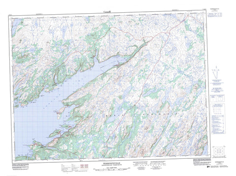
001M10 Terrenceville Canada topo map, 1:50,000 scale
001M10 Terrenceville NRCAN topographic map.
Includes UTM and GPS geographic coordinates (latitude and longitude). This 50k scale map is suitable for hiking, camping, and exploring, or you could frame it as a wall map.
Printed on-demand using high resolution, on heavy weight and acid free paper, or as an upgrade on a variety of synthetic materials.
Topos available on paper, Waterproof, Poly, or Tyvek. Usually shipping rolled, unless combined with other folded maps in one order.
- Product Number: NRCAN-001M10
- Parent Topo: TOPO-001M
- Map ID also known as: 001M10, 01M10, 1M10
- Unfolded Size: Approximately 26" high by 36" wide
- Weight (paper map): ca. 55 grams
- Map Type: POD NRCAN Topographic Map
- Map Scale: 1:50,000
- Geographical region: Newfoundland and Labrador, Canada
Neighboring Maps:
All neighboring Canadian topo maps are available for sale online at 1:50,000 scale.
Purchase the smaller scale map covering this area: Topo-001M
Spatial coverage:
Topo map sheet 001M10 Terrenceville covers the following places:
- Ampleton Cove - Back Cove - Battle Cove - Bay D'East - Bay L'Argent - Bay L'Argent Back Cove - Beachy Cove - Big Cove - Big Cove - Big Eastern Cove - Black Cove - Black Duck Hole - Black Point Cove - Black Point Cove - Bombards Cove - Bottom Cove - Broad Cove - Brook Cove - Brook Cove - Cape Cove - Charley Cove - Chiffy Cove - Cock and Hen Cove - Dog Cove - Doughball Cove - Dowden Hole - East Bay - English Harbour East - Femme Harbour - Fortune Bay - Fox Cove - Frenchmans Mesh Cove - Friars Hole - Gooseberry Cove - Grand Le Pierre Harbour - Green Cove - Hannafords Cove - Herring Cove - Herring Cove - Jack Fountain Cove - Jersey Cove - Jim Cove - Jimmys Cove - Joe Cove - Jonathans Cove - Killick Rock Cove - Kinsleys Cove - Kinsleys Gulch - Landing Cove - Langue de Cerf Cove - Little Bay de l'Eau - Little Eastern Cove - Little Harbour - Little Harbour - Little Scotts Cove - Long Harbour - Louse Hole - Lower Little Bay - May Cove - Meadow Cove - Mille Harbour - Mine Cove - Mine Cove - Mirrors Cove - Muddy Hole - Mullowneys Cove - New Harbour - Northeast Cove - Northwest Arm - Old Cove - Osmond Cove - Paradise Sound - Pays Cove - Pennells Harbour - Ragged Point Cove - Rats Hole Cove - Ravens Cove - Red Cove - Ryle Barrisway - Sawpit Cove - Scotts Cove - Shag Rock Cove - Shag Rock Coves - Shark Cove - Shoal Cove - Spudgel Cove - Swile Cove - Swiles Nest Cove - Tarnell Cove - Terrenceville Harbour - The Basin - Toms Cove - Twin Point Cove - West Cove - Western Cove - Western Harbour - White Point Cove - White Rock Cove - Wild Bight - Wild Cove - Yellow Cove - Young Bight - Nancy Shore - Sandy Beach - The Beach - Wild Shore - Anstay Point - Back Cove Head - Back Cove Point - Bay de l'Eau Friar - Bay D'East Head - Black Point - Black Point - Bluff Point - Brimstone Point - Burn Cowhouse Point - Cape Mille - Chiffy Point - Clark Point - Cuff Head - Deep Water Point - Deepwater Point - Eastern Head - Eastern Head - Eastern Head - Eastern Point - Eastern Point - Flat Brook Point - Flat Point - Friar Point - Grand Le Pierre Head - Grassy Point - Green Point - Gull Point - Langue de Cerf Point - Little Bay Point - Long Point - Long Point - Middle Head - Mille Harbour Point - Old Mans Nose - Otter Point - Otter Rub - Otter Rub Point - Overhang Head - Pardys Point - Ragged Point - Ragged Point - Red Head - Rope Tails - Salmon Net Point - Salmon Net Stake - Sandy Point - Schooner Brook Point - Scratch Point - Seal Point - Sharp Point - Sheeps Hole Point - Shot Point - Stave Point - Swile Point - Tarnell Point - Tickle Point - Turbot Head - Western Head - Western Point - Western Point - White Point - White Point - Yellow Cove Friar - Frenchman's Oven - The Grip - The Gut - Blue Cliff - Indian Head - Red Cliff - Church Woods - Grinning Brook Woods - Old Joes Wood - Piccos Woods - Staircase Woods - Bay de l'Eau Island - Bombards Island - New Harbour Island - Petticoat Island - Smock Island - Smock Islands - Stearin Island - Wood Island - Bakers Pond - Bar Pond - Bar Pond - Barasway Gull Pond - Bark Pond - Bay d'East Pond - Beaver Pond - Beaver Pond - Beaver Pond - Beaver Ponds - Beaver Ridge Pond - Big Deadfall Pond - Big Diver Pond - Big Goose Pond - Big Goose Pond - Big Grebe Pond - Big Gull Pond - Big Island Pond - Big Lake - Big Loo Pond - Big OtterPond - Big Pond - Big Southeast Pond - Billys Pond - Billys Pond - Black Duck Pond - Black Duck Ponds - Black Hill Pond - Blind Pond - Bootwood Pond - Bottle Pond - Bottle Pond - Brook Pond - Burnwoods Pond - Cape Roger Pond - Charlie Hustlers Pond - Chopping Block Pond - Clampwood Pond - Club Pond - Coffee Pond - Cow Pond - Crooked Pond - Cross Hill Pond - Cross Hills Pond - Crow Pond - Crow Pond - Curve Pond - Deer Hill Ponds - Deer Park Pond - Deer Pond - Dicks Pond - Dillmans First Pond - Dillmans Second Pond - Dog Pond - Double Pond - Double Ponds - Duck Pond - Duck Pond - Dunns Pond - Eastern Bay d'East Pond - Eastern Staircase Pond - English Harbour Barasway - Femme Gull Pond - Femme Long Pond - Femme Pond - First Berry Hill Pond - First Pond - Fishing Brook Pond - Five Island Pond - Flat Hill Pond - Fox Hill Pond - Gates Pond - Georges Pond - Georges Pond - Gisborne Lake - Goose Pond - Goose Pond - Goose Pond - Grandys Pond - Grassy Pond - Grebe Ponds - Green Island Pond - Gull Pond - Gull Pond - Gull Pond - Gull Pond - Gull Pond - Gull Pond - Gull Pond - Gull Pond - Half and Half Pond - Handy Pond - Harbour Pond - Hare Hill Pond - Hat Pond - Hawk Pond - Hay House Pond - Hay Pond - Head Pond - Heffern Mountain Pond - Heffern Pond - Horn Hill Pond - Joeys Barren Pond - Juniper Knob Pond - Kerosene Pond - Kettle Woods Pond - Kinsleys Pond - Line Pond - Little Barasway - Little Barasway Pond - Little Deadfall Pond - Little Diver Pond - Little Harbour Pond - Little Loo Pond - Little Loo Pond - Little Otter Pond - Little Southeast Brook Pond - Little Tilt Pond - Long Pond - Long Pond - Longue de Curf Barasway - Loo Pond - Loo Pond - Man O War Mark Pond - Mark Hill Pond - Markrock Pond - Micks Pond - Middle Big Pond - Mink Pond - Moose Pond - Moose Pond - Mooting Pond - Moulting Pond - Muddy Pond - Muskrat Pond - Naked Mans Pond - Nine Island Pond - Nipnose Pond - Nipnose Pond - Oil Jacket Pond - Old Joes Pond - Old Scrape Pond - Old Shade Pond - Old Tilt Pond - Otter Pond - Otter Pond - Otter Pond - Otter Pond - Outside Middle Pond - Partridge Pond - Pays Cove Gull Pond - Pays Cove Pond - Point Pond - Pole Pond - Pond of Islands - Pork Hills Pond - Powderhorn Pond - Raft Pond - Raft Pond - Rats Home Pond - Red Rock Pond - Round Pond - Round Pond - Rubble Pond - Ryles Barasway Pond - Sage Pond - Saints Pond - Salmonier Pond - Second Berry Hill Pond - Second Pond - Second Pond - Second Pond - Shag Rock Cove Pond - Shoal Pond - Shoal Pond - Shoestring Pond - Southeast Bight Hills Pond - Southern Gull Pond - Southern Hills Pond - Spudgel Cove Pond - Staircase Pond - Steering Pond - Stiff Gut Pond - Sugarloaf Barasway - Swiles Nest Pond - Taylors Mountain Pond - Taylors Pond - Tealeaf Pond - Ten Mile Pond - Terrenceville Barasway - Terrenceville Otter Ponds - The Barasway - The Still - Tilt Pond - Tom Grandys Pond - Tommy Joes Pond - Toms Pond - Trout Pond - West Cove Pond - Western Feeder Pond - Western Long Pond - Western Staircase Pond - Wickleys Pond - Youngs East Pond - Youngs West Pond - Backy Knob - Bakers Hill - Beaver Ridge - Berry Hill - Billys Hill - Black Hill - Black Hill - Black Mountain - Bottom Brook Ridge - Breakheart - Bunkers Hill - Cape Roger Mountain - Caplin Hill - Cross Hill - Cross Hills - Deer Hill - Dillmans Lookout - Dog Cove Hill - Eastern Fox Hills - Eastern Lookout - Flahertys Hill - Georges Lookout - Giles Hill - Hare Droke Hill - Hare Hills - Heffern Mountain - Horn Hill - Little Cape Roger Mountain - Long Ridge - Margaret Antle Berry Hill - Mark Hill - Owls Lookout - Pork Hills - Red Hill - Rocky Hills - Round Hill - Round Hill - Sage Ridge - Simmons Lookout - Snooks Tolt - Southeast Bight Hills - Southern Hills - Staircase Hill - Sugarloaf Hill - Taylors Mountain - Western Fox Hills - Witchhazel Hill - Youngs Hill - Bay de l'Eau River - Bay d'East Brook - Betty Brook - Big Southeast Brook - Black Duck Brook - Black River - Bottom Brook - Clam Brook - Doughball Brook - Duck Brook - Dunns Brook - Eastern Feeder - Fishing Brook - Grand Le Pierre Brook - Grinning Brook - Harbour Brook - Lakelys Rock Brook - Little Southeast Brook - Mare Brook - Middle Feeder - Northeast Brook - Paradise River - Pardys Brook - Rattling Brook - Ryle Barrisway Brook - Salmonier Brook - Schooner Brook - Shines Brook - Sugarloaf Brook - Swiles Nest Brook - Terenceville Brook - Terrenceville Brook - Big Fish Shoal - Black Point Shoal - Black Point Shoal - Boat Rocks - Cuff Rocks - Drew Rock - Druid Rock - Fish Rock - Fox Cove Rock - Friar Shoal - Harbour Shoal - Hares Ear Rock - Hares Ears Shoal - Hay Ground Shoal - Jack Fountain Rock - Jim Rock - Jimmys Rock - Kelpie Ledge - Kelpy Rock - Little Shoal - Pays Cove Shoal - Shag Rock - Spudgel Cove Rocks - Western Friar Shoal - Western Rock Shoal - New Crossing - Old Crossing - Bay L'Argent - English Harbour East - Grand Le Pierre - Little Bay East - St. Bernard's-Jacques Fontaine - Terrenceville - Bay de l'Eau - Femme - Harbour Mille - Harbour Mille-Little Harbour East - Jacques Fontaine - Jim Myles Garden - Little Harbour East - New Harbour - Pays Cove - St. Bernard's - Grassy Bar - The Flats - The Meadow - White Blanket


