
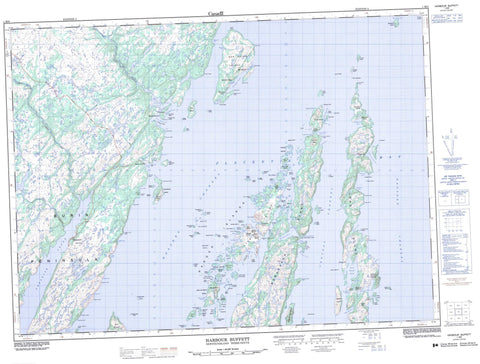
001M09 Harbour Buffett Canada topo map, 1:50,000 scale
001M09 Harbour Buffett NRCAN topographic map.
Includes UTM and GPS geographic coordinates (latitude and longitude). This 50k scale map is suitable for hiking, camping, and exploring, or you could frame it as a wall map.
Printed on-demand using high resolution, on heavy weight and acid free paper, or as an upgrade on a variety of synthetic materials.
Topos available on paper, Waterproof, Poly, or Tyvek. Usually shipping rolled, unless combined with other folded maps in one order.
- Product Number: NRCAN-001M09
- Parent Topo: TOPO-001M
- Map ID also known as: 001M09, 01M9, 1M9, 01M09, 1M09
- Unfolded Size: Approximately 26" high by 36" wide
- Weight (paper map): ca. 55 grams
- Map Type: POD NRCAN Topographic Map
- Map Scale: 1:50,000
- Geographical region: Newfoundland and Labrador, Canada
Neighboring Maps:
All neighboring Canadian topo maps are available for sale online at 1:50,000 scale.
Purchase the smaller scale map covering this area: Topo-001M
Spatial coverage:
Topo map sheet 001M09 Harbour Buffett covers the following places:
- Arnold's Cove - Back Cove - Baker Cove - Bar Haven - Bear Cove - Best's Harbour - Big Dog Harbour - Big Southwest Cove - Broad Cove - Browns Cove - Buffett Harbour - Butts Hole - Civil East Cove - Clattice Harbour - Coffins Cove - Collett Cove - Collins Cove - Cooper Cove - Cooper Cove - Cooper's Cove - Crabbe Cove - Davis Cove - Deep Cove - Deep Cove - Dog Harbour - Doting Hole - Doting Hole - Dunn Cove - Glendon Cove - Grandies Cove - Great Brule Harbour - Great Sandy Harbour - Haddock Cove - Hay Cove - Haystack Harbour - Hennesy Cove - Holletts Cove - Jean de Gaunt Cove - Jean de Gaunt Harbour - Ladder Cove - Little Brule Harbour - Little Harbour - Little Sandy Harbour - Merchant Cove - Merry Harbour - Nan Cove - New Harbour - North East Cove - North Wild Cove - Northeast Cove - Paradise Sound - Placentia Bay - Port Royal - Port Royal Arm - Port Royal Cove - Riley Cove - Smiths Cove - Southwest Cove - Spencer Cove - Spencers Cove - St. Bernard's Cove - Thibaut Cove - Tom Murray Cove - Toms Bottom - Barren Point - Benny Point - Brimstone Head - Brown Head - Brule Harbour Head - Burin Peninsula - Calls Point - Carroll Point - Clattice Harbour Head - Culleton Head - Dewden Point - Dog Harbour Head - Dog Harbour Neck - Grassy Point - Greep Head - Gulch Head - Gunning Point - Hospital Head - James Point - Jigging Point - Kearney Head - Ladder Cove Head - Long Beach Point - Long Island Point - Macweiches Point - Nan Point - New Harbour Head - Otter Point - Otter Point - Parfrey Head - Parfrey Point - Pond Head - Red Point - Redhead Point - Rose au Rue Point - Stickland Point - Tacks Head - Tobins Point - West Point - Western Cove Head - Bordeaux Gut - Central Channel - Eastern Channel - Judges Gut - Sayers Gut - Western Channel - Bagg's Island - Bar Haven Island - Barren Island - Barren Island - Batts Island - Beerberry Islands - Bell Island - Big Dock Island - Big Island - Billy Green Islands - Bird Island - Bordeaux Island - Bread Island - Buffett Island - Burnt Island - Butler Island - Chambers Island - Cheese Island - Circle Island - Civil East Island - Collett Cove Island - Cooper Island - Crane Island - Creve Island - Creve Islands - Dicks Island - Dog Harbour Island - Duck Island - Duck Island - Duck Island - Fish Islands - Flat Island - Galton Island - George Best Island - George Dock Island - Goose Island - Gooseberry Island - Gray Gull Island - Great Coat Island - Green Island - Green Island - Green Island - Green Island - Green Island - Greens Island - Gull Islands - Hangmans Island - Harbour Island - Harbour Islands - Holletts Island - Holletts Islands - Hound Island - Isaac Island - Isle Valen - Jarvis Islands - Jean de Gaunt Island - King Island - Little Butler Island - Little Chambers Island - Long Island - Long Island - Lower Dock Island - Lower Gray Gull Islands - Marshall Island - Merasheen Island - Middle Island - Moor Island - North Tilt Island - Northwest Island - Og Island - Parfrey Island - Pincher Island - Pinnacle Island - Rabbit Island - Ragged Islands - Riley Island - Rose au Rue Island - Ryans Island - Saddleback Island - Sand Island - Shag Island - Shag Roost - Ship Island - Smith Island - South Tilt Island - Spruce Island - Stearin Island - Sugarloaf Island - The Castle - Trap Island - Vigors Island - West Island - White Island - White Islands - Gates Pond - Nine Island Pond - Saltwater Pond - Hare's Ears - Jean de Gaunt Hill - Ledwick Hills - Lower Castle - Tacks Lookout - Tom Bottem Hill - Tom Bottom Hill - Toms Bottom Hill - Upper Castle - Black River - Paradise River - Sandy Harbour River - Skippers Brook - Long Reach - Bar Haven Bank - Big Rock - Big Shoal - Brandies Shoal - Brule Shoal - Buffett Bank - Coombes Rock - Cross Rocks - Deep Water Bank - Dock Island Sunker - Duck Rock - Duck Rocks - Duck Rocks - Forked Duck Rock - Grandies Rocks - Grandmother Rocks - Green Island Rock - Harbour Rock - Harry Rock - Haystack - Haystack Bank - Little Harbour Rock - Mackerel Shoal - Mark Rock - Matthew Rock - Monks Ground - Net Rock - Roost Rock - Sam Adams Shoal - Saturday Ledge - Seal Rock - Seal Rocks - Shag Rocks - Shag Roost - Shag Roost Sunkers - Shoal Bank - Stearin Rock - The Castles - The Jerseyman - Tinker Rocks - Wareham Rock - Western Rock - Western Sunker - Whales Back Rock - White Island Bank - Williams Rock - Winging Rock - Yellow Rock - Arnold's Cove - Baker Cove - Bar Haven - Best's Harbour - Broad Cove - Coffin Cove - Cooper's Cove - Davis Cove - Glendon Cove - Great Brule - Harbour Buffett - Harbour Island - Haystack - Jean de Gaunt Island - Kingwell - Little Brule - Monkstown - Northeast Harbour Buffett - Peaches Cove - Port Royal - Prowseton - Rose au Rue - Sandy Harbour - Spencers Cove - Tacks Beach - The Tickles - Western Cove


