
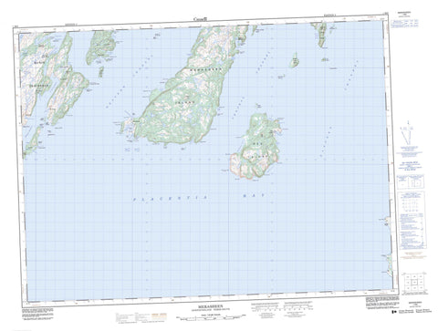
001M08 Merasheen Canada topo map, 1:50,000 scale
001M08 Merasheen NRCAN topographic map.
Includes UTM and GPS geographic coordinates (latitude and longitude). This 50k scale map is suitable for hiking, camping, and exploring, or you could frame it as a wall map.
Printed on-demand using high resolution, on heavy weight and acid free paper, or as an upgrade on a variety of synthetic materials.
Topos available on paper, Waterproof, Poly, or Tyvek. Usually shipping rolled, unless combined with other folded maps in one order.
- Product Number: NRCAN-001M08
- Parent Topo: TOPO-001M
- Map ID also known as: 001M08, 01M8, 1M8, 01M08, 1M08
- Unfolded Size: Approximately 26" high by 36" wide
- Weight (paper map): ca. 55 grams
- Map Type: POD NRCAN Topographic Map
- Map Scale: 1:50,000
- Geographical region: Newfoundland and Labrador, Canada
Neighboring Maps:
All neighboring Canadian topo maps are available for sale online at 1:50,000 scale.
Purchase the smaller scale map covering this area: Topo-001M
Spatial coverage:
Topo map sheet 001M08 Merasheen covers the following places:
- Back Cove - Channels Harbour - Clattice Harbour - Cochrane Cove - Darby Harbour - Deep Cove - Dirty Rock Cove - Dough Ball Cove - Green Cove - Hogan Cove - Indian Harbour - Jigging Cove - Little Merasheen Harbour - Margery Cove - Merasheen Harbour - Murphy Cove - Northwest Arm - Northwest Cove - Oliver Cove - Paradise Sound - Pete Cove - Placentia Bay - Presque Harbour - Red Island Harbour - Rocky Cove - Rocky Cove - Sand Cove - Scrape Cove - South Wild Cove - Southwest Arm - Southwest Cove - St. Kyran's Harbour - Storehouse Cove - Toslow Cove - Valen Harbour - Virgin Cove - Wild Cove - Avalon Peninsula - Beachy Cove Head - Big Bald Head - Blue Point - Breakheart Point - Buffett Head - Cross Point - Dicks Point - Dunn Point - Grandy Point - Harbour Head - Herring Point - Hogan Cove Head - Hole in the Wall Point - Latine Point - Little Bald Head - Long Point - Long Point - Long Point - Margaret Point - Margery Cove Point - Moll Point - Northwest Head - Pete Cove Head - Pond Head - Ragged Point - Red Head - Red Point - Redland Point - Scrape Cove Head - Shalloway Point - Slatey Point - Soldier Point - Southwest Head - Stony Point - Wadman Point - West Head - White Point - Central Channel - Eastern Channel - Western Channel - Redland Slide - White Sail - Canary Islands - Cooper Island - Dog Islands - Dutch Cap Island - Fish Island - Goat Island - Goat Island - Great Seal Island - Green Islands - Iron Island - Isle Valen - Little Goat Islands - Little Isle Valen - Little Seal Island - Long Island - Merasheen Island - Red Island - Rose au Rue Island - Saddleback Island - Southwest Island - Sugarloaf Island - Calvary Hill - Gallivan Hill - Ironskull Hill - The Friar - The Tolt - Allen Rock - Bald Head Shoal - Barrett Rock - Bennett Bank - Big Shoal - Big Sunker - Black Rock - Brook Rock - Burgeo Ground - Charley Rock - Coppaleen Rock - Creek Shoal - Cross Point Shoal - Dirty Rocks - Dough Ball Shoals - Eastern Ridge - Eastern Rock - Eastern Sunker - Fish Rock - George Rock - Goat Island Sunker - Grandy Point Rock - Harbour Rock - Hennessey Rock - Hollett Rock - Inside Rock - Iron Island Bank - Ironskull Rock - Isaac Rock - Jeans Rock - Joe Ground - Leal Rocks - Little Shoal - Long Point Rock - Long Point Shoal - Mad Cap Shoal - Middle Ground - Middle Rock - Moll Rock - Moses Rock - Murphy Rock - Mussel Ledge - Neverfail Rock - Northward Rock - Outer Burgeo Ground - Owen Rock - Paddy Rock - Pond Head Sunkers - Privécoeur Shoal - Red Island Rocks - Red Island Shoal - Rocky Cove Sunker - Rose au Rue Sunker - Rowland Rock - Samson Point Shoal - Seal Island Rocks - Shag Rock - Southern Shoal - Stony Rock - Telegraph Rock - The Deadman - The Ridge - Tide Cove Sunker - Tinker Rocks - Toslow Rocks - Tripper Rock - Western Rocks - White Sail Bank - Clattice Harbour - Clattice South West - Indian Harbour - Isle Valen - Merasheen - Murphys Cove - Presque - Red Island - St. Annes - St. Kyran's - St. Leonards - Toslow


