
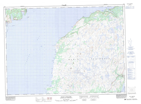
001M06 Point Entragee Canada topo map, 1:50,000 scale
001M06 Point Entragee NRCAN topographic map.
Includes UTM and GPS geographic coordinates (latitude and longitude). This 50k scale map is suitable for hiking, camping, and exploring, or you could frame it as a wall map.
Printed on-demand using high resolution, on heavy weight and acid free paper, or as an upgrade on a variety of synthetic materials.
Topos available on paper, Waterproof, Poly, or Tyvek. Usually shipping rolled, unless combined with other folded maps in one order.
- Product Number: NRCAN-001M06
- Parent Topo: TOPO-001M
- Map ID also known as: 001M06, 01M6, 1M6, 01M06, 1M06
- Unfolded Size: Approximately 26" high by 36" wide
- Weight (paper map): ca. 55 grams
- Map Type: POD NRCAN Topographic Map
- Map Scale: 1:50,000
- Geographical region: Newfoundland and Labrador, Canada
Neighboring Maps:
All neighboring Canadian topo maps are available for sale online at 1:50,000 scale.
Purchase the smaller scale map covering this area: Topo-001M
Spatial coverage:
Topo map sheet 001M06 Point Entragee covers the following places:
- Andleys Cove - Back Cove - Bakeapple Cove - Belle Bay - Big Friar Cove - Blue Pinion Harbour - Brown Harbour - Browns Harbour - Canoe Cove - Caplin Cove - Country Path Cove - D'Argent Bay - Deep Bight - Doughball Cove - East Green Point Cove - Eastern Cove - English Harbour West - Fortune Bay - Fox Cove - Grand Jersey Cove - Grand John Cove - Gush Cove - Jones Cove Bottom - Little Friar Cove - Middle Head Cove - Otter Cove - Peltry Cove - Peltry North Cove - Rosée Harbour - Round Nap Cove - Seal Cove - Shepperds Cove - St. Jacques Harbour - Tilt Cove - Venison Cove - Weather Puff Cove - West Green Point Cove - Western Cove - Wild Cove - Wood Cove - Long Bank - Long Beach - Big Doughball Head - Big Head - Bluff Head - Bluff Point - Crow Head - Devil Brook Head - Fish Rock Head - Garden Point - Grand Jersey Head - Grand John Head - Grand John Point - Harbour My God Point - Little Head - Middle Head - Miller Head - North Point - Otter Cove Point - Pat Anne Point - Point Enragée - Red Head - Red Landing Head - Scott Point - Sharp Point - Sharp Point - Tilt Point - West Point - West Sharp Point - Western Point - Western Point - Wild Cove Point - Wolf Head - Eastern Neck - Round Nap Wood - Browns Harbour Island - Devil Brook Island - English Harbour Island - St. Jacques Island - Andleys Pond - Barasway de Plate - Barasway de Plate Pond - Beaver Ponds - Big Doughball Pond - Big Pond - Big Pond - Big Steel Pond - Black Duck Pond - Bobs Hill Pond - Bridals Pond - Brook Cove Pond - Brook Pond - Browns Harbour Pond - Catgut Pond - Charlies Pond - Cheesemans Pond - Clam Brook - Ducey Bark Pond - Foot of the Neck Pond - Football Pond - Goose Pond - Grand Jervais Gull Pond - Grand John Barasway - Grand John Gull Pond - Grand John Pond - Grandfather Lookout Pond - Gull Pond - Gull Pond - Harbour My God Barasway - Harbour My God Long Pond - Hay Ponds - Hideaway Pond - Horn Hill Pond - Inside Oil Pond - Inside Pond - Island Pond - Jerrys Pond - Jones Cove Pond - Jugtilt Pond - Kelp Shade Pond - Lily Pond - Little Doughball Pond - Little Loo Pond - Little River Ponds - Long Pond - Long Pond - Long Pond on the Neck - Loo Pond - Loo Pond - Lookout Ponds - Lower Western Cove Pond - Millers Woods Pond - Northwest Pond - Oil Ponds - Otter Pond - Outside Bobs Pond - Outside Pond - Pat Anne Pond - Peaches Pond - Peltry Barasway - Peltry Pond - Raggedy River Ponds - Redland Cove Pond - Redland Pond - Rocky Brook Pond - Saucepan Hill Pond - Scotts Barasway - Scotts Great Pond - Scotts Little Pond - Seal Cove Pond - Second Pond - Shepperds Pond - Southeast Pond - The Flats - Third Pond - Tilt Ponds - Tom Butlers Loo Pond - Uncle Johns Pond - Walshes Pond - Weather Puff Pond - Western Gull Pond - White Mountain Pond - Wood Cove Pond - Big Hill - Bluff Head - Bobs Hills - Bottle Hill - Brown Lookout - Buttercup Hill - Garnish Blue Hills - Grandfather Lookout - Grandys Lookout - Hare Hill - Horn Hill - Horse Chops - Kelp Shade Hills - Long Tilt Hill - Lookout - Lookout(Hill) - Northwest Mountain - Pat Anne Hill - Pin Hill - Powderhorn Hill - Saucepan Hill - Scotts Hill - Snotchin Hill - The Rubbles - Tilt Hill - Western Lookout - Whales Trunk - White Mountain - Black River - Catgut Brook - Daylongs Brook - Devil Brook - Doughball Brook - Eastern Black River - Eastern Brook - Fox Cove Brook - Grand Jervais Brook - Grand John River - Hay Brook - Jones Cove Brook - Jugtilt Brook - Raggedy River - Red Harbour Brook - Round Nap Brook - Scott Brook - Valences Brook - Western Brook - Wild Cove Pond Brook - Belleoram Banks - Big Boot Shoal - Big Shoal - Blue Pinion Shoal - Blue Pinion Shoal - Charleys Rock - Dennis Shoal - Harbour Shoal - Hay Shoals - Little Boot Shoal - Mary Ann Shoal - Meadow Shoal - Middle Ground - North West Shoal - St. Jacques Shoal - Thoroughfare Shoal - Tilt Rock - White Rock - Wood Cove Rock - Red Harbour - St. Jacques-Coomb's Cove - Barasway de Plate - English Harbour West - Grand John - Great Jervais - Point Enragée - Point Rosie - St. Jacques - Partridge Gulch - Peltry Bottom - Tilt Valley


