Free Shipping on map orders over $300
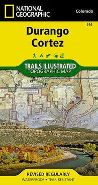
Durango : Cortez Trails Illustrated Map
Durango and Cortez, Colorado (144) by National Geographic Maps
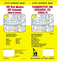
Durango and Cortez, Colorado plus Farmington, Aztec and Bloomfield, New Mexico by GM Johnson
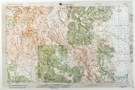
Durango, Colorado (NJ 13-7) Raised Relief Map
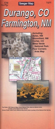
Durango, Colorado and Farmington, New Mexico by The Seeger Map Company Inc.
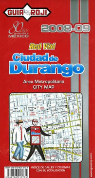
Durango, Mexico by Guia Roji
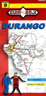
Durango, Mexico, State Map by Guia Roji
Durban Harbour by Canadian Hydrographic Service
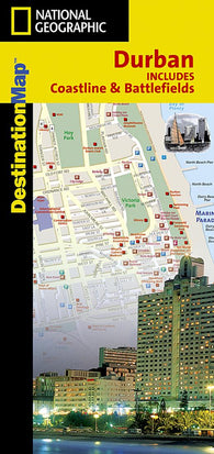
Durban, South Africa, Including Coastline and Battlefields, DestinationMap by National Geographic Maps
Durham / Chapel Hill, N. Carolina Street Map
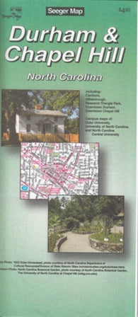
Durham and Chapel Hill, North Carolina by The Seeger Map Company Inc.
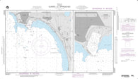
Durres And Approaches (NGA-54267-1) by National Geospatial-Intelligence Agency
DUSKY SOUND (7656) by Land Information New Zealand (LINZ)
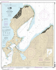
Dutch Harbor (16529-16) by NOAA
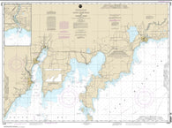
Dutch Johns Point to Fishery Point, including Big Bay de Noc and Little Bay de Noc; Manistique (14908-18) by NOAA
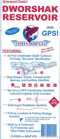
Dworshak Reservoir Fishing Map
DYRØYA-GIBOSTAD (83) by Kartverket
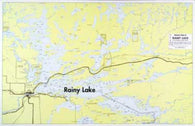
E-11: RAINY LAKE BOATERS MAP
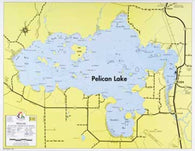
E-12: PELICAN LAKE HYDROGRAPHIC
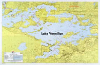
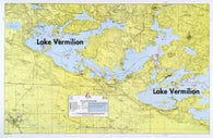
E-13: LAKE VERMILION – EAST
E-14: LAKE VERMILION – WEST
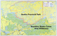
E-15: MINNESOTA-CANADIAN WILDERNESS
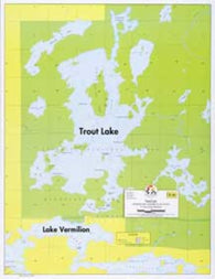
E-16: TROUT LAKE – HYDROGRAPHIC
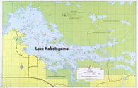
E-17: KABETOGAMA LAKE HYDROGRAPHIC
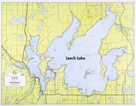
E-18: LEECH LAKE HYDROGRAPHIC
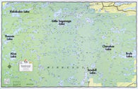
E-19: WINCHELL LAKE, ARROW LAKE, FOWL LAKE
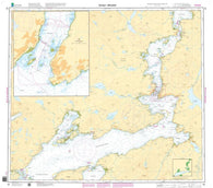
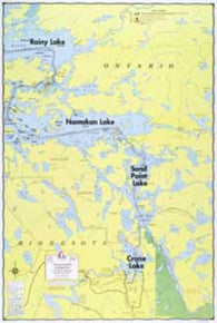
E-1: CRANE LAKE, SAND POINT LAKE, NAMAKAN LAKE
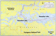
E-20: NAMAKAN LAKE WALL MAP
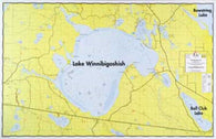
E-21: LAKE WINNIE HYDROGRAPHIC
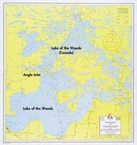
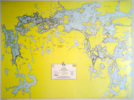
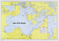
E-22: LAKE OF THE WOODS
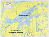
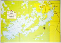
E-23: SAGANAGA LAKE – ENLARGED
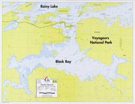
E-24: BLACK BAY OF RAINY LAKE
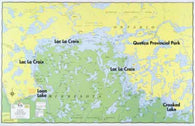
E-25: LAC LA CROIX – HYDROGRAPHIC
E-26: LAKE OF THE WOODS – SOUTHERN
E-2: LAC LA CROIX WALL MAP
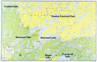
E-3: BASSWOOD LAKE, KNIFE LAKE, MOOSE LAKE
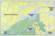
E-4: SAGANAGA LAKE, SAGANAGONS LAKE, SEAGULL LAKE
E-5: BRULE LAKE, ALICE LAKE, SAWBILL LAKE
E-8: SEAGULL LAKE HYDROGRAPHIC
E5: From Lake Constance to Verona Hiking Map