
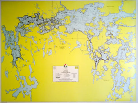
E-25: LAC LA CROIX – HYDROGRAPHIC
A depth map of Lac La Croix based on soundings taken by the state in 1976. Lake bottom contours are shown in 10-foot intervals in both U.S. and Canadian waters
- Product Number: FSHR_E25
- Reference Product Number: - None -
- ISBN: - None -
- Unfolded (flat) Size: 22.38 inches high by 34 inches wide
- Map format: Wall
- Map type: Trade Maps - Fishing
- Geographical region: Canada,United States
- Geographical subregion: Minnesota,Ontario


