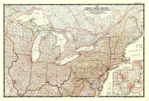
1953 The Great Lakes Region of the United States and Canada
This map showcases the Great Lakes Region of the United States and Canada. Includes four insets: Illinois waterways (Lake Michigan to Lockport), Welland canal (Lake Ontario to Lake Erie), St. Marys River (Lake Huron to Lake Superior), and Detroit and St. Clair Rivers (Lake Erie to Lake Huron). Published in 1953.
- Product Number: PODHNG_US_CAN_GRE_LAK_53
- Reference Product Number: 2321265M
- ISBN: - None -
- Date of Publication: 6/1/1953
- Unfolded (flat) Size: 29 inches high by 43 inches wide
- Map format: Wall
- Map type: Trade Maps - Political
- Geographical region: Canada,United States
- Geographical subregion: Connecticut,Illinois,Indiana,Iowa,Kentucky,Maine,Maryland,Massachusetts,Michigan,Minnesota,Missouri,New Hampshire,New York,Ohio,Ontario,Pennsylvania,Quebec,Rhode Island,Vermont,Virginia,West Virginia,Wisconsin